Iwo Jima

Iwo Jima (硫黄島 officially Iōtō?)[1] , also frequently Iōjima listen: "sulfur island", is an island of the Japanese Volcano Islands chain, which makes up the southern end of the Ogasawara Islands. The island is located 1,200 kilometers (650 nautical miles) south of mainland Tokyo and administered as part of Ogasawara, one of eight villages of Tokyo. It is famous as the site of the February–March 1945 Battle of Iwo Jima between the United States and Japan during World War II, when the iconic photograph Raising the Flag on Iwo Jima was taken. The U.S. occupied Iwo Jima until 1968, when it was returned to Japan. Today Iwo Jima has no permanent civilian population, but has an air base operated by the Japan Maritime Self-Defense Force and occasionally used for day and night landing practice (touch-and-go exercises) by the U.S. Navy's Carrier Air Wing Five based at Naval Air Facility Atsugi.
Contents |
Name
Iwo Jima was traditionally called Iwōtō (Iōtō). Prior to Japan's 1946 orthography reform, a historical spelling resulted in (approximately) Iwōtō (modern Iōtō). An alternative, Iwōjima (modern Iōjima)—where jima is an alternative pronunciation of tō (島 "island"?)—also appeared in nautical atlases.[2] Japanese naval officers who arrived to fortify the island before the American invasion mistakenly called it Iwo Jima.[2] In this way, the "Iwo Jima" pronunciation became mainstream and was the one used by American forces who arrived during World War II. Former island residents protested against this rendering, and the Ministry of Land, Infrastructure and Transport's Geographical Survey Institute debated the issue and formally announced on June 18, 2007, that the official Japanese pronunciation of the island's name would be reverted to the pre-war Iōtō.[1] Moves to revert the pronunciation were sparked by the high profile films Flags of Our Fathers and Letters from Iwo Jima.[2] The change does not affect how the name is written in Japanese (硫黄島?), only how it is pronounced.
Geographic features

The island has an approximate area of 21 km² (8 mi²) at . The most prominent feature is Mount Suribachi (摺鉢山 Suribachiyama?)[3] on the southern tip, a vent that is thought to be dormant and is 166 m (546 ft) high. Iwo Jima is unusually flat and featureless for a volcanic island. Suribachi is the only obvious volcanic feature, as it is only the raised center of a larger submerged volcanic caldera. 80 km north of the island is North Iwo Jima (北硫黄島 Kitaiōtō?, literally: "North Sulphur Island") and 60 km south South Iwo Jima (南硫黄島 Minamiiōtō?, "South Sulphur Island") making up the Volcano Islands group of the Ogasawara Islands. Just south of Minamiiōjima are the Mariana Islands.
History
Before 1945
Before World War II, Iwo Jima was administered (as it is today) by the prefectural government of Tokyo. A census in June 1943 reported an island civilian population of 1018 (533 males, 485 females) in 192 households in six settlements. The island had a primary school, a shinto shrine, and a single police officer; it was serviced by a mail ship from Haha-jima once a month, as well as a Nippon Yusen ship once every couple of months. The island's economy relied upon sulfur mining, sugarcane farming, and fishing; an isolated island in the middle of the Pacific Ocean with poor economic prospect, Iwo Jima had to import all rice and consumer goods from the Home Islands.
Even before the beginning of World War II, there was a garrison of the Imperial Japanese Navy at the southern part of Iwo Jima. It was off-limits to the island's civilian population, who had little contact with the naval personnel in any case, except for trade purposes.
Throughout 1944 there was a massive military buildup on Iwo Jima, in anticipation of an American invasion; in July its civilian population was forcibly evacuated, and no civilians have settled permanently on the island ever since.
The Battle of Iwo Jima
The invasion of Iwo Jima began at 02:00 on February 19, 1945, and continued to March 26, 1945. The battle was a major initiative of the Pacific Campaign of World War II. The Marine invasion, known as Operation Detachment, was charged with the mission of capturing the airfields on the island which up until that time had harried U.S. bombing missions to Tokyo. Once the bases were secured, they could then be of use in the impending invasion of the Japanese mainland.
The battle was marked by some of the fiercest fighting of the War. The Imperial Japanese Army positions on the island were heavily fortified, with vast bunkers, hidden artillery, and 18 kilometers (11 mi) of tunnels.[4][5] The battle was the first American attack on the Japanese Home Islands and the Imperial soldiers defended their positions tenaciously. Of the 21,000 Japanese soldiers present at the beginning of the battle, over 20,000 were killed and only 1,083 taken prisoner.[6]
One of the first objectives after landing on the beachhead was the taking of Mount Suribachi. Joe Rosenthal photographed five Marines Ira Hayes, Mike Strank, Rene Gagnon, Harlon Block, Franklin Sousley, and a U.S. Navy corpsman John Bradley. raising the U.S. flag atop Mt. Suribachi on the fourth day of the battle (February 23). The photograph was extremely popular, being reprinted in thousands of publications. It won the Pulitzer Prize for Photography that same year, and ultimately came to be regarded as one of the most significant and recognizable images of the war, and possibly the most reproduced photograph of all time.[7]
Within the next month of fighting, 3 of the 6 soldiers raising the flag were killed.
After the fall of Mt. Suribachi in the south, the Japanese still held a strong position throughout the island. General Tadamichi Kuribayashi still had the equivalent of eight infantry battalions, a tank regiment, two artillery and three heavy mortar battalions, plus the 5,000 gunners and naval infantry. With the landing area secure, more troops and heavy equipment came ashore and the invasion proceeded north to capture the airfields and the remainder of the island. Most Japanese soldiers fought to the death. On the night of March 25, a 300-man Japanese force launched a final counterattack. The Marines suffered heavy casualties; more than 100 were killed and another 200 Americans were wounded. The island was officially declared "secured" the following day. The number of American casualties was greater than the total Allied casualties at Battle of Normandy on D-Day.
Even after Iwo Jima was declared secured, about three thousand Japanese soldiers were left alive in the island's warren of caves and tunnels. Those who could not bring themselves to commit suicide hid in the caves during the day and came out at night to prowl for provisions. Some did eventually surrender and were surprised that the Americans often received them with compassion, offering water, cigarettes, or coffee.[8] The last of these stragglers, two of Lieutenant Toshihiko Ohno's (whose body was never found) men, Yamakage Kufuku and Matsudo Linsoki, lasted six years, surrendering in 1951[9] (another source gives the date of surrender as January 6, 1949).[10]
The U.S. military occupied Iwo Jima until 1968, when it was returned to Japan.
Reunion of honor
On February 19, 1985, the 40th anniversary of the day that U.S. forces began the assault on the island, veterans from both forces gathered for the Reunion of Honor just a few meters away from the spot where U.S. Marines had landed on the island.[11]
During the memorial service a granite plaque was unveiled with the message:
On the 40th anniversary of the battle of Iwo Jima, American and Japanese veterans met again on these same sands, this time in peace and friendship. We commemorate our comrades, living and dead, who fought here with bravery and honor, and we pray together that our sacrifices on Iwo Jima will always be remembered and never be repeated.
It is inscribed on both sides of the plaque, with the English translation facing the beaches where U.S. forces landed and the Japanese translation facing inland, where Japanese troops defended their position.
After that, the Japan-U.S. combination memorial service of the 50th anniversary was held in front of this monument in March 1995. The 55th anniversary was held in 2000, followed by a 60th reunion in March 2005 (see U.S. National Park Service photo below).
| Iwo Jima Air Base 硫黄島飛行場 Iōtō Hikōjō |
|||
|---|---|---|---|
| IATA: IWO – ICAO: RJAW | |||
| Summary | |||
| Airport type | Military | ||
| Owner | Ministry of Defense, Japan | ||
| Operator | JMSDF | ||
| Location | Iwo Jima, Ogasawara, Tokyo | ||
| Elevation AMSL | 384 ft / 117 m | ||
| Runways | |||
| Direction | Length | Surface | |
| ft | m | ||
| 07/25 | 8700 | 2650 | Paved |
The Japan Maritime Self-Defense Force (JMSDF) operates a naval air base on the island. The airstrip is 2,650 meters (8,700 ft) long and 60 meters (200 ft) wide. Its orientation is 07/25. The four-letter ICAO code is RJAW and the three-letter IATA code is IWO. The JMSDF is in charge of support, air-traffic control, fueling, and rescue. The Japan Air Self-Defense Force also utilizes the base. The Japan Ground Self-Defense Force is in charge of explosive-ordnance disposal. 400 Japanese troops are stationed on the island.[2] The U.S. Navy's Carrier Air Wing Five, based at the United States Naval Air Facility Atsugi when not embarked/deployed aboard USS George Washington, also utilizes the base for field carrier landing practice (FCLP). The U.S. Navy still has a 1,639 acres (6.63 km2) disfunctioned communication facility (Iwo-Jima Communication Site) on the island, while the U.S. Coast Guard's Iwo Jima LORAN-C transmitter facility was transferred to Japan in 1993 and demolished in 1994. Civilian access to the island is restricted to those attending memorial services for American and Japanese fallen soldiers, construction workers for the naval air base, and meteorological agency officials. The Japanese troops stationed on the island register their residential addresses in Ayase, Kanagawa or Sayama, Saitama for voting, tax and social security purposes. Officially, there is no population on the island.
U.S. nuclear arms base
Iwo Jima appears to be one of a number of Japanese islands which has been used by the United States to host nuclear arms, according to Robert S. Norris, William M. Arkin, and William Burr writing for the Bulletin of Atomic Scientists in early 2000.[12][13] This is despite a Japanese policy of not allowing nuclear weapons on Japanese soil. Whether the site is currently used for this purpose is unknown, as great secrecy surrounds the United States’ siting of nuclear arms bases; but on December 12, 1999, U.S. Undersecretary for Defense Policy Walter Slocombe told The New York Times, “Our position is that there have been no violations of our obligations under the security treaty and related arrangements.”[14]
Norris, Arkin, and Burr, concluded however:
There were nuclear weapons on Chichi Jima and Iwo Jima (Iwo To), an enormous and varied nuclear arsenal on Okinawa, nuclear bombs (without their fission cores) stored on the mainland at Misawa and Itazuki airbases (and possibly at Atsugi, Iwakuni, Johnson, and Komaki airbases as well), and nuclear-armed U.S. Navy ships stationed in Sasebo and Yokosuka. […] It is true that Chichi Jima, Iwo Jima, and Okinawa were under U.S. occupation, that the bombs stored on the mainland lacked their plutonium and/ or uranium cores, and that the nuclear-armed ships were a legal inch away from Japanese soil. All in all, this elaborate stratagem maintained the technicality that the United States had no nuclear weapons “in Japan.”[14]
Iwo Jima in popular culture
Iwo Jima is in the book Flags of Our Fathers (2006) and the movie based on it Flags of Our Fathers. The movie Letters from Iwo Jima (2006) is based on a Japanese book of letters, some of which were the final letter, by Japanese soldiers. Both films were directed by Clint Eastwood.
A 2005 documentary The League of Grateful Sons was shot during the 60th Anniversary trip. (Vision Forum also featured that trip as one of the episodes in its ongoing radio drama series Jonathan Park (The return to Iwo Jima).)
The island is in the John Wayne film Sands of Iwo Jima (1948).
Photo gallery
See also
- List of volcanoes in Japan
- Battle of Iwo Jima
- Raising the flag on Iwo Jima
- Iwo Jima LORAN-C transmitter
- Jack Lucas - received Medal of Honor at Iwo Jima
Notes
- ↑ 1.0 1.1 "地名等の統一に関する連絡協議会 硫黄島の呼称を「いおうじま」から「いおうとう」へ変更". Geographical Survey Institute of Japan (2007-06-18). Retrieved on 2007-06-20. (Japanese)
- ↑ 2.0 2.1 2.2 2.3 Greimel, Hans; Lily Hindy (June 20, 2007). "Japan changes name of Iwo Jima", USA Today. Retrieved on 2007-06-24.
- ↑ Japanese Wikipedia article on Suribachiyama, Iwo Jima (Japanese)
- ↑ Letters From Iwo Jima World War II Multimedia Database
- ↑ Japanese Defense of Iwo Jima
- ↑ Morison, Samuel Eliot (2002) [1960]. Victory in the Pacific, 1945, vol. 14 of History of United States Naval Operations in World War II. Urbana, Ill.: University of Illinois Press. ISBN 0252070658. OCLC 49784806.
- ↑ Fifty Years Later, Iwo Jima Photographer Fights His Own Battle
- ↑ Toland, John (1970). The Rising Sun: The Decline and Fall of the Japanese Empire 1936-1945. New York: Random House. pp. p. 731. OCLC 105915.
- ↑ Toland, p. 737
- ↑ Cook, Donald. "Capture of Two Holdouts January 6, 1949". No Surrender: Japanese Holdouts. Retrieved on 2007-09-11.
- ↑ Boardman, Robert (January/February 1986). ""A Higher Honor"". Discipleship Journal. NavPress. Retrieved on 2007-06-20.
- ↑ Norris, Robert S.; William M. Arkin, and William Burr (January/February 2000). "How much did Japan know?" (– Scholar search). Bulletin of the Atomic Scientists 56 (1): pp. 11–13, 78–79. ISSN 0096-3402. http://www.thebulletin.org/article.php?art_ofn=jf00norris. Retrieved on 2007-06-20.
- ↑ Norris, Robert S.; William M. Arkin, and William Burr (November/December 1999). "NRDC: Nuclear Notebook: Appendix B: Deployments By Country, 1951-1977" (– Scholar search). Bulletin of the Atomic Scientists 55 (6): pp. 66–67. ISSN 0096-3402. http://www.thebulletin.org/article_nn.php?art_ofn=nd99norris_041. Retrieved on 2007-06-20.
- ↑ 14.0 14.1 "Allegations of Clandestine US Nuclear Weapons in Japan". Disarmament Diplomacy (The Acronym Institute) (42). December 1999. http://www.acronym.org.uk/dd/dd42/42base.htm. Retrieved on 2007-06-24.
External links
- Map by Geographical Survey Institute of Japan
- Iwo Jima (Iōtō) on Google Maps
- Association of Iwo Jima Japan
- 2007 Tonemapped HDR Image of Mt. Suribachi- The sand underneath the vegetation in the foreground is the original beach that the Marines landed on during their assault on the island.
- Siebert L, Simkin T (2002-). Volcanoes of the World: an Illustrated Catalog of Holocene Volcanoes and their Eruptions. Smithsonian Institution, Global Volcanism Program Digital Information Series, GVP-3, (http://www.volcano.si.edu/world/).
- Iwo-Jima, Volcano Islands, Japan
- History of U.S. Marine Corps Operations in World War II Volume IV: Western Pacific Operations by George W. Garand and Truman R. Strobridge
- [1],[2] - Satellite photos taken on December 4, 2003, from www.spaceimaging.com
- 3-D Stereo Photograph of Iwo Jima Flag-raising - From The Tampa Tribune and TBO.com
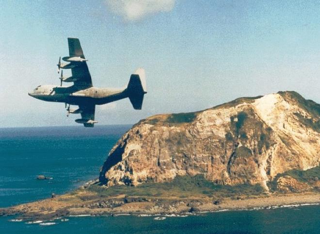
- Photograph of a C130 fly-by past Iwo Jima and the original source can be found here.
![[1]](http://archive.spaceimaging.com/ikonos/2/kpms/2003/12//browse.222384.crss_sat.0.0.jpg)
![[2]](http://archive.spaceimaging.com/ikonos/2/kpms/2003/12//browse.222385.crss_sat.0.0.jpg)