Honolulu County, Hawaii
| Honolulu County, Hawaii | |
| Map | |
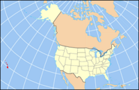
 Location in the state of Hawaii |
|
 Hawaii's location in the U.S. |
|
| Statistics | |
| Founded | April 30, 1907 |
|---|---|
| Seat | Honolulu CDP |
| Motto | Ha’aheo No ‘O Honolulu (Honolulu Pride)[1] |
| Area - Total - Land - Water |
2,127 sq mi (5,509 km²) 600 sq mi (1,554 km²) 1,527 sq mi (3,955 km²), 71.80% |
| Population - (2000) - Density |
876,156 1,461/sq mi (564/km²) |
| Time zone | Hawaii-Aleutian time zone: UTC-10 |
| Congressional districts | 1st, 2nd |
| Website: www.honolulu.gov | |
The City and County of Honolulu is a combined city-county jurisdiction located in the U.S. state of Hawaiʻi. It is also the official municipal and cultural entity of the combined urban district of Honolulu and the rest of the island of Oʻahu in the U.S. state of Hawaiʻi, as prescribed in the city charter adopted in 1907 and accepted by the Legislature of the Territory of Hawaiʻi. The City and County encompasses all of the island of Oʻahu and several minor outlying islands including all of the Northwestern Hawaiian Islands (islands beyond Niʻihau except Midway Atoll).[2] It acts as a public corporation that manages various aspects of traditional municipal governance primarily in the American manner. The population of the City and County was 876,156 at the 2000 census,[3] making it the eleventh-largest municipality in the United States.[4]
Upon becoming a consolidated city-county on April 30, 1907, the combined territories were incorporated as the City and County of Honolulu, as it is known today.[2]
The current Mayor of Honolulu is Mufi Hannemann.[5]
Contents |
Government

Originally governed by a Board of Supervisors, the City and County of Honolulu is administered under a mayor-council system of governance overseeing all municipal services: civil defense, emergency medical, fire, parks and recreation, police, sanitation, streets, water, among others. One of the largest municipal governments in the United States, the City and County of Honolulu has an annual operating budget of $1 Billion.
The government of the City and County of Honolulu is simplified and streamlined and coalesces at three major divisions of municipal power.
- The Mayor of Honolulu is the principal executor of administrative authority and wields highly centralized abilities which in most cities are weighted more equally between the mayor and legislature. Because of the nature of these abilities, the Mayor of Honolulu is often considered by political scientists as one of the most powerful mayors in the nation. The mayor is elected on a non-partisan basis to a four-year term.
- The Honolulu City Council is the unicameral legislative body. Its elected members are responsible for drafting and passing laws, as well as proposing budgets for various departments. Unlike other cities in the United States, the council is absolutely independent of the mayor, who does not make any appearances during any of the council sessions. The nine council members each represent one of nine districts, and are elected on a non-partisan basis to staggered four-year terms.
- The Prosecuting Attorney of Honolulu is absolutely independent of the other two major divisions of municipal power, and is not charged with providing counsel to those bodies; that duty is a responsibility of the Department of Corporation Counsel under mayoral jurisdiction. The prosecuting attorney is elected on a non-partisan basis to a four-year term.
The City and County of Honolulu is one of only a handful of U.S. cities with an extensive neighborhood board system. With 36 neighborhood boards, the system is perhaps the largest of its kind. Members are elected to two-year terms. The office of neighborhood board member is an advisory position for public policy and civil investment.
Districts


Like most cities in the United States, the City and County of Honolulu is divided into smaller administrative districts. There are nine such districts, each of which elects a member of the city council. The boundaries of each district are revised every ten years in conjunction with the U.S. Census. Each district is composed of unincorporated subdivisions unofficially called towns and cities.
- DISTRICT I: ʻEwa, ʻEwa Beach, Honouliuli, West Loch, Kapolei, Makakilo, Kalaeloa, Honokai Hale and Nanakai Gardens, Ko ʻOlina, Nānākuli, Waiʻanae, Mākaha, Keaʻau, Mākua.
- DISTRICT II: Mililani Mauka, Wahiawā, Whitmore Village, Mokulēʻia, Waialua, Haleʻiwa, Waimea, Pūpūkea, Sunset Beach, Kahuku, Lāʻie, Hauʻula, Punaluʻu, Kahana, Kaʻaʻawa, Kualoa, Waiāhole, Kahaluʻu, ʻĀhuimanu, Heʻeia.
- DISTRICT III: Waimānalo, Kailua, Kāneʻohe.
- DISTRICT IV: Hawaiʻi Kai, Kuliʻouʻou, Niu Valley, ʻĀina Haina, Wailupe, Waiʻalae-Iki, Kalani Valley, Kāhala, Wilhelmina Rise, a portion of Kapahulu, a portion of Kaimukī, Diamond Head, Waikīkī, Ala Moana.
- DISTRICT V: Kapahulu, Kaimukī, Pālolo Valley, St. Louis Heights, Mānoa, Mōʻiliʻili, McCully, Kakaʻako, Ala Moana, Makiki.
- DISTRICT VI: Makiki, downtown Honolulu, Punchbowl, Liliha, Pauoa Valley, Nuʻuanu, ʻĀlewa Heights, Papakōlea, Kalihi Valley, Kalihi.
- DISTRICT VII: Kalihi, Kapālama, Pālama, Iwilei, Sand Island, Māpunapuna, Airport, Hickam, Pearl Harbor, Ford Island, Āliamanu, Salt Lake, Foster Village, Stadium, Hālawa Valley Estates.
- DISTRICT VIII: Fort Shafter, Moanalua, Hālawa, ʻAiea, Pearl City, Seaview, Crestview, Waipiʻo Gentry.
- DISTRICT IX: Waikele, Waipahu, Village Park, Kunia, Mililani.
Civic center
The civic center is coextensive with what is known as the Capitol District in downtown Honolulu. The official seat of governance for the City and County of Honolulu is located within the district at Honolulu Hale, established in the 1920s as a city hall structure and houses the chambers of the Mayor of Honolulu and the Honolulu City Council. In the 1960s and 1970s, Mayor Frank Fasi developed the modern civic center as it is known today. He took to controversial and aggressive measures to reclaim property, demolish massive concrete structures in the area, construct underground parking facilities and open a green campus above ground with manicured lawns and specially commissioned sculpted artwork. He also oversaw the construction of new government buildings to house the departments that fell within mayoral jurisdiction. The most prominent of those new buildings were the Honolulu Municipal Building and Hale Makaʻi, the headquarters of the Honolulu Police Department. Civic centers were also constructed off the Capitol District campus including the Kapiʻolani Bandstand, Neal S. Blaisdell Center, and the Waikīkī Shell.
County services
The City and County of Honolulu collects various forms of taxes including a lucrative property tax. Revenue from those taxes are used to provide several services for the residents. The most prominent of those services are:
- Honolulu Board of Water Supply
- Honolulu Fire Department
- Honolulu Police Department
- Honolulu Emergency Medical Services
- TheBus
Demographics
As of the census[3] of 2000, there were 876,156 people, 286,450 households, and 205,671 families residing in the City and County of Honolulu. The population density was 1,461 people per square mile (564/km²). There were 315,988 housing units at an average density of 527/sq mi (203/km²). The racial makeup of the county was 46.04% Asian, 21.28% white, 8.87% Pacific Islander, 2.35% black or African American, 0.25% Native American, 1.28% from other races, and 19.93% from two or more races. Hispanic or Latino of any race were 6.70% of the population.
There were 286,450 households out of which 31.8% had children under the age of 18 living with them, 54.5% were married couples living together, 12.3% had a female householder with no husband present, and 28.2% were non-families. 21.6% of all households were made up of individuals and 7.0% had someone living alone who was 65 years of age or older. The average household size was 2.95 and the average family size was 3.46.
In the county the population was spread out with 23.80% under the age of 18, 10.1% from 18 to 24, 30.6% from 25 to 44, 22.0% from 45 to 64, and 13.4% who were 65 years of age or older. The median age was 36 years. For every 100 females there were 101.1 males. For every 100 females age 18 and over, there were 99.7 males.
Geography


According to the U.S. Census Bureau, the county has a total area of 2,127 square miles (5,509 km²), of which, 600 square miles (1,553 km²) of it is land and 1,527 square miles (3,955 km²) of it is water. The total census tract area is 71.80% water. However, the majority of this area is the Pacific Ocean that surrounds the islands.
Communities
| Alphabetical | Population Size |
|---|---|
|
|
Adjacent counties
- Maui County, Hawaii - southeast
- Kauai County, Hawaii - northwest
National protected areas
- James Campbell National Wildlife Refuge
- Oahu Forest National Wildlife Refuge
- Papahānaumokuākea Marine National Monument
- USS Arizona Memorial
Transportation


Air
Located on the western end of Honolulu proper, Honolulu International Airport (HNL) is the principal aviation gateway to the state of Hawaii.
Highways
Several freeways serve Honolulu:
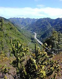
- Interstate H-1, which, coming into the city from the west, passes Hickam Air Force Base and Honolulu International Airport, runs just north of Downtown and continues eastward through Makiki and Kaimuki, ending at Waialae/Kahala. H-1 connects to Interstate H-2 from Wahiawa and Interstate H-3 from Kaneohe, west of the city proper.
- Interstate H-201—also known as the Moanalua Freeway and formerly numbered Hawaii State Rte. 78—connects two points along H-1: at Aloha Stadium and Fort Shafter. Close to H-1 and Aloha Stadium, H-2 has an exchange with the western terminus of Interstate H-3 to the windward side of Oahu (Kaneohe). This complex of connecting ramps, some directly between H-1 and H-3, is in Halawa.
- Interstate H-2 runs from Pearl City, through Waipio and Mililani, to Wahiawa and dissolves into a highway (Wilikina Drive) near the military base, U.S. Army base Schofield Barracks and Army Airfield Wheeler. The interstate is a convenient way to get to the island's North Shore.
- Interstate H-3 is also known as the John A. Burns Freeway, and runs from the H-1 in Honolulu to the community of Kane'ohe.
Other major highways that link the Honolulu CDP with other parts of the Island of Oahu are:
- Pali Highway, State Rte. 61, crosses north over the Koolau range via the Pali Tunnels to connect to Kailua and Kaneohe on the windward side of the Island.
- Likelike Highway, State Rte. 63, also crosses the Koolau to Kaneohe via the Wilson Tunnels.
- Kalanianaole Highway, State Rte. 72, runs eastward from Waialae/Kahala to Hawaii Kai and around the east end of the island to Waimanalo Beach.
- Kamehameha Highway, State Rte. 99, runs westward from near Hickam Air Force Base to Aiea and beyond, eventually running through the center of the island and ending in Kaneohe.
Like most major American cities, the City and County of Honolulu experiences heavy traffic congestion during rush hours, especially to and from the western communities of Kapolei, Ewa, Aiea, Pearl City, Waipahu, and Mililani. Land for expanding road capacity is at a premium everywhere on Oahu.
Public transportation
Bus
Established by former Mayor Frank F. Fasi, Honolulu's public transit system has been twice honored by the American Public Transportation Association bestowing the title of "America's Best Transit System" for 1994–1995 and 2000–2001. Oahu Transit Services' "TheBus" operates 107 routes with a fleet of 525 buses.
In 2004, construction had started on a bus rapid transit (BRT) system using dedicated rights-of-way for buses. The system, proposed by then Mayor Jeremy Harris, was expected to link the Iwilei neighborhood with Waikiki. However, current Mayor Mufi Hannemann has largely dismantled the BRT system and deployed its buses along other express bus routes.
Rail
Currently, there is no urban rail transit system in Honolulu, although electric street railways were once used during the early days of Honolulu's history. The last major attempt was called the Honolulu Area Rail Rapid Transit project, popularly known as HART. Originally proposed in 1968 by Mayor Neal S. Blaisdell and supported by his successor, Frank Fasi, HART was originally envisioned as a 29-mile line from Pearl City to Hawaii Kai. By 1980, however, the project's length was cut to an 8-mile segment between the University of Hawaii at Manoa and Honolulu International Airport.
In the wake of proposed budget cuts by President Ronald Reagan, including the elimination of all funding for transit projects by 1985, newly elected Mayor Eileen Anderson cancelled the project in 1981 and returned grants and funding to their sources,[6][7] arguing the project would break her vow of fiscal responsibility.[8].[9]
Several attempts had been made since Anderson's cancellation of HART to construct a fixed rail mass transit system. All attempts stalled in Honolulu City Council hearings. In 2004, the city, county and state approved development of an action plan for a system to be built in several phases. The initial line proposed linking Kapolei in West Oahu to the University of Hawaii at Manoa. However, on December 22, 2006 the city council approved a fixed-guideway system meant to accommodate either rail or buses, running from Kapolei in West Oahu to Ala Moana, with spurs into Waikiki and Manoa.
On November 4th, 2008, the residents of Honolulu voted to approve a new $4.5 billion rail project that would connect West Oahu with downtown, Waikiki and University of Hawaii. The trains will be approximately 200 feet long, electric, steel wheel to steel rail technology and will capable of carrying more than 300 passengers each.[10][11]
Education
Colleges and universities
Colleges and universities in the City and County of Honolulu include: three in the Honolulu community (University of Hawaii at Manoa, Chaminade University, and Hawaii Pacific University) and Brigham Young University–Hawaii in Laie.
Primary and secondary schools
Hawaii Department of Education operates public schools in Honolulu.
Cultural institutions

Performing arts
Established in 1900, the Honolulu Symphony is the oldest US symphony orchestra west of the Rocky Mountains. Other classical music ensembles include the Hawaii Opera Theatre. Honolulu is also a center for Hawaiian music. The main music venues include the Neal Blaisdell Center Concert Hall, the Waikiki Shell, and the Hawaii Theatre.
Honolulu also includes several venues for live theater, including the Diamond Head Theatre.
Visual arts
There are various institutions supported by the state and private entities for the advancement of the visual arts. The Honolulu Academy of Arts is endowed with the largest collection of Asian and Western art in Hawaii. It also has the largest collection of Islamic art, housed at the Shangri La estate. The academy hosts a film and video program dedicated to arthouse and world cinema in the museum's Doris Duke Theatre, named for the academy's historic patroness Doris Duke.
The Contemporary Museum is the only contemporary art museum in the state. It has two locations: main campus in Makiki and a multi-level gallery in downtown Honolulu at the First Hawaiian Center.
The Hawaii State Art Museum is also located in downtown Honolulu at No. 1 Capitol District Building and boasts a collection of art pieces created by local artists as well as traditional Hawaiian art. The museum is administered by the Hawaii State Foundation on Culture and the Arts.
Natural museums
Recognized internationally as the premier cultural institution of Hawaii, the Bishop Museum is the largest of Honolulu's museums. It is endowed with the state's largest collection of natural history specimens and the world's largest collection of Hawaiiana and Pacific culture artifacts. The Honolulu Zoo is the main zoological institution in Hawaii while the Waikiki Aquarium is a working marine biology laboratory. The Waikiki Aquarium is partnered with the University of Hawaii and other universities worldwide. Established for appreciation and botany, Honolulu is home to several gardens: Foster Botanical Garden, Liliuokalani Botanical Garden, Walker Estate, among others.
Sports
Currently, Honolulu has no professional sports teams. However, Honolulu hosts the NFL's annual Pro Bowl each February in addition to the NCAA football Hawaii Bowl. Honolulu also supports the Hawaii Winter League annually from late September to late November, hosting minor league players from MLB, NPB, and Korea. Games are hosted at Les Murakami and Hans L'Orange Park. Fans of spectator sports in Honolulu generally support the football, volleyball, basketball, and baseball programs of the University of Hawaii at Manoa. High school sporting events, especially football, are especially popular. Venues for spectator sports in Honolulu include:
- Aloha Stadium (American football and soccer (football))
- Les Murakami Stadium at UH-Manoa (baseball)
- Stan Sheriff Center at UH-Manoa (basketball and volleyball)
- Neal Blaisdell Center Arena (basketball)
Honolulu's mild climate lends itself to year-round fitness activities as well. In 2004, Men's Fitness magazine named Honolulu the fittest city in the U.S. Honolulu is also home to three large road races:
- The Great Aloha Run is held annually on Presidents' Day.
- The Honolulu Marathon, held annually on the second Sunday in December, draws more than 20,000 participants each year, about half to two thirds of them from Japan.
- The Honolulu Triathlon is an Olympic distance triathlon event governed by USA Triathlon. Held annually in May since 2004, there is an absence of a sprint course.
Media
Honolulu is home to numerous forms media including newspapers, magazines, radio and television.
References
- ↑ "Events, Official Web Site for The City and County of Honolulu." City and County of Honolulu. Accessed October 14, 2008.
- ↑ 2.0 2.1 "About the City and County of Honolulu" (Government website). City and County of Honolulu. Retrieved on 2008-01-27.
- ↑ 3.0 3.1 "American FactFinder". United States Census Bureau. Retrieved on 2008-01-31.
- ↑ "Hawaii Fast Facts and Trivia" (Commercial website). Marchex, Inc.. Retrieved on 2008-01-27.
- ↑ "Mayor of Honolulu" (Government website). City and County of Honolulu. Retrieved on 2008-01-27.
- ↑ "Honolulu: trains at last?", Railway Age (November, 1990). Retrieved on 2008-01-19.
- ↑ "Honolulu's mayor ends proposal for rail line in downtown area", New York Times (June 28, 1981). Retrieved on 2008-01-20.
- ↑ Leavitt, Judith A. (1985). American Women Managers and Administrators. Greenwood Press. pp. pp. 8-9. ISBN 0313237484.
- ↑ "Will rail fly this time?", Honolulu Star-Bulletin (December 16, 1998). Retrieved on 2008-10-12.
- ↑ http://www.khnl.com/Global/story.asp?S=9295785 Honolulu - Rail transit passes
- ↑ http://www.honoluluadvertiser.com/apps/pbcs.dll/article?AID=/20081106/NEWS01/811060369/1001/NEWS05 Honolulu rail might be rerouted to airport
External links
|
|
||||||||||||||
