Himalayas
| Himalayas | |
| Range | |
 The north face of Mount Everest as seen from the path to the base camp in Tibet
|
|
| Countries | Bhutan, Tibet (PRC), India, Nepal, Pakistan, Burma, Afghanistan |
|---|---|
| Highest point | Mount Everest |
| - elevation | 8,848 m (29,029 ft) |
| - coordinates | |

The Himalaya Range (Sanskrit: हिमालय, IPA pronunciation: [hɪ'mɑlijə]), or Himalayas for short, is a mountain range in Asia, separating the Indian subcontinent from the Tibetan Plateau. By extension, it is also the name of a massive mountain system which includes the Karakoram, the Hindu Kush, and a host of minor ranges extending from the Pamir Knot. The name comes from the Sanskrit word, himālaya, a tatpurusa compound meaning "the abode of snow" (from hima "snow", and ālaya "abode"; see also Himavat).[1]As words, the expression "Himalaya Range" is similar to the expression Sierra Nevada.
Together, the Himalayan mountain system is the planet's highest and home to the world's highest peaks: the Eight-thousanders, including Mount Everest (Nepal/Tibet) and K2 (Pakistan's Northern Areas). To comprehend the enormous scale of this mountain range consider that Aconcagua, in the Andes, at 6,962 m, is the highest peak outside Asia, while the Himalayan system includes over 100 mountains exceeding 7,200 meters.[2]
The Himalayan system, which includes outlying subranges, stretches across six countries: Bhutan, China, India, Nepal, Pakistan and Afghanistan. They are the source of three of the world's major river systems, the Indus, the Ganga-Brahmaputra, and the Yangtze. Approximately 1.3 billion people live in the drainage basin of the Himalayan rivers.
The range proper runs west to east, from the Indus river valley to the Brahmaputra river valley, thereby forming an arc 2,400 km long, which varies in width from 400 km in the western Kashmir-Xinjiang region to 150 km in the eastern Tibet-Arunachal Pradesh region. The Himalaya chain consists of three parallel ranges, with the northern-most range known as the Great or Inner Himalayas.
Location
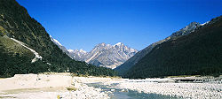
The Himalayas separate the Indo-Gangetic plain from the Tibetan plateau. The bulk of the mountain range lies in Nepal, Bhutan and the states of Jammu and Kashmir, Himachal Pradesh, Uttarakhand, Sikkim and Arunachal Pradesh in India[3]. The outlying parts of the range lie in Tibet, Pakistan (some in disputed territories) and Burma[3].
Ecology
The flora and fauna of the Himalayas varies with climate, rainfall, altitude, and soils. The climate ranges from tropical at the base of the mountains to permanent ice and snow at the highest elevations. The amount of yearly rainfall increases from west to east along the front of the range. This diversity of climate, altitude, rainfall and soil conditions generates a variety of distinct plant and animal communities.
Lowland forests
On the Indo-Gangetic plain at the base of the mountains, an alluvial plain drained by the Indus and Ganga-Brahmaputra river systems, vegetation varies from west to east with rainfall. The xeric Northwestern thorn scrub forests occupy the plains of Pakistan and the Indian Punjab. Further east lie the Upper Gangetic plains moist deciduous forests of Uttarakhand and Uttar Pradesh and Lower Gangetic plains moist deciduous forests of Bihar and West Bengal. These are monsoon forests, with drought-deciduous trees that lose their leaves during the dry season. The moister Brahmaputra Valley semi-evergreen forests occupy the plains of Assam.
The Terai belt
Above the alluvial plain lies the Terai strip, a seasonally marshy zone of sand and clay soils. The Terai has higher rainfall than the plains, and the downward-rushing rivers of the Himalaya slow down and spread out in the flatter Terai zone, depositing fertile silt during the monsoon season and receding in the dry season. The Terai has a high water table due to groundwater percolating down from the adjacent zone. The central part of the Terai belt is occupied by the Terai-Duar savanna and grasslands, a mosaic of grasslands, savannas, deciduous and evergreen forests that includes some of the world's tallest grasslands. The grasslands of the Terai belt are home to the Indian Rhinoceros (Rhinoceros unicornis).
Bhabhar belt
Above the Terai belt is an upland zone known as the Bhabhar, a zone of porous and rocky soils, made up of debris washed down from the higher ranges. The Bhabhar and the lower Shiwalik ranges have a subtropical climate. The Himalayan subtropical pine forests occupy the western end of the subtropical belt, with forests dominated by Chir Pine (Pinus roxburghii). The central part of the range is home to the Himalayan subtropical broadleaf forests, dominated by sal (Shorea robusta).
Shiwalik Hills
Also called Churia or Margalla Hills. Intermittent outermost range of foothills extending across Himalayan region through Pakistan, India, Nepal and Bhutan. Consists of many sub-ranges. Summits generally 600 to 1,200 meters. Steeper southern slopes form along a fault zone called Main Frontal Thrust; northern slopes are gentler. Permeable conglomerates and other rocks allow rainwater to percolate downslope into the Bhabhar and Terai, supporting only scrubby forests upslope.
Inner Terai or Dun Valleys
The Inner Terai valleys are open valleys north of Shiwalik Hills or nestled between Shiwalik subranges. Examples include Dehra Dun in India and Chitwan in Nepal.
Lesser Himalaya
Prominent range 2,000 to 3,000 meters high forming along the Main Boundary Thrust fault zone with a steep southern face and gentler northern slopes. Nearly continuous except for river gorges. Rivers gather in candelabra form to the north to break through this range in relatively few places.
Midlands
'Hilly' region averaging about 1,000 meters immediately north of the Mahabharat Range, rising over about 100 km to about 4,000 meters at the Main Frontal Thrust fault zone where the Greater Himalaya begin.
- Montane forests - At the middle elevations of the range, the subtropical forests yield to a belt of temperate broadleaf and mixed forests, with the Western Himalayan broadleaf forests at the western end of the range, and the Eastern Himalayan broadleaf forests in Assam and Arunachal Pradesh. Above the broadleaf forests are the Western and Eastern Himalayan subalpine conifer forests.
Alpine shrub and grasslands

Above the tree line are the Northwestern, Western, and Eastern Himalayan alpine shrub and meadows, which yield to tundra in the higher Himalayan range. The alpine meadows are the summer habitat of the endangered Snow Leopard (Uncia uncia).
Origins and growth

The Himalayas are among the youngest mountain ranges on the planet. According to the modern theory of plate tectonics, their formation is a result of a continental collision or orogeny along the convergent boundary between the Indo-Australian Plate and the Eurasian Plate. This is called a fold mountain. The collision began in the Upper Cretaceous period about 70 million years ago, when the north-moving Indo-Australian Plate, moving at about 15 cm per year, collided with the Eurasian Plate. About 50 million years ago this fast moving Indo-Australian plate had completely closed the Tethys Ocean, the existence of which has been determined by sedimentary rocks settled on the ocean floor and the volcanoes that fringed its edges. Since these sediments were light, they crumpled into mountain ranges rather than sinking to the floor. The Indo-Australian plate continues to be driven horizontally below the Tibetan plateau, which forces the plateau to move upwards. The Arakan Yoma highlands in Myanmar and the Andaman and Nicobar Islands in the Bay of Bengal were also formed as a result of this collision.
The Indo-Australian plate is still moving at 67 mm per year, and over the next 10 million years it will travel about 1,500 km into Asia. About 20 mm per year of the India-Asia convergence is absorbed by thrusting along the Himalaya southern front. This leads to the Himalayas rising by about 5 mm per year, making them geologically active. The movement of the Indian plate into the Asian plate also makes this region seismically active, leading to earthquakes from time to time.
Glaciers and river systems

The Himalayan range encompasses about 15,000 glaciers, which store about 12,000 km3 of freshwater. The 70 km long Siachen Glacier at the India-Pakistan border is the second longest glacier in the world outside the polar region. Some of the other more famous glaciers include the Gangotri and Yamunotri (Uttarakhand), Nubra, Biafo and Baltoro (Karakoram region), Zemu (Sikkim) and Khumbu glaciers (Mount Everest region).
The higher regions of the Himalayas are snowbound throughout the year in spite of their proximity to the tropics, and they form the sources for several large perennial rivers, most of which combine into two large river systems:

- The western rivers combine into the Indus Basin, of which the Indus River is the largest. The Indus begins in Tibet at the confluence of Sengge and Gar rivers and flows southwest through Pakistan to the Arabian Sea. It is fed by the Jhelum, the Chenab, the Ravi, the Beas, and the Sutlej rivers, among others.
- Most of the other Himalayan rivers drain the Ganga-Brahmaputra Basin. Its two main rivers are the Ganga and the Brahma and the Yamuna among other tributaries. The Brahmaputra originates as the Yarlung Tsangpo River in western Tibet, and flows east through Tibet and west through the plains of Assam. The Ganga and the Brahmaputra meet in Bangladesh, and drain into the Bay of Bengal through the world's largest river delta.
The eastern-most Himalayan rivers feed the Ayeyarwady River, which originates in eastern Tibet and flows south through Myanmar to drain into the Andaman Sea.
The Salween, Mekong, the Yangtze and the Huang He (Yellow River) all originate from parts of the Tibetan plateau that are geologically distinct from the Himalaya mountains, and are therefore not considered true Himalayan rivers. Some geologists refer to all the rivers collectively as the circum-Himalayan rivers.[4] In recent years scientists have monitored a notable increase in the rate of glacier retreat across the region as a result of global climate change.[5] Although the effect of this won't be known for many years it potentially could mean disaster for the hundreds of millions of people who rely on the glaciers to feed the rivers of northern India during the dry seasons.[6]
According to a UN climate report, the Himalayan glaciers that are the sources of Asia's biggest rivers could disappear by 2035 as temperatures rise[7] and India, Tibet, Pakistan, Bangladesh, Nepal and Myanmar could experience floods followed by droughts in coming decades.
Lakes
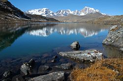
The Himalaya region is dotted with hundreds of lakes. Most lakes are found at altitudes of less than 5,000 m, with the size of the lakes diminishing with altitude. The largest lake is the Pangong Tso, which is spread across the border between India and Tibet. It is situated at an altitude of 4,600 m, and is 8 km wide and nearly 134 km long. A notable high (but not the highest) lake is the Gurudogmar in North Sikkim at an altitude of 5,148 m (16,890 ft) (altitude source: SRTM). Other major lakes include the Tsongmo lake, near the Indo-Tibet border in Sikkim, and Tilicho lake in Nepal in the Annapurna massif, a large lake in an area that was closed to tourists until recently.
The mountain lakes are known to geographers as tarns if they are caused by glacial activity. Tarns are found mostly in the upper reaches of the Himalaya, above 5,500 metres. For more information about these, see here.
Impact on climate
The Himalayas have a profound effect on the climate of the Indian subcontinent and the Tibetan plateau. They prevent frigid, dry Arctic winds blowing south into the subcontinent, which keeps South Asia much warmer than corresponding temperate regions in the other continents. It also forms a barrier for the monsoon winds, keeping them from traveling northwards, and causing heavy rainfall in the Terai region. The Himalayas are also believed to play an important part in the formation of Central Asian deserts such as the Taklamakan and Gobi deserts.
The mountain ranges also prevent western winter disturbances from Iran from traveling further, resulting in snow in Kashmir and rainfall for parts of Punjab and northern India. Despite being a barrier to the cold northernly winter winds, the Brahmaputra valley receives part of the frigid winds, thus lowering the temperature in the northeast Indian states and Bangladesh. These winds also cause the North East monsoon during this season for these parts.
In turn, the jet stream affects the image of Himalayan peaks. The strong stream of winds from the west pass through Everest, creating a familiar plume of snows blowing from the summit, and visible from a great distance.
Mountain passes
The rugged terrain of the Himalaya makes few routes through the mountains possible. Some of these routes include:
- Zoji La lies between the vale of Kashmir and the Kargil district and is the only Western entrance to the highlands of Ladakh.
- Banihal is an important pass connecting the hill areas of Jammu to the Kashmir Valley.
- Gangtok in Sikkim to Lhasa in Tibet, via the Nathula Pass and Jelepla Passes (offshoots of the ancient Silk Road).
- Bhadgaon in Nepal to Nyalam in Tibet.
- Rohtang Pass in Himachal Pradesh, India.
- Mohan Pass is the principal pass in the Siwalik Hills, the southern most and geologically youngest foothills running parallel to the main Himalayas in Sikkim.
Impact on politics and culture

It should be noted that almost half of the humans and livestock of India live on one-third of the landscape within 500km of the Himalayan range.(pdf,3mb)
The Himalayas, due to their large size and expanse, have been a natural barrier to the movement of people for tens of thousands of years. In particular, this has prevented intermingling of people from the Indian subcontinent with people from China and Mongolia, causing significantly different languages and customs between these regions. The Himalayas have also hindered trade routes and prevented military expeditions across its expanse. For instance, Genghis Khan could not expand his empire south of the Himalayas into the subcontinent.
Himalaya
Himalaya is made up of two Sanskrit words - "Him" which means snow and "alaya" means house, together meaning the abode of snow.
Him also means Nepalese "snow-covered mountain" and is used to name the various mountains of the Himalayas. In Nepal, these are as follows:
- Sagarmatha Himal
- Annapurna Himal
- Ganesh Himal
- Langtang Himal
- Manaslu Himal
- Rolwaling Himal
- Jugal Himal
- Gauri Sankar Himal
- Kanjirowa Himal
- Khumbu Himal
- Dhaulagiri Himal
Notable Peaks of the Himalayan System (includes outlying ranges)
| Peak Name | Other names and meaning | Elevation (m) | Elevation (ft) | First ascent | Notes |
|---|---|---|---|---|---|
| Everest | Sagarmatha, "Forehead of the Sky", Chomolangma, "Mother of the Universe" |
8,848 | 29,035 | 1953 | World's highest mountain, situated in Tibet and Nepal. |
| K2 | Chogo Gangri | 8,611 | 28,251 | 1954 | World's 2nd highest. Located in the Karakoram of Pakistan administered Kashmir and the Trans-Karakoram tract. |
| Kangchenjunga | Kangchen Dzö-nga, "Five Treasures of the Great Snow" | 8,586 | 28,169 | 1955 | World's 3rd highest . Located in Sikkim (India) and Nepal. |
| Lhotse | "South Peak" | 8,516 | 27,940 | 1956 | World's 4th highest. Situated between Nepal & Tibet, in the shadow of Everest. |
| Makalu | "The Great Black" | 8,462 | 27,765 | 1955 | World's 5th highest. Situated in Nepal. |
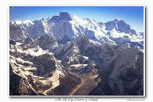
| Cho Oyu | Qowowuyag, "Turquoise Goddess" | 8,201 | 26,905 | 1954 | World's 6th highest. Situated in Nepal. |
| Dhaulagiri | "White Mountain" | 8,167 | 26,764 | 1960 | World's 7th highest. Situated in Nepal. |
| Manaslu | Kutang, "Mountain of the Spirit" | 8,156 | 26,758 | 1956 | World's 8th highest. Located in the Gurkha Himal, Nepal. |
| Nanga Parbat | Diamir, "Naked Mountain" | 8,126 | 26,660 | 1953 | World's 9th highest . Located in Pakistan. |
| Annapurna | "Goddess of the Harvests" | 8,091 | 26,545 | 1950 | World's 10th highest. Deadliest mountain on Earth. Situated in Nepal. |
| Gasherbrum I | "Beautiful Mountain" | 8,080 | 26,509 | 1958 | 11th highest mountain on Earth. Located in the Karakoram Pakistan |
| Broad Peak | Faichan Kangri | 8,047 | 26,401 | 1957 | 12th highest mountain on Earth. Located in the Karakoram Pakistan. |
| Gasherbrum II | - | 8,035 | 26,362 | 1956 | 13th highest mountain on Earth. Located in the Karakoram Pakistan. |
| Shishapangma | Xixiabangma, "Crest Above The Grassy Plains" | 8,013 | 26,289 | 1964 | 14th highest mountain on Earth. Located in Tibet. |
| Gyachung Kang | unknown | 7,952 | 26,089 | 1964 | 15th highest mountain on Earth. Located in Nepal/Tibet. |
| Gasherbrum IV | - | 7,925 | 26,001 | 1958 | 17th highest on Earth and an extremely technical climb. Located in the Karakoram Pakistan. |
| Masherbrum | unknown | 7,821 | 25,660 | 1960 | 22nd highest on Earth. Located in the Karakoram Pakistan. |
| Nanda Devi | "Bliss-Giving Goddess" | 7,817 | 25,645 | 1936 | 23rd highest on Earth. Located in Uttarakhand, India. |
| Rakaposhi | "Shining Wall" | 7,788 | 25,551 | 1958 | A massive peak that towers above local terrain. Located in the Pakistans Karakoram. |
| Gangkhar Puensum | Gankar Punzum, "Three Mountain Siblings" | 7,570 | 24,836 | Unclimbed | World's highest unclimbed peak remains off-limits to mountaineers. Located in the Kingdom of Bhutan. |
| Ama Dablam | "Mother And Her Necklace" | 6,848 | 22,467 | 1961 | Considered by some to be the most beautiful peak in the world. Located in the Khumbu, Nepal. |
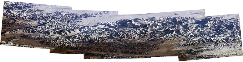
Panorama
Notable Himalayan mountaineers
- George Mallory (1886–1924) Attempt at first ascent of Mount Everest; died on North Face.
- Noel Odell (1890–1987) British. First ascent, in 1936, of Nanda Devi, which remained the highest summited peak until 1950.
- Bill Tilman (1898–1977) British. First ascent of Nanda Devi in 1936. In 1934, first person to penetrate Nanda Devi sanctuary
- Frank Smythe (1900–1949) British. Mount Blank, Kamet, and early attempt on Kangchenjunga.
- Eric Shipton (1907–1977) British. With Bill Tillman, first to penetrate Nanda Devi sanctuary. Discovered route to Everest over Khumbu Glacier.
- John Hunt (1910–1998) British. Leader of 1953 expedition of Mount Everest.
- Tenzing Norgay (1914–1986) Nepalese Sherpa mountaineer. First man on Everest's summit along with Edmund Hillary.
- Maurice Herzog (b. 1919) First person to summit an Eight-thousander, Annapurna, in 1950. Lost all toes and most fingers due to frostbite. Peak not climbed again until 1970.
- Sir Edmund Hillary (1919–2008) New Zealand mountaineer and explorer, the first man on Everest's summit along with Tenzing Norgay.
- Tom Bourdillon (1924–1956) member of British Everest expeditions 1951, 1952, and 1953, reached 300 feet (90 m) from summit of Everest three days before Edmund Hillary and Tenzing Norgay finally conquered it.
- Hermann Buhl (1924–1957) First ascent of Nanga Parbat in 1953 (feat accomplished solo and without oxygen). First ascent of Broad Peak. Died in fall on Chogolisa, body never found.
- Willi Unsoeld (1926–1979) United States. First ascent of Everest from West Face and first major traverse of a Himalayan peak, 1963. Daughter Nanda Devi Unsoeld killed during Nanda Devi expedition 1976. Died during avalanche on Mount Rainier, 1979.
- Chris Bonington (b. 1934) First ascent of Annapurna (South Face), 4 ascents of Everest.
- Nawang Gombu (b. 1936) Indian mountaineer. First person to climb Everest twice: 1963 and 1965.
- Jim Whittaker (b. 1936) United States. First American to summit Everest.
- Reinhold Messner (born 1944) Italian mountaineer. First man to climb all fourteen eight-thousanders.
- Jerzy Kukuczka (1948–1989) Polish mountaineer. Ascended all fourteen eight-thousanders faster than anybody else, establishing ten new routes.
- Nazir Sabir Pakistani mountaineer. First ascent of two eight thousanders (Broad Peak & Gasherbrum II) in a single attempt.
- Swami Sundaranand (b. 1926 India) Climbed 25 mountains with little or no equipment from 1950-1990 to experience open eyed Samādhi using the ancient techniques of the Himalayan Yogis. Noted also for his extensive photography of the Indian Himalayas.[8][9][10] Land has been secured in Gangotri, India, for a museum dedicated to his rare Himalayan photos and documentation of the Himalayan Glaciers with a special emphasis on environmental protection of the region.
- Jaime Viñals First Central American person to climb Mount Everest.[11]
- Casey Mackins An English mountaineer who climbed Mt Everest by a new route without oxygen from Tibet in 1984 and then again from Nepal in 1990 during his famous Sea to Summit expedition where he became the first person to climb Everest starting from sea level
- José Antonio Delgado Sucre(1965–2006) was the first Venezuelan mountaineer to reach the summit of five eight-thousanders. He was one of the most experienced climbers in Latin America. He was born in Caracas, Venezuela.
- Ed Viesturs (b. June 22, 1959) is the first American, and 12th person overall, to summit all fourteen mountains over 8000 meters (collectively known as the eight-thousanders), and the sixth climber to do it without bottled oxygen.
- Pemba Dorjie (born c. 1977) a Sherpa who currently holds the world record for the quickest climb to the summit of Mount Everest from camp. On May 21, 2004 Dorjie set that record, with a total time of 8 hours and 10 minutes.
- Appa Sherpa (born c. 1960) On May 16, 2007, successfully summited Mt. Everest for the 18th time, breaking his own record for most successful ascents.
- Krzysztof Wielicki (born 1950) Polish mountaineer, the fifth man to climb all fourteen eight-thousanders. Three of them (Mount Everest, Kangchenjunga and Lhotse) he ascended as the first man ever to do it in winter.
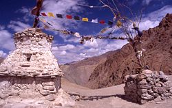
Religion

Several places in the Himalaya are of religious significance in Hinduism and Buddhism. In Hinduism, the Himalaya have also been personified as the god Himavat, the father of Shiva's consort, Parvati.
Some of the important religious places in the Himalayas are:-
- Haridwar, the place where the river Ganga enters the plains.
- Badrinath, a temple dedicated to Vishnu.
- Kedarnath, where one of the 12 Jyotirlingas is located.
- Gaumukh, the source of the Bhagirathi (and hence, by extension, the Ganga), located a few miles above the town of Gangotri.
- Deoprayag, where the Alaknanda and Bhagirathi merge to form the Ganga.
- Rishikesh, has a temple of Lakshmana.
- Mount Kailash, a 6,638 m high peak which is the abode of the Hindu Gods Shiva and Uma and is also venerated by Buddhists. The peak is forbidden to climb, it is so sacred it is circled at its base. Lake Manasarowar lies at the base of Mount Kailash, and is the source of the Brahmaputra.
- Amarnath, has a natural Shiva linga of ice which forms for a few weeks each year. Thousands of people visit this cave during these few weeks.
- The Vaishno Devi is a popular shrine among Durga devotees.
- Sri Hemkund Sahib - Sikh gurudwara where Guru Gobind Singh is claimed to have meditated and achieved enlightenment in a previous incarnation.
In addition, to the above, a number of Tibetan Buddhist sites are situated in the Himalaya, including the residence of the Dalai Lama.
The following mystic entities are associated with the Himalayas:
- The Yeti is one of the most famous creatures in cryptozoology. It is a large primate-like creature that is supposed to live in the Himalaya. Most mainstream scientists and experts consider current evidence of the Yeti's existence unpersuasive, and the result of hoaxes, legend or misidentification of mundane creatures.
- Shambhala is a mystical city with various legends associated with it, it is one of twenty-four Himalayan hidden realms, or beyul, in Vajrayana Buddhism.[12] While some legends consider it to be a real city where secret Buddhist doctrines are being preserved, other legends believe that the city does not physically exist and can only be reached in the mental realm.
The Himalayas in fiction
- Kim, by Rudyard Kipling, is the signature account of life in nineteenth century India as seen through British eyes and is based on the exploits of a young boy in the Himalayas and plains of India while engaged in the Great Game.
- Shangri-La is a fictional utopia situated somewhere in the Himalayas, based on the legendary Shambhala. It is described in the novel Lost Horizon, written by the British writer James Hilton in 1933.
- Tintin in Tibet is one of the series of classic comic-strip albums, written and illustrated by trytruy Belgian writer and illustrator Hergé, featuring the young reporter Tintin investigating a plane crash in the Gosain Than massif in the Himalayas. (1960)
- The Hollywood movie Vertical Limit (2000), is set in the K2 peak of the Himalayas, in Pakistan.
- Several levels of Tomb Raider 2 and one level in Tomb Raider: Legend of the Tomb Raider series are situated in the Himalayas.
- The Inheritance of Loss written by Kiran Desai is partly set in the Himalaya Mountains. It won the Man Booker Prize in 2006.
- Rumer Godden's novel "Black Narcissus" (1939) is about an order of nuns who set up a convent in the Himalayas. The film, released in 1947 by Powell and Pressburger and starring Deborah Kerr, was not actually shot in the Himalayas and relied primarily on matte paintings to evoke the mountains.
- Isabel Allende's novel, Kingdom of the Golden Dragon takes place mostly in the Forbidden Kingdom, a fictional country in the Himalayas.
- "Dragon Rider (novel)" is authored by Cornelia Funke and tells the story of an epic journey that a small boy, a brownie, and a dragon take to the "Rim of Heaven," a place in the Himalayas where dragons reside.
See also
- American Himalayan Foundation
- Baltistan
- Eastern Himalaya
- Indian Himalayan Region
- Eight-thousander - a list of peaks over 8,000 metres
- Geography of China
- Geography of India
- Himalayan Towers
- Karakoram (mountain range)
- Karakoram Highway
- Ladakh
- List of highest mountains - all mountains over 7,200 metres
- List of mountains in Pakistan
- Mountain ranges of Pakistan
- Trekking peak
References
- ↑ Oracle Education Foundation: Indian Himalayas
- ↑ "Himalayan Mountain System". Retrieved on 2007-08-07.
- ↑ 3.0 3.1 "Biodiversity Hotspots-Himalaya- Overview". Conservation International. Conservation International (2007). Retrieved on 2008-07-12.
- ↑ Gaillardet, J; Métivier, Lemarchand, Dupré, Allégre, Li, Zhao (2003). "Geochemistry of the Suspended Sediments of Circum-Himalayan Rivers and Weathering Budgets over the Last 50 Myrs" (PDF). Geophysical Research Abstracts 5 (13617). http://www.cosis.net/abstracts/EAE03/13617/EAE03-J-13617.pdf. Retrieved on 2006-11-04.
- ↑ Vanishing Himalayan Glaciers Threaten a Billion
- ↑ Glaciers melting at alarming speed
- ↑ Big melt threatens millions, says UN
- ↑ United Nations, May 2007, Our Planet magazine
- ↑ Personal Time with Swami-ji, 157 mins Film, The Center for Healing Arts [1]
- ↑ Himalaya: Through the Lens of a Sudu Published August 2001 ISBN 81-901326-0-1
- ↑ Neira, Claudia (July 2002). "Faith that moves mountains". IDBAmerica Online.
- ↑ Levine, Norma (1993). Blessing Power of the Buddhas: Sacred Objects, Secret Lands. Element Books. pp. 132. ISBN 1-85230-305-0.
- The Himalayan Journal published by Himalayan Club
Further reading
- Swami Sundaranand Himalaya: Through the Lens of a Sudu Published by Tapovan Kuti Prakashan (August 2001). ISBN 81-901326-0-1
- Michael Palin, Himalaya, Weidenfeld Nicolson Illustrated (2004). ISBN 0-297-84371-0
- Augusto Gansser, Andreas Gruschke, Blanche C. Olschak: Himalayas. Growing Mountains, Living Myths, Migrating Peoples, New York, Oxford: Facts On File 1987. ISBN 0816019940 and New Delhi: Bookwise 1987.
- John Hunt, Ascent of Everest, Hodder & Stoughton (1956). ISBN 0-89886-361-9
- Everest, the IMAX movie (1998). ISBN 0-7888-1493-1
- Swami Tapovan Maharaj Wanderings in the Himalayas, English Edition, Pulished by Chinmaya Publication Trust, Madras-3 (1960) translated by T.N. Kesava Pillai, M.A.
- Nandy, S.N., Dhyani, P.P. and Samal, P.K., Resource Information Database of the Indian Himalaya, GBPIHED, Almora (2006) [1]
- Maurice Isserman and Stewart Weaver, Fallen Giants: The History of Himalayan Mountaineering from the Age of Empire to the Age of Extremes (Yale University Press, 2008). ISBN 978-0300115017
External links
- A German language page with comprehensive information about the mountains of the Himalaya. Has links to good images.
- Maps, pictures and travelogues from various regions of the Himalayas
- The making of the Himalaya and major tectonic subdivisions
- Geology of the Himalayan mountains
- Birth of the Himalaya
- Some notes on the formation of the Himalaya
- Pictures from a trek in Annapurna (film by Ori Liber)
- Geology of Nepal Himalaya
Image Gallery
|
|||||||||||
|
||||||||||||||||||||||
|
|||||||
