Henry County, Illinois
| Henry County, Illinois | |
| Map | |
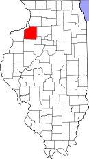 Location in the state of Illinois |
|
 Illinois's location in the U.S. |
|
| Statistics | |
| Founded | 1826 |
|---|---|
| Seat | Cambridge |
| Largest city | Kewanee |
| Area - Total - Land - Water |
826 sq mi (2,138 km²) 823 sq mi (2,132 km²) 2 sq mi (6 km²), 0.29% |
| Population - (2000) - Density |
51,020 62/sq mi (24/km²) |
| Time zone | Central: UTC-6/-5 |
| Website: www.co.henry.il.us | |
Henry County is a county located in the U.S. state of Illinois. As of 2000, the population was 51,020. Its county seat is Cambridge, Illinois[1]. It is one of the four counties that make up the Davenport-Moline-Rock Island Metropolitan Statistical Area.[2]
Contents |
Geography
According to the U.S. Census Bureau, the county has a total area of 826 square miles (2,138 km²), of which, 823 square miles (2,132 km²) of it is land and 2 square miles (6 km²) of it (0.29%) is water. It is the 29th largest of Illinois' 102 counties. The area is fairly flat, with elevations ranging from 650 feet above sea level in the northwest to 850 in the southeast. The land is mostly used for agriculture, about 456,596 acres (1,848 km²) or 86.7% of the county's land area. [1].
Adjacent counties
- Whiteside County - northeast
- Bureau County - east
- Stark County - southeast
- Knox County - south
- Mercer County - west
- Rock Island County - northwest
History
Henry County was formed in 1826 out of Fulton County, Illinois. It is named in honor of Patrick Henry, Revolutionary War firebrand and champion of individual rights, to whom the slogan "give me liberty, or give me death" is attributed.
Demographics

| Historical populations | |||
|---|---|---|---|
| Census | Pop. | %± | |
| 1900 | 40,049 |
|
|
| 1910 | 41,736 | 4.2% | |
| 1920 | 45,162 | 8.2% | |
| 1930 | 43,851 | −2.9% | |
| 1940 | 43,798 | −0.1% | |
| 1950 | 46,492 | 6.2% | |
| 1960 | 49,317 | 6.1% | |
| 1970 | 53,217 | 7.9% | |
| 1980 | 57,968 | 8.9% | |
| 1990 | 51,159 | −11.7% | |
| 2000 | 51,020 | −0.3% | |
| IL Counties 1900-1990 | |||
As of the census[3] of 2000, there were 51,020 people, 20,056 households, and 14,299 families residing in the county. The population density was 62 people per square mile (24/km²). There were 21,270 housing units at an average density of 26 per square mile (10/km²). The racial makeup of the county was 96.19% White, 1.14% Black or African American, 0.10% Native American, 0.25% Asian, 0.01% Pacific Islander, 1.31% from other races, and 0.99% from two or more races. 2.88% of the population were Hispanic or Latino of any race. 24.6% were of German, 12.4% Swedish, 11.6% American, 9.7% English, 9.0% Irish and 8.2% Belgian ancestry according to Census 2000. 96.7% spoke English and 2.5% Spanish as their first language.
There were 20,056 households out of which 31.80% had children under the age of 18 living with them, 60.00% were married couples living together, 8.00% had a female householder with no husband present, and 28.70% were non-families. 25.10% of all households were made up of individuals and 13.20% had someone living alone who was 65 years of age or older. The average household size was 2.51 and the average family size was 3.00.
In the county the population was spread out with 25.30% under the age of 18, 7.70% from 18 to 24, 26.40% from 25 to 44, 24.30% from 45 to 64, and 16.30% who were 65 years of age or older. The median age was 39 years. For every 100 females there were 96.10 males. For every 100 females age 18 and over, there were 92.50 males.
The median income for a household in the county was $39,854, and the median income for a family was $48,413. Males had a median income of $34,436 versus $21,757 for females. The per capita income for the county was $18,716. About 5.60% of families and 8.00% of the population were below the poverty line, including 10.50% of those under age 18 and 6.60% of those age 65 or over.
Cities and towns
- Alpha
- Andover
- Annawan
- Atkinson
- Bishop Hill
- Cambridge
- Cleveland
- Coal Valley (partial)
- Colona
- Galva
- Geneseo
- Hooppole
- Kewanee
- Orion
- Woodhull
Census-designated places
- Fairbank
- Green Rock
- Lynn Center
- Nekoma
- Opheim
- Ophiem
- Sunny Hill
- Sunny Hill Estates
- Swedona
- Ulah
- Warner
Townships
Henry County is divided into twenty-four townships:
|
|
|
|
References
- ↑ "Find a County". National Association of Counties. Retrieved on 2008-01-31.
- ↑ United States Office of Management and Budget. "Update of Statistical Area Definitions and Guidance on Their Uses" (PDF) 5, 36.. Retrieved on 2006-07-21.
- ↑ "American FactFinder". United States Census Bureau. Retrieved on 2008-01-31.
External links
|
|||||||||||||||||||||||
|
|||||||||||||||||||||||
|