Guerrero
| State of Guerrero | |||
|
|||
 |
|||
| Country | |||
|---|---|---|---|
| Capital | Chilpancingo | ||
| Municipalities | 76 | ||
| Largest City | Acapulco | ||
| Government | |||
| - Governor | Zeferino Torreblanca (PRD) | ||
| - Federal Deputies | PRD: 9 | ||
| - Federal Senators | PRD: 2 PRI: 1 |
||
| Area Ranked 14th |
|||
| - Total | 64,281 km² (24,819 sq mi) | ||
| Population (2005) | |||
| - Total | 3,115,202(Ranked 11th) | ||
| Time zone | CST (UTC-6) | ||
| - Summer (DST) | CDT (UTC-5) | ||
| HDI (2004) | 0.7296 - medium Ranked 30th |
||
| ISO 3166-2 | MX-GRO | ||
| Postal abbr. | Gro. | ||
| Website: Guerrero State Government | |||

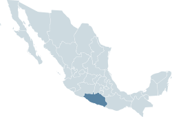
The State of Guerrero is a state in the southern meridional region of Mexico. With an area of 64,282 square kilometers (24,819.4 sq mi), it occupies about 3.3% of Mexican territory. It borders the Pacific Ocean to the south (500 km), Michoacán to the west (524 km), Oaxaca to the east (241 km), and Mexico State (216 km), Morelos (88 km), and Puebla to the north (128 km). Guerrero is named in honor of the second president of the republic, General Vicente Ramón Guerrero Saldaña (August 10, 1782 – February 14, 1831), a hero of the Mexican War of Independence. In 2003, the population was estimated at 3,167,400 people.
The state capital is Chilpancingo de los Bravo. Besides Chilpancingo, its principal cities are Acapulco, Petatlan, Taxco, Iguala, and Zihuatanejo.
Guerrero is an important tourist destination. There are three main areas of tourism, known as the Triángulo del Sol (triangle of the sun). The first is Acapulco. The second is Taxco, a colonial town noted for its silverware. The third is Ixtapa/Zihuatanejo. Ixtapa was a destination created by the federal government during the slow economy of the 1980s to increase tourism.
Contents |
History
During the 14th and 15th centuries, the mountain and coastal regions of Guerrero were occupied by Nahuatl-speaking people who practiced Slash and burn farming in the tropical forests and cultivated small irrigated fields along the numerous river valleys. The Spanish conquest brought dramatic declines in the native population.[1] However, unlike many other portions of Mexico, this decline was not offset by significant Spanish settlement. Rough topography, the low potential for economic development, and perceived health hazards were disincentives to settlement. As a result, agriculture and cattle raising were not common in the region until well into the 19th century.[2] While Guerrero has experienced significant population growth and economic development during the last 60 years, the geographic pattern and character of this growth remain strongly influenced by the state's rugged physiography and limitations on transportation.[3]
Geography
In most of Guerrero, a hot and humid climate with a summer rainy season prevails, although it has a complex geographical morphology that allows a more temperate climate in the central and northern regions.
Government and politics
The Constitution of the State of Guerrero provides that the government of Guerrero, like that of every other state in Mexico, consists of three powers: the executive, the legislative, and the judiciary.
Executive power rests in the governor of Guerrero, who is directly elected by the citizens, using a secret ballot, to a 6-year term, with no possibility of reelection. Legislative power rests in the Congress of Guerrero, which is a unicameral. Judicial power is invested in the Superior Court of Justice of Guerrero.
Municipalities
The State of Guerrero is divided into 7 regions (regiones): Acapulco, Centro, Costa Chica, Costa Grande, Montaña, Norte, and Tierra Caliente. These are subdivided into 81 municipalities, each headed by a municipal president (mayor). Most municipalities are named after the city that serves as municipal seat; e.g., the municipal seat of the Municipality of Chilpancingo is the City of Chilpancingo de los Bravos.
Major communities
- Ciudad Altamirano
- Acapulco (Acapulco de Juárez)
- Chilpancingo (Chilpancingo de los Bravo)
- Iguala (Iguala de la Independencia)
- Taxco (Taxco de Alarcón)
- Tlapa de Comonfort
- Zihuatanejo
Municipalities
Acapulco De Juarez, Ahuacuotzingo, Ajuchitlan Del Progreso, Alcozauca De Guerrero, Alpoyeca, Apaxtla, Arcelia, Atenango Del Rio, Atlamajalcingo Del Monte, Atlixtac, Atoyac De Alvarez, Ayutla De Los Libres, Azoyu, Benito Juarez, Buenavista De Cuellar, Coahuayutla De Jose Maria Izazaga, Cocula, Copala, Copalillo, Copanatoyac, Coyuca De Benitez, Coyuca De Catalan, Cuajinicuilapa, Cualac, Cuautepec, Cuetzala Del Progreso, Cutzamala De Pinzon, Chilapa De Alvarez, Chilpancingo (Chilpancingo de los Bravo), Florencio Villarreal, General Canuto A Neri, General Heliodoro Castillo, Huamuxtitlan, Huitzuco De Los Figueroa, Iguala De La Independencia, Igualapa, Ixcateopan De Cuauhtemoc, Jose Azueta, Juan R Escudero, Leonardo Bravo, Malinaltepec, Martir De Cuilapan, Metlatonoc, Mochitlan, Olinala, Ometepec, Pedro Ascencio Alquisiras, Petatlan, Pilcaya, Pungarabato, Quechultenango, San Luis Acatlan, San Marcos, San Miguel Totolapan, Taxco De Alarcon, Tecoanapa, Tecpan De Galeana, Teloloapan, Tepecoacuilco De Trujano, Tetipac, Tixtla De Guerrero, Tlacoachistlahuaca, Tlacoapa, Tlalchapa, Tlalixtaquilla De Maldonado, Tlapa de Comonfort, Tlapehuala, La Union, Xalpatlahuac, Xochihuehuetlan, Xochistlahuaca, Zacapocstepec Zapotitlan Tablas, Zirandaro, Zitlala, Eduardo Neri,
Notes
- ↑ Acuña, R. (1987). Relaciones Geográficas del Siglo XVI: Michoacán. Universidad Nacional Autónoma de México.
- ↑ Gerhard, P. (1972). A Guide to the Historical Geography of New Spain. University of Cambridge Press.
- ↑ Lambert, D.P. (1994). "Regional Core-Periphery Imbalance: The Case of Guerrero, Mexico, Since 1821". Yearbook, Conference of Latin Americanist Geographers (20): 59–71.
External links
- (Spanish) Guerrero State Government
- (Spanish) Towns, cities, and postal codes in Guerrero
|
||||||||||