Gallatin County, Illinois
| Gallatin County, Illinois | |
| Map | |
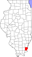 Location in the state of Illinois |
|
 Illinois's location in the U.S. |
|
| Statistics | |
| Founded | 1812 |
|---|---|
| Seat | Shawneetown |
| Largest city | Shawneetown |
| Area - Total - Land - Water |
328 sq mi (851 km²) 324 sq mi (838 km²) 5 sq mi (12 km²), 1.43% |
| Population - (2000) - Density |
6,445 20/sq mi (8/km²) |
| Time zone | Central: UTC-6/-5 |
Gallatin County is a county located in the U.S. state of Illinois. As of 2000, the population was 6,445. Its county seat is Shawneetown, Illinois[1].
Contents |
Geography
According to the U.S. Census Bureau, the county has a total area of 328 square miles (851 km²), of which, 324 square miles (838 km²) of it is land and 5 square miles (12 km²) of it (1.43%) is water.
The Wabash and Ohio rivers join in the northeastern part of the county. The Saline River is a major drainage in the county, and it feeds into the Ohio River.
Adjacent counties
- White County - north
- Posey County, Indiana - northeast
- Union County, Kentucky - east
- Hardin County - south
- Saline County - west
- Hamilton County - northwest
National protected area
- Shawnee National Forest (part)
History
The County was organized in 1812, having been formed from Randolph County. The County was named for Albert Gallatin, who was Secretary of the Treasury at the time. The Shawneetown Bank was the only bank in Illinois back then.
Saline springs along the Saline River between Equality and Junction, Illinois played a big part in the County's early history. The springs are on State land along the south bank of the Saline River, just east of the bridge on Illinois Route 1. Slave trader and landowner Blake Drone made his fortune leasing the salt works from the government.
Settlements
Cities
|
Villages
|
Unincorporated
|
Townships
Gallatin County is divided into ten townships:
|
|
Demographics

| Historical populations | |||
|---|---|---|---|
| Census | Pop. | %± | |
| 1900 | 15,836 |
|
|
| 1910 | 14,628 | −7.6% | |
| 1920 | 12,856 | −12.1% | |
| 1930 | 10,091 | −21.5% | |
| 1940 | 11,414 | 13.1% | |
| 1950 | 9,818 | −14% | |
| 1960 | 7,638 | −22.2% | |
| 1970 | 7,418 | −2.9% | |
| 1980 | 7,590 | 2.3% | |
| 1990 | 6,909 | −9% | |
| 2000 | 6,445 | −6.7% | |
| IL Counties 1900-1990 | |||
As of the census[2] of 2000, there were 6,445 people, 2,726 households, and 1,837 families residing in the county. The population density was 20 people per square mile (8/km²). There were 3,071 housing units at an average density of 10 per square mile (4/km²). The racial makeup of the county was 98.37% White, 0.26% Black or African American, 0.71% Native American, 0.06% Asian, 0.03% Pacific Islander, 0.09% from other races, and 0.47% from two or more races. 0.87% of the population were Hispanic or Latino of any race. 28.8% were of American, 18.3% German, 14.5% Irish, 12.8% English and 5.6% French ancestry according to Census 2000. 98.2% spoke English and 1.3% Spanish as their first language.
There were 2,726 households out of which 28.30% had children under the age of 18 living with them, 54.80% were married couples living together, 9.80% had a female householder with no husband present, and 32.60% were non-families. 29.40% of all households were made up of individuals and 16.10% had someone living alone who was 65 years of age or older. The average household size was 2.34 and the average family size was 2.90.
In the county the population was spread out with 22.20% under the age of 18, 8.20% from 18 to 24, 25.40% from 25 to 44, 26.00% from 45 to 64, and 18.20% who were 65 years of age or older. The median age was 41 years. For every 100 females there were 94.10 males. For every 100 females age 18 and over, there were 90.00 males.
The median income for a household in the county was $26,118, and the median income for a family was $34,539. Males had a median income of $30,750 versus $20,280 for females. The per capita income for the county was $15,575. About 15.30% of families and 20.70% of the population were below the poverty line, including 31.10% of those under age 18 and 14.10% of those age 65 or over.
References
- ↑ "Find a County". National Association of Counties. Retrieved on 2008-01-31.
- ↑ "American FactFinder". United States Census Bureau. Retrieved on 2008-01-31.
External links
- History of Gallatin County http://www.rootsweb.com/~ilgallat/gch.htm
- History of Gallatin County and its Communities http://www.lth6.k12.il.us/schools/gallatin/communities.htm
|
||||||||||||||||||||
|