Euboea
For the mythological figure, see Euboea (mythology)
| Euboea Εύβοια |
|
|---|---|
| Geography | |
 |
|
| Island Chain: | Aegean Islands |
| Area:[1] | 3,684.848 km² (1,423 sq.mi.) |
| Highest Mountain: | Mt. Dirphys (1,745 m (5,725 ft)) |
| Government | |
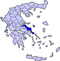
| Periphery: | Central Greece |
| Prefecture: | Euboea |
| Capital: | Chalcis |
| Statistics | |
| Population: | 198,130 (as of 2001) |
| Density: | 54 /km² (139 /sq.mi.) |
| Postal Code: | 34x xx |
| Area Code: | 22x0 |
| License Code: | XA |
| Website | |
| www.naevias.gr | |
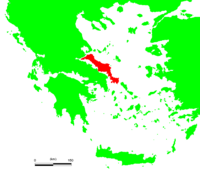
Euboea (Modern Greek, Εύβοια - Évia — Ancient Greek, Εὔβοια - Eúboia) is the second largest of the Greek Aegean Islands and the second largest Greek island overall in area and population, after Crete. It is separated from the mainland of Greece by the Euripus channel, so narrow that it changes direction every three hours. In general outline it is a long and narrow, seahorse-shaped island; it is about 150 km (90 miles) long, and varies in breadth from 50 km (30 miles) to 6 km (4 miles). Its general direction is from northwest to southeast, and it is traversed throughout its length by a mountain range, which forms part of the chain that bounds Thessaly on the east, and is continued south of Euboea in the lofty islands of Andros, Tinos and Mykonos.
Contents |
Geography

Like most of the Greek islands, Euboea was originally known under other names in ancient times, such as Macris and Doliche from its shape, Ellopia and Abantis from the tribes inhabiting it.
Euboea was believed to have originally formed part of the mainland, and to have been separated from it by an earthquake. This is fairly probable, because it lies in the neighbourhood of a fault line, and both Thucydides and Strabo write that the northern part of the island had been shaken at different periods. Its northern extremity is separated from the Thessalian coast by a strait, which at one point is not more than 130 feet (40 m) wide. In the neighbourhood of Chalcis, both to the north and the south, the bays are so confined as to make plausible the story of Agamemnon's fleet having been detained there by contrary winds. At Chalcis itself, where the strait is narrowest, it is called the Euripus Strait. The extraordinary changes of tide which take place in this passage have been a subject of note since classical times. At one moment the current runs like a river in one direction, and shortly afterwards with equal velocity in the other. A bridge was first constructed here in the twenty-first year of the Peloponnesian War (410 BC). The name Euripus was corrupted during the Middle Ages into Evripo and Egripo, and in this latter form transferred to the whole island. Later the Venetians, when they occupied the district, altered it to Negroponte, referring to the bridge which connected it with the mainland.
The main mountains include Dirphys (1,745 m), Pyxaria (1,341 m) in the northeast and Ochi (1,394). The neighboring gulfs are the Pagasetic Gulf in the north, Maliakos Gulf, Northern Euboean Gulf in the west, the Euboic Sea and the Petalion Gulf. At the 2001 census the island had a population of 198,130, and a total land area of 3,684.848 km².
History
Ancient
The history of the island is for the most part that of its two principal cities, Chalcis and Eretria. Both cities were Ionian settlements from Attica, and their importance in early times is shown by their numerous colonies in Magna Graecia and Sicily, such as Cumae and Rhegium, and on the coast of Macedonia. In this way they opened new trade routes to the Greeks, and extended the field of western civilization.
The strength of their commerce is shown by the fact that the Euboic scale of weights and measures was used in Athens until Solon, and among the Ionic cities generally. They were rival cities, and appear to have been equally powerful at first; one of the earliest of the sea battles mentioned in Greek history took place between them, and it is also said that many of the other Greek states took part.
In 490 BC, Eretria was utterly ruined and its inhabitants were transported to Persia. Though it was restored after the Battle of Marathon, on a site at a little distance from its original position, it never regained its former eminence, but it was still the second city on the island. From this time its neighbour Chalcis held an undisputed supremacy. Already, however, this city had suffered from the growing power of Athens. In the year 506 BC the Chalcidians were totally defeated by the Athenians, who established 4,000 Attic settlers on their lands, and seem to have reduced the whole island to a condition of dependence.
Again, in 446 BC, when Euboea endeavoured to throw off the yoke, it was once more reduced by Pericles, and a new body of settlers was planted at Histiaea in the north of the island, after the inhabitants of that town had been expelled. The Athenians fully recognized its importance to them, for supplying them with corn (ie, grain) and cattle, securing their commerce, and guaranteeing them against piracy, because its proximity to the coast of Attica rendered it extremely dangerous to them when in other hands. But in 410 BC the island succeeded in regaining its independence. After this it took sides with one or other of the leading states, until, after the Battle of Chaeronea, it passed into the hands of Philip II of Macedon, and finally into those of the Romans.
Medieval
In 1157 all the coastal towns of Euboea were destroyed by a Sicilian force.[2]
Modern
In modern history, Euboea came into prominence following the Fourth Crusade. In the partition of the Eastern Roman Empire by the Latins, the island was divided into three fiefs which placed themselves under the protection of the Venetian Republic, henceforth the sovereign power. On 12 July 1470, after a heated defence, the well-fortified city of Chalkis (Negroponte) was wrested from Venice by Mehmed II, and the whole island fell into the hands of the Ottoman Empire. At the conclusion of the Greek War of Independence in 1830, the island constituted a part of the newly-established Greek state.
Euboea is linked to the mainland by two bridges, one that runs through Chalcis and is also accessible from Thebes, and another which bypasses Chalcis and is accessed from Athens. All of Euboea's modern bridges are suspended.
In the 1980s, the Dystos lake was filled with grass which was set on fire by farmers to make more farmland. This act caused devastation of much of the plants and the environment in that area. A part of the lake later regenerated. Also the municipalities of Anthidona and Avlida in the mid to late 20th century, which once were part of the eastern part of the Boeotia Prefecture, reverted to Chalcis. Since then, the postal codes corresponded with the rest of Euboea, including Skyros.
Recent
On January 24 through January 28, 2006, a snowstorm which also affected Eastern Europe brought heavy snowfalls with snow accumulating to heights ranging from 1 to 4 metres (3.3 to 13 ft), cutting off roads from the rest of Greece in the northern, eastern and southern parts of the island. Electricity was cut off to parts of the island for several days. Two days later when the snowstorm tapered off, villages in the south and north remained cut off from roads and water supply. Communications were later restored as bulldozers cleared away the snow as far as Aliveri a day later. The snowstorm became one of the worst in the island's history. Another system arrived on February 7, 2005 and brought heavy snows that isolated several residents in their homes with 3 to 5 metres (9.8 to 16 ft) of snow, enough to reach upper balconies and almost cover homes in snow over their roofs in several villages. In Kampia, snowfall of up to 2 metres (6.6 ft) covered people's cars, and some people had to dig away the snow to get into their vehicles. Roads were also blocked and some locations were cut off from the rest of the island. The storm did not cause blackouts. A day later, temperatures began to rise and roads were re-opened and communications restored.
Another natural disaster was the forest fire that occurred in the Aliveri part of the island, fires lasted in July 2007 and devastated much of the forests including the vicinity of the hotel and devastated the tourist industry of the island. Fires battled for a few days until the situation ended completely. Hundreds of buildings were damaged..
On October 14, 2008, a near tremendous earthquake rumbled the island and measured 6.6 on the Richter scale, over four months after the Achaia-Ilia earthquake that measured at the same range, mostly the same measurement. The earthquake was even felt in Athens and parts of the mainland.
Demographics

Among the rest population, there are two sub-groups on the island, who live there since the early Middle Ages: the Arvanites and the Vlachs. Arvanites traditionally occupy portions of the southern tip of the island and are concentrated today in the area around Cape Kafireas also known as Cavo D'Oro, where the Arvanitika are still spoken by the villagers. The area southern of Aliveri is the northernmost limit of their presence in Euboea. Arvanites settled Euboea in the 14th century during the Venetian rule of the island. The Vlachs are largely assimilated and live in the hilly and mountainous area in central and northern Euboea. The Vlach language is not spoken as much as it once was. Euboea also formerly hosted a large Sarakatsani population who emigrated from the mainland of Central Greece and Epirus at the beginning of the 19th century and settled around Mandoudi and Agia Anna. The population of the island according to the census of 2001 was 198,130.
Economics
The mining areas include magnesite in Mantoudi and Limni, lignite in Aliveri and iron and nickel from Diprhys. Marble is mined 3 km north of Eretria which include Marmor Chalcidicum and asbestos in the northeastern part of Carystus in the Okhi mountains.
The trees include chestnuts.
Transport
- Greek National Road 44, Cen., S, SE
- Greek National Road 77 NW, N, W, Cen.
Communications
Television
- Space - Chalkida
Local Administration
Euboea Prefecture
| Euboea Prefecture Νομός Εύβοιας |
|
|---|---|
 |
|
|
|
| Country: | |
| Capital: | Chalcis |
| Periphery: | Central Greece |
| Population: | 218,032 (2005)Ranked 9th |
| Area: | 4,167.449 km² (1,609 sq.mi.) Ranked 7th |
| Density: | 52 /km² (136 /sq.mi.) |
| Number of provinces: | 3 |
| Number of municipalities: | 25 |
| Number of communities: | 2 |
| Postal codes: | 34x xx |
| Area codes: | 22x0 |
| Licence plate code: | ΧΑ |
| ISO 3166-2 code: | GR-04 |
| Website: | www.naevias.gr |
Euboea Prefecture is somewhat larger than the island, and includes two municipalities on the mainland, Anthidona and Avlida, as well as the island municipality of Skyros. At the 2001 census the prefecture had a population of 215,136 inhabitants, whereas the island itself had a population of 198,130. The prefecture's land area is 4,167.449 km², whereas the total land area of the municipalities actually on the island is 3,684.848 km², which includes that of numerous small offshore islets (the largest of which is Petalioi Island, near Euboea's southeastern tip).
Municipalities and communities
| Municipality | YPES code | Seat (if different) | Postal code |
|---|---|---|---|
| Aidipsos | 1401 | Loutrá Aidipsoú | 343 00 |
| Amarynthos | 1402 | 340 06 | |
| Anthidona | 1403 | Drosia | 341 00 |
| Artemisio | 1404 | 342 00 | |
| Avlida | 1405 | Vathy | 341 00 |
| Avlon | 1406 | Avlonari | 340 09 |
| Chalcis | 1426 | 341 00 | |
| Dirfys | 1407 | Steni Dirfyos | 340 14 |
| Dystos | 1408 | Krieza | 340 17 |
| Elymnioi | 1409 | Limni | 340 05 |
| Eretria | 1410 | 340 08 | |
| Istiaia | 1411 | 342 00 | |
| Karystos | 1412 | 340 01 | |
| Kireas | 1414 | Mantoudi | 340 04 |
| Konistres | 1415 | 340 16 | |
| Kymi | 1416 | 340 03 | |
| Lilantia | 1417 | Vasiliko | 340 02 |
| Marmari | 1419 | 340 13 | |
| Messapia | 1420 | Psachna | 344 00 |
| Nea Artaki | 1421 | 346 00 | |
| Nileas | 1422 | Agia Anna | 340 10 |
| Oreoi | 1427 | 340 12 | |
| Skyros | 1423 | 340 07 | |
| Styra | 1424 | 340 15 | |
| Taminaioi | 1425 | Aliveri | 345 00 |
| Community | YPES code | Seat (if different) | Postal code |
| Kafireas | 1413 | Amygdalea | 340 01 |
| Lichada | 1418 | 343 00 |
- Note: The municipalities of Anthidona and Avlida are on the mainland, attached to the northeastern part of Boeotia Prefecture. Skyros is not on the main island of Euboea, but is on an offshore island by itself. Map
Provinces
- Province of Chalkida - Chalkida
- Province of Istiaeotis - Istiaia
- Province of Karystiaea - Karystos
Note: Provinces no longer hold any legal status in Greece.
Prefecture Population
| Year | Population | Change | Density |
|---|---|---|---|
| 1991 | 209,132 | 5,236/123.23% | 53.51/km² |
| 2001 | 217,218 | 8,086/3.87% | 55.59/km² |
Wildfires
The 2007 Greek fires were some of the deadliest in world history, killing at least 64 people in the Peloponnese and Evia.
Persons
- Konstantinos Kallias (9 July 1901- 7 April 2004), a Greek politician
- Georgios Papanikolaou (1883–1962) physician, a pioneer in cytology and early cancer detection
- Giannis Skarimpas, writer
Sporting teams
- Khalkis-Lilas - Chalkida, third division
- Chalkida BC - Chalkida, Greek A2 League
See also
- Euboea, Amazon soldier, champion diver and friend of Princess Diana, of Themyscira. Created by George Pérez for DC Comics.(Wonder Woman Annual #1, 1988)
- List of settlements in the Euboea prefecture
- Global warming
- List of traditional Greek place names
References
- This article incorporates text from the Encyclopædia Britannica Eleventh Edition, a publication now in the public domain.
- ↑ "Basic Characteristics". Ministry of the Interior. www.ypes.gr. Retrieved on 2007-08-07.
- ↑ Norwich, John Julius. Byzantium: The Decline and Fall (New York: Alfred A. Knopf, 1996) p. 116
External links
|
||||||||||||||||||||||||||||||||||
