Edwards County, Illinois
| Edwards County, Illinois | |
| Map | |
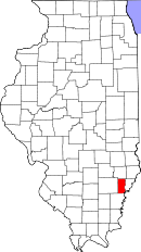 Location in the state of Illinois |
|
 Illinois's location in the U.S. |
|
| Statistics | |
| Founded | 1815 |
|---|---|
| Seat | Albion |
| Largest city | Albion |
| Area - Total - Land - Water |
223 sq mi (577 km²) 222 sq mi (576 km²) 0 sq mi (1 km²), 0.14% |
| Population - (2000) - Density |
6,971 31/sq mi (12/km²) |
| Time zone | Central: UTC-6/-5 |
Edwards County is a county located in the U.S. state of Illinois. As of 2000, the population was 6,971. Its county seat is Albion, Illinois[1].
Contents |
Geography
According to the U.S. Census Bureau, the county has a total area of 223 square miles (577 km²), of which 222 square miles (576 km²) is land and 0.386 square miles (1 km²) (0.14%) is water.
When Edwards County was formed in 1814, it comprised nearly half of the State of Illinois. New counties were formed from it until, in 1824, it assumed its present form. Edwards County is now one of the smallest counties in Illinois.
Adjacent counties
- Richland County (north)
- Wabash County (east)
- Gibson County, Indiana (southeast)
- White County (south)
- Wayne County (west)
Major highways
 Illinois Route 1
 Illinois Route 15
 Illinois Route 130
History
Edwards County was named for Ninian Edwards, the governor of the Illinois Territory, and, later, governor of Illinois.
Unlike most of the counties in Illinois, Edwards County is subdivided into "Road Districts", as opposed to "Townships". Most of Illinois was surveyed according to the Land Ordinance of 1785, which required the establishment of townships that are six miles square. Most of the counties in the State are made up of such townships. Edwards County, on the other hand, consists of Road Districts that do not generally correspond with the surveyed townships. This is a reflection of the fact that Edwards County was settled prior to the survey that established the townships.
Demographics
| Historical populations | |||
|---|---|---|---|
| Census | Pop. | %± | |
| 1900 | 10,345 |
|
|
| 1910 | 10,049 | −2.9% | |
| 1920 | 9,431 | −6.1% | |
| 1930 | 8,303 | −12% | |
| 1940 | 8,974 | 8.1% | |
| 1950 | 9,056 | 0.9% | |
| 1960 | 7,940 | −12.3% | |
| 1970 | 7,090 | −10.7% | |
| 1980 | 7,961 | 12.3% | |
| 1990 | 7,440 | −6.5% | |
| 2000 | 6,971 | −6.3% | |
| IL Counties 1900-1990 | |||
As of the census[2] of 2000, there were 6,971 people, 2,905 households, and 2,027 families residing in the county. The population density was 31 people per square mile (12/km²). There were 3,199 housing units at an average density of 14 per square mile (6/km²). The racial makeup of the county was 98.87% White, 0.14% Black or African American, 0.09% Native American, 0.40% Asian, 0.04% Pacific Islander, 0.09% from other races, and 0.37% from two or more races. 0.46% of the population were Hispanic or Latino of any race. 29.3% were of English, 26.6% American, 22.2% German and 6.3% Irish ancestry according to Census 2000. 99.1% spoke English as their first language.
There were 2,905 households out of which 29.80% had children under the age of 18 living with them, 59.00% were married couples living together, 8.20% had a female householder with no husband present, and 30.20% were non-families. 27.50% of all households were made up of individuals and 14.60% had someone living alone who was 65 years of age or older. The average household size was 2.37 and the average family size was 2.88.
In the county the population was spread out with 23.10% under the age of 18, 8.00% from 18 to 24, 26.10% from 25 to 44, 24.30% from 45 to 64, and 18.50% who were 65 years of age or older. The median age was 40 years. For every 100 females there were 93.80 males. For every 100 females age 18 and over, there were 91.50 males.
The median income for a household in the county was $31,816, and the median income for a family was $38,750. Males had a median income of $27,165 versus $19,579 for females. The per capita income for the county was $16,187. About 6.30% of families and 9.80% of the population were below the poverty line, including 13.80% of those under age 18 and 8.70% of those age 65 or over.
Settlements
Cities
- Albion
- Grayville (north half)
Villages
- Bone Gap
- Browns
- West Salem
Unincorporated
- Black
- Ellery
- Samsville
Precincts
- Albion
- Bone Gap
- Browns
- Dixon
- Ellery
- French Creek
- Salem
- Shelby
References
- United States Census Bureau 2007 TIGER/Line Shapefiles
- United States Board on Geographic Names (GNIS)
- United States National Atlas
- ↑ "Find a County". National Association of Counties. Retrieved on 2008-01-31.
- ↑ "American FactFinder". United States Census Bureau. Retrieved on 2008-01-31.
External links
Edwards County precincts and their boundaries
|
|||||||||||||||||||||||
|