Douglas, Isle of Man
| Douglas | |
| Manx: Doolish | |
|
|
|
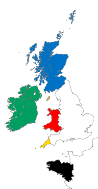
 Douglas shown within the Isle of Man |
|
| Population | 26,218 (2006 Census) |
|---|---|
| OS grid reference | |
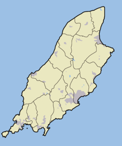
| Parish | Douglas |
| Sheading | Middle |
| Crown dependency | Isle of Man |
| Post town | ISLE OF MAN |
| Postcode district | IM1 / IM2 |
| Dialling code | 01624 |
| Police | Isle of Man |
| Fire | Isle of Man |
| Ambulance | Isle of Man |
| House of Keys | Douglas North Douglas East Douglas South Douglas West |
| Website: www.douglas.gov.im/ | |
| List of places: Isle of Man | |
Douglas (Manx: Doolish) is the capital and largest town of the Isle of Man, with a population of 26,218 people. It is located at the mouth of the River Douglas, and a sweeping bay of two miles. The River Douglas forms part of the town's harbour and main commercial port.
Douglas is home to the High Courts and the Isle of Man Government.
The town serves as the Island's main hub for business, finance, shipping, transport, shopping and entertainment.
Contents |
History
The discovery of a bronze weapon in central Douglas, and the large Ballaquayle Viking treasure hoard on the outskirts, both in the 1890s, hint at the early importance of the site now occupied by Douglas. It is believed that the town expanded little and remained a small fishing village though, until the seventeenth century, when trade began to thrive. Douglas's progression mirrored that of many other Manx river settlements. Over the next century Douglas began to reap the benefits of trans-Atlantic trade, due to the discovery of the New World, and co-operation on a local level with Liverpool.[1] The town's prosperity was facilitated by the low cost of living, and favourable legal status enjoyed by English debtors and half pay officers. The initial growth and development of the town owed much to its natural harbour (now the Inner Harbour), since greatly expanded and improved. The burgeoning 'Running Trade' (smuggling) was one of the stimuli for the town to expand. Legitimate merchants who rose to prominence over the period included the Murreys, the Moores, and the Bacons.[1] Over the course of the 18th century, the town's population rose significantly, from 800 (approx.) in 1710 to nearly 2,500 in 1784. The number of houses and temporary accommodations, eateries, and quays increased greatly during this time, with their construction necessitated by the growing numbers of those in the trading industry.[1]
Throughout the nineteenth century, the town's demographics began to follow the same trends as the United Kingdom, due to the Industrial Revolution. The growing number of people wanting to holiday in the area, from the early nineteenth century, forged a new industry,[1] and from around 1870 onwards, the town was transformed into a leading holiday resort. Juxtaposed with this prosperity were the increasingly unsanitary conditions, and poor quality housing; this, again, reflected a trend seen across the United Kingdom.[2] The open sewage, middens (domestic waste dump), and smell from the harbour at low tide all contributed to the town's uncleanliness. Oil and gas lamps first appeared in late 1820s and 1830s, the first hospital to join the Dispensary was built in 1850, and Douglas bay became home to one of the town's most iconic pieces of scenery in 1832, when the Tower of Refuge was built to offer shelter and provisions for sailors awaiting rescue.[3] Douglas, in the first half of the nineteenth century though, was often characterized by the destitution of its population and the high number of epidemics, in particular, cholera, that they suffered from.[1]
Douglas rise as the social and economic stronghold of the Isle was recognized in 1869, when it became the capital, an honour previously held by Castletown, a smaller town in the south of the Island. Douglas's political landscape also changed significantly in the nineteenth century, in spite of the conservatism shown by some townsfolk: in 1844 for example, at a public meeting, the idea of a town council was rejected in favour of retaining the system of Town High Bailiffs (when the Town Bill Act was passed at Tynwald in 1852, the people of Douglas again rejected the idea). However, an act passed later that decade, which did not include opt-out clauses, was accepted, and in 1860, Douglas elected its first town council, which was predominantly middle class in its makeup. The Town Commissioners were able to tackle the town's problems with greater efficiency, and by 1869, the sewage problem had been largely taken care of.[1]
The Commissioners also designed to alter the anachronistic architecture of Douglas, built during the era of fishing and trading, and no longer amenable or safe for tourists. The proportion of the Manx population living in Douglas was also expanding, with 35% living there by 1891. The Victorian and later modernisation of the town was achieved at the expense of the original maze-like layout of the oldest streets. These were cleared away in the new street schemes and slum clearances of the 1870s to 1920s. The town's infrastructure was radically altered in order to convenience tourists, and in 1878, the Loch Promenade was constructed. In 1870, there were 60,000 visitors annually, by 1884, this had grown to 182,000. In 1887, 310,916 visited for Queen Victoria's Golden Jubilee.[1]
In the absence of any archaeological data, it is possible that the origins of the town may be revealed by analysis of the original street and plot pattern. It is now home to the Island's offshore financial services industry.
Tynwald, the Manx Parliament, meets in Douglas (except on Tynwald Day, when it instead meets on Tynwald Hill in St John's - a small village near the west coast of the island).
During World War I and World War II, Douglas and other parts of the Isle of Man were home to internment camps for 'enemy aliens'. A section of the Promenade was cordoned off and many guest houses were used for this purpose.
In 2011 Douglas is scheduled to host the Commonwealth Youth Games.
Geography
Douglas is situated on the east of the island near the confluence point of two rivers, the Dhoo and the Glass. At Douglas, the rivers flow through the quay and into Douglas Bay. A gently sloping valley runs inland. Hills lie to the north-west and south-east.
The town is surrounded by several other smaller towns and villages, most notably Onchan to the north (which forms a conurbation with Douglas) and Union Mills to the west.
Demography
The Isle of Man census 2006 lists the population of Douglas as 26,218, increased from a population of 25,347 in 2001. The town has 32.75% of the islands total population of 80,085.[4]
Landmarks


Douglas has a number of attractions and items of interest:
- The Tower of Refuge is a small castle like shelter built upon Conister Rock in Douglas Bay as a sanctuary for shipwrecked sailors. Construction was instigated by Sir William Hillary, founder of the RNLI.
- Douglas Head is home to the Camera Obscura which has recently undergone restoration and is open to the public during the summer months. Other artefacts and remnants of Victorian Tourism can still be found on walks around the area.
- The horse-drawn trams that run along the promenade from the Sea Terminal to the Manx Electric Railway station from spring to early autumn.
- Steam trains run 15 miles from Douglas railway station to Port Erin in the south of the Island.
- The Grandstand on Glencrutchery Road marks the start and finish of the annual TT Races and various other motorsports.
- Victoria Road Prison was the first purpose-built prison in the Isle of Man. Opened in 1891, the prison closed in 2008 and is now open to the public.
- The Gaiety Theatre and the Villa Marina are popular venues for all manner of stage acts - from rock music to comedy to drama to ballet. The Gaiety Theatre is one of the best surviving examples of the work of Frank Matcham and dates from 1900. Both venues have recently undergone extensive renovations.
- The award-winning Manx Museum in Kingswood Grove is a treasure house which contains many of the most important cultural artefacts relating to the Manx nation. Some of the highlights include the Calf of Man Crucifixion Stone, the Pagan Lady's necklace from the Viking excavations at Peel Castle, and the largest collection of Archibald Knox materials. It also houses the National Art Collection, and the National Archives.
- The Jubilee clock is a street clock built in 1887 in commemoration of the Golden Jubilee of Queen Victoria's reign. It is located at the foot of Victoria Street and Loch Promenade. The location also marks one terminus of the Upper Douglas Cable Tramway
- Other buildings of interest include Isola restaurant, in John Street, and the Douglas Hotel, on the North Quay, both merchants' houses from the mid-eighteenth century; The Castle Mona (formerly the Quality Hotel), a magnificent seaside mansion built by John Murray, 4th Duke of Atholl in 1804, currently awaiting refurbishment; and the Loch Promenade, a magnificent curving terrace of former boarding houses dating from the 1870s. Douglas is becoming increasingly renowned as it saw the first architectural essays of the Arts and Crafts architect Baillie Scott.
- The breakwater extension which was completed in 1983 was opened by Princess Alexandra and built outside the existing smaller one, which carried a rail-mounted crane
- The Sunken Gardens on Loch Promenade were created as a result of the widening of the promenade at the turn of the twentieth century. A construction line was installed for this task.
Sport
The National Sports Centre (NSC), a large multi-sports centre and athletics stadium is located on Pulrose Road. The NSC is owned by the Department of Tourism and Leisure of the Isle of Man Government and operated by the Manx Sport & Recreation. The King George V Bowl, multi-use stadium is located on Pulrose Road. It is owned by Douglas Borough Council.
Douglas is home to nine of the football clubs that compete in the Isle of Man Football League. These are
- Braddan F.C. who play their home games at Cronkbourne Football Ground, Cronkbourne, Victoria Road.
- Corinthian F.C. who play their home games at Nobles Park.
- Douglas and District F.C. who play their home games at Groves Road, Pulrose.
- Douglas Royal F.C. who play their home games at the National Sports Centre, Groves Road.
- Gymnasium F.C. who play their home games at Tromode Park, Tromode Road.
- Police F.C. who play their home games at Groves Road, Pulrose which they share with Pulrose United.
- Pulrose United F.C. who play their home games at Groves Road, Pulrose.
- St Georges F.C. who play their home games at Glencrutchy Road.
- St Marys F.C. who play their home games at The Bowl, Pulrose Road.
Panorama of Douglas bay


References
- ↑ 1.0 1.1 1.2 1.3 1.4 1.5 1.6 Gordon N. Kniveton; Robert E. Forster, B.A.; Robert Kelly; Stuart Slack; Frank Cowin F.R.I.C.S.. Douglas Centenary 1896-1996. Manx Experience. ISBN 1873120214.
- ↑ Clive Behagg (1991-10-03). "5: The Development of the Labour Party 1885–1902". Labour and Reform: Working Class Movements, 1815-1914 (Access to History). Hodder & Stoughton. p. 99–103. ISBN 034052930X.
- ↑ "Tower of Refuge". IOM Guide. Retrieved on 2008-10-04.
- ↑ "Isle of Man Census 2006 Summary Results" (PDF), Economic Affairs Division, Isle of Man Treasury (2006), pp. 3. Retrieved on 2008-09-28.
External links
- Douglas Borough Council
- General Information About Douglas
- Isle of Man Building Control Districts showing parish boundaries
- Isle of Man Census Report 2006
|
||||||||||||||||
|
|||||||||
|
|||||||||||||||||||||||||||