Chicago 'L'
| The 'L' | |
 |
|
| Info | |
|---|---|
| Locale | Chicago |
| Transit type | Rapid transit |
| Number of lines | 8 |
| Number of stations | 144 |
| Daily ridership | 658,524 (avg. weekday, 2006) |
| Operation | |
| Began operation | 1892 |
| Operator(s) | Chicago Transit Authority (CTA) |
| Technical | |
| System length | 106.1 mi (170.6 km) |
| Track gauge | 1,435 mm (4 ft 8½ in) (standard gauge) |
The 'L'[1] (variously, and sometimes, styled "L", El, EL, or L) is a rapid transit system that serves the city of Chicago in the United States. It is operated by the Chicago Transit Authority (CTA), and is the third busiest rail mass transit system in the United States, behind New York City's New York City Subway, and Washington, D.C.'s Metrorail. It also is one of the few mass-transit systems offering 24 hour service in the U.S. The oldest section of the 'L' dates from 1892 making it the second oldest rapid transit system in the Americas after New York (where the oldest operating elevated sections date to the 1880s). It has been credited with helping create the densely built-up downtown that is one of Chicago's distinguishing features.[2]
Contents |
Overview
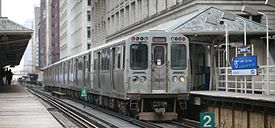
The 'L' consists of a network of eight rapid transit lines totaling 106.1 miles (170.8 km). 57.1 miles (91.9 km) of it is elevated, 36.9 miles (59.4 km) of it is surface, and 12.1 miles (19.5 km) of it is underground on over 242.6 miles (390.4 km) of double-track rail line with 144 stations. This network is laid out in a spoke-hub distribution paradigm, which focuses transit toward a central loop. Inter-suburban travel requires indirect commute to the loop and transfer to another line. These lines primarily serve the city proper, but also reach eight close-in suburbs; service to more distant suburbs is provided by the Metra and South Shore Line commuter rail systems. Although the 'L' gained its nickname because large parts of the system are elevated,[3] the Red and Blue lines traverse the downtown area in subways, and also have long sections in the medians of expressways that lead into and out of Chicago. Chicago pioneered the use of the expressway median for rail lines in the 1950s. There are also open-cut and/or grade-level portions (with street crossings) on some parts of the system.
It is one of the few rapid transit systems in North America to provide 24-hour service, though only on the two busiest lines.[4] On average 658,524 people ride the 'L' each weekday, 419,258 each Saturday, and 315,240 each Sunday.[5] Annual ridership for 2006 was 195.2 million, the highest since 1993.[6][7]
Noisy and at times slow and/or overwhelmingly crowded, the 'L' has nonetheless become one of the symbols of the city it serves. In a 2005 poll, Chicago Tribune readers voted it one of the "seven wonders of Chicago,"[8] behind the lakefront and Wrigley Field but ahead of Sears Tower, the Water Tower, the University of Chicago, and the Museum of Science and Industry.
Lines

See also: List of stations on the 'L'
Chicago's rapid transit system currently consists of eight principal routes. Since 1993 'L' lines have been identified by color,[9] although older route names survive to some extent in CTA publications and popular usage to distinguish branches of longer lines:
Red Line
█ Red Line, consisting of the Howard, State Street Subway and Dan Ryan branches
- The Red Line is the busiest 'L' route, serving an average of 230,434 passengers each weekday.[10] It includes 34 stations on its 21.8-mile (35 km) route, traveling from Howard Street terminal on the city's northern border with Evanston, through downtown Chicago via the State Street subway, then down the Dan Ryan Expressway median to 95th Street on the Far South Side. Despite its length, the Red Line stops five miles short of the city's southern border. Extension plans are currently being considered. The Red Line is one of two 'L' lines operating 24 hours a day, 7 days a week.
Blue Line
█ Blue Line, consisting of the O'Hare, Milwaukee-Dearborn Subway, and Congress branches.
- The Blue Line extends from O'Hare International Airport through the Loop via the Milwaukee-Dearborn-Congress subway to the West Side. Most Blue Line trains travel to Des Plaines Avenue in Forest Park via the Eisenhower Expressway median. The route from O'Hare to Des Plaines Avenue is 26.93 miles (43 km) long. The combined number of stations is 33. Until 1970, the northern section of the Blue Line terminated at Logan Square, during which time it was called the Milwaukee route after Milwaukee Avenue which ran parallel to it; in that year service was extended to Jefferson Park via the Kennedy Expressway median, and in 1984 to O'Hare. The Blue Line is the CTA's second busiest, with 128,343 weekday boardings. It operates 24 hours a day, 7 days a week.
Brown Line
█ Brown Line, or Ravenswood Line
- The Brown Line follows an 11.4-mile (18 km) route, with 19 stations between Kimball Avenue in Albany Park and the Loop in downtown Chicago. The Brown Line has an average weekday ridership of 66,000.[11]
Green Line
█ Green Line, consisting of the Lake Street and Englewood-Jackson Park branches
- A completely elevated route utilizing the system's oldest segments (dating back to 1892), the Green Line extends 20.8 miles (30 km) with 29 stops between Forest Park and Oak Park (Harlem/Lake (CTA)), through Chicago's Loop, to the South Side. South of the Garfield station the line branches, with trains alternately heading to Ashland/63rd in Englewood and Cottage Grove/63rd in Woodlawn. The East 63rd branch formerly extended to Jackson Park, but the portion east of Cottage Grove, which ran above 63rd Street, was demolished in stages in the 1980s and 1990s due to structural problems and then not replaced due to community demands. The average number of weekday boardings is 39,685.
Orange Line
█ Orange Line or Midway Line
- The 13-mile (21 km) long Orange Line was constructed in the early 1990s on existing railroad embankments and new concrete and steel elevated structure. It runs from a station in Chicago Midway International Airport on the Southwest Side to the Loop in downtown Chicago. Average weekday ridership is 30,111.
Pink Line
█ Pink Line consisting of Douglas Branch and Paulina Connector
- The Pink Line is an 11.2-mile (18 km) trial rerouting of former Blue Line Douglas Park branch trains from Cicero (54/Cermak) via the previously non-revenue Paulina Connector and the Green Line on Lake Street to the Loop. Its average weekday ridership is 13,461.
Purple Line
█ Purple Line, consisting of Evanston Shuttle and Evanston Express
- The Purple Line is a 3.9-mile (6 km) branch serving north suburban Evanston and Wilmette with express service to the Loop during rush hour. The local service operates from the Wilmette terminal at Linden Avenue through Evanston to the Howard Street terminal where it connects with the Red and Yellow lines. The rush hour express service continues from Howard to the Loop, running nonstop on the four-track line used by the Red Line to Belmont station, then serving all Brown Line stops to the Loop. Average weekday ridership is 9,956, although this does not count boardings from Belmont south, which are included in Red and Brown line statistics. The stops from Belmont to Chicago Avenue were added in the 1990s to relieve crowding on the Red and Brown lines.[12]
Yellow Line
█ Yellow Line, or Skokie Swift
- The Yellow Line is a 4.7-mile (8 km) nonstop shuttle that runs from the Howard Street terminal to Dempster Street terminal in suburban Skokie. The Yellow Line is the only 'L' route that does not provide direct service to the Loop. This line was originally part of the North Shore Line's commuter rail service, and was acquired by the CTA in the 1960's. There are currently plans to construct an infill station at Oakton Street to serve downtown Skokie. Upon completion (expected in 2008 or 2009), this will signal the end of over 40 years of the Skokie Swift operating as a non-stop shuttle. At present, its average weekday ridership is 2,651.
History


The first 'L'—the Chicago and South Side Rapid Transit Railroad—began revenue service on June 6 1892, when a small steam locomotive pulling four wooden coaches with 30 passengers departed the 39th Street station and arrived at Congress Street 14 minutes later, over tracks still used today by the Green Line.[13] Over the next year service was extended to 63rd Street and Stony Island Avenue, then the entrance to the World's Columbian Exposition in Jackson Park.[14]
Later in 1893 trains began running on the Lake Street Elevated Railroad and in 1895 on the Metropolitan West Side Elevated, which had lines to Douglas Park, Garfield Park (since replaced), Humboldt Park (since demolished), and Logan Square. The Metropolitan was the United States' first non-exhibition rapid transit system powered by electric traction motors,[15] a technology whose practicality had been previously demonstrated on the "intramural railway" at the world's fair.[16] Two years later the South Side 'L' introduced multiple-unit control, in which several or all the cars in a train are motorized and under the control of the operator, not just the lead unit. Electrification and MU control remain standard features of most of the world's rapid transit systems.
A drawback of early 'L' service was that none of the lines entered the central business district. Instead trains dropped passengers at stub terminals on the periphery due to a state law requiring approval by neighboring property owners for tracks built over public streets, something not easily obtained downtown. This obstacle was overcome by the legendary traction magnate Charles Tyson Yerkes, who went on to play a pivotal role in the development of the London Underground and was immortalized by Theodore Dreiser as the ruthless schemer Frank Cowperwood in The Titan (1914) and other novels. Yerkes, who controlled much of the city's streetcar system, obtained the necessary signatures through cash and guile—at one point he secured a franchise to build a mile-long 'L' over Van Buren Street from Wabash Avenue to Halsted Street, extracting the requisite majority from the pliable owners on the western half of the route, then building tracks chiefly over the eastern half, where property owners had opposed him. The Union Loop opened in 1897, greatly increasing the rapid transit system's convenience but at the cost of noisy, obstructed streets, a fact of life in downtown Chicago to this day. Operation on the Yerkes-owned Northwestern Elevated, which built the North Side 'L' lines, began three years later, essentially completing the elevated infrastructure in the urban core although extensions and branches continued to be constructed in outlying areas through the 1920s.
Rarely profitable, the 'L' lines after 1911 came under the control of Samuel Insull, president of the Chicago Edison electric utility (now Commonwealth Edison), whose interest stemmed initially from the fact that the trains were the city's largest consumer of electricity. Insull instituted many improvements, including free transfers and through routing, although he did not formally combine the original firms into the Chicago Rapid Transit Company until 1924. He also bought three other Chicago electrified railroads, the North Shore, Aurora and Elgin, and South Shore interurban lines, and ran the trains of the first two into downtown Chicago via the 'L' tracks. This period of relative prosperity ended when Insull's empire collapsed in 1932, but later in the decade the city with the help of the federal government accumulated sufficient funds to begin construction of two subway lines to supplement and, some hoped, permit eventual replacement of the Loop elevated.
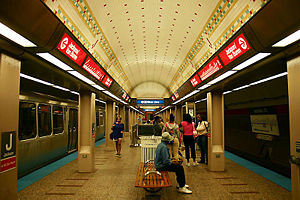
The State Street subway was completed in 1943; the Dearborn subway, work on which was suspended during World War II, opened in 1951. The subways were constructed with a secondary purpose of serving as bomb shelters, the closely spaced support columns are evidence of this (a plan to replace the entire elevated system with subways was also proposed with this intent as well). The subways bypassed a number of tight curves and circuitous routings on the original elevated lines (Milwaukee trains, for example, originated on Chicago's northwest side but entered the Loop at the southwest corner), speeding service for many riders.
By the 1940s the financial condition of the 'L,' and of Chicago mass transit in general, had become too precarious to permit continued private operation, and the necessary steps were taken to enable public takeover. In 1947 the Chicago Transit Authority acquired the assets of the Chicago Rapid Transit Company and the Chicago Surface Lines, operator of the city's streetcars. Over the next few years the CTA modernized the 'L,' replacing antiquated wooden cars with new steel ones and closing lightly used branch lines and stations, many of which had been spaced only a quarter mile apart.
Shortly after its takeover of the 'L', the CTA introduced an express service known as the A/B skip-stop service. Under this service, trains were designated as either "A" or "B" trains, and stations were alternately designated as "A" or "B", with heavily-used stations designated as "AB". "A" trains would only stop at "A" or "AB" stations, and "B" trains would only stop at "B" or "AB" stations. Station signage carried the station's skip-stop letter and was also color-coded by skip-stop type; "A" stations had red signage, "B" stations had green signage, and "AB" stations had blue signage. The system was designed to speed up lines by having trains skip stations with fewer passengers while still allowing for frequent service at the heavily-used "AB" stations. The CTA first implemented A/B skip-stop service on the Lake Street Line (now part of the Green Line) in 1948, and the service proved effective as travel times were cut by a third. By the 1950s, the service was being used throughout the system. All lines used the A/B skip-stop service between the 1950s and the 1990s with the exception of the Evanston and Skokie lines, which were too short to justify skip-stop service. Also, the Congress and Douglas branches of what later became the Blue Line were designated as "A" and "B" respectively, as were the Englewood ("A") and Jackson Park ("B") branches of what later became the Green Line, so individual stops were not skipped while trains were serving those branches. As time went by, the time periods in which skip-stop service was used were gradually decreased, as the waits at "A" and "B" stations became increasingly long during non-peak service. By the 1990s, use of the A/B skip-stop system was only justified during rush hour due to decreasing ridership and resultant service reductions. In 1993, the CTA began the elimination of skip-stop service when it switched the southern branches of the Red and Green Lines; after this point, Green Line trains stopped at all stations, and Red Line trains stopped at all stations south of Harrison. The elimination of A/B skip-stop service continued with the opening of the all-stop Orange Line and the conversion of the Brown Line to all-stop service. On April 28, 1995, the A/B skip-stop system was completely eliminated with the transfer of the O'Hare branch of the Blue Line and the Howard branch of the Red Line to all-stop service. The removal of skip-stop service greatly increased ridership at former "A" and "B" stations, but it did result in an increase in travel time on some parts of the system.[17]
The first air-conditioned cars were introduced in 1964 and the last pre-World War II cars retired in 1973. New lines were built in expressway medians, the Congress branch replacing the Garfield Park 'L' in 1958 and the Dan Ryan branch opening in 1969, followed by the first Kennedy Expressway extension in 1970.
The 'L' today
'L' ridership has increased steadily in recent years after catastrophic losses in the late 1980s and early 1990s. Ridership had been remarkably stable for nearly 40 years after the CTA takeover despite declining mass transit usage nationwide, with an average of 594,000 riders boarding each weekday in 1960[18] and 577,000 in 1985. Thereafter, however, ridership dropped sharply, bottoming out at 418,000 in 1992,[19] when the Loop Flood forced the CTA to suspend operation for several weeks in the State and Dearborn subways, used by the most heavily traveled lines.
Overall traffic volume has since recovered, although growth has not been uniformly distributed, with usage of North Side lines generally up, often dramatically so, while that of West and South Side lines is flat or declining. Ridership on the Brown Line, for instance, has increased 83% since 1979, necessitating the station reconstruction project currently underway to accommodate longer trains.[20]

Annual traffic on the Howard branch of the Red Line, which reached 35 million in 2005, is approaching the 1927 prewar peak of 38.5 million.[21] The section of the Blue Line between the Loop and Logan Square, which serves once-neglected but now bustling neighborhoods such as Wicker Park, Bucktown, and Palmer Square, has seen a 54% increase in weekday riders since 1992. On the other hand, weekday ridership on the South Side portion of the Green Line, which closed for two years for reconstruction starting in 1994, was 50,400 in 1978 but only 13,000 in 2006. Boardings at the 95/Dan Ryan stop on the Red Line, though still the system's busiest at 14,100 riders per weekday, are a little over half the peak volume in the 1980s. In 1976, three North Side 'L' branches - what were then known as the Howard, Milwaukee, and Ravenswood lines − accounted for 42% of non-downtown boardings. Today (with the help of the Blue Line extension to O'Hare), they account for 58%.
The North Side (which has historically been the highest density area of the city) skew no doubt reflects the Chicago building boom of the past decade, which has focused primarily on North Side neighborhoods and downtown.[22] It may ease somewhat in the wake of the current high level of residential construction along the south lakefront. For example, ridership at the linked Roosevelt stops on the Green, Orange, and Red Lines,[23] which serve the burgeoning South Loop neighborhood, has tripled since 1992, with an average of 8,000 boardings per weekday. Patronage at the Cermak-Chinatown stop on the Red Line (4,000 weekday boardings) is at the highest level since the station opened in 1969. The 2003 Chicago Central Area Plan has proposed construction of a Green Line station at Cermak, midway between Chinatown and the McCormick Place convention center, in expectation of continued growth in the vicinity.
Iconic of Chicago though it may be, the 'L' is not the city's predominant form of mass transit. As of mid-2006 it accounted for just 36% of the CTA's 1.48 million weekday riders, the remainder traveling on the agency's extensive bus network. The rail system's rider share has increased over time, however. In 1926, the year of peak prewar rail usage, the 'L' carried 229 million passengers – seemingly a formidable number, but less than 20% of the 1.16 billion Chicago transit patrons that year, most of whom rode streetcars.[24] The shift to rail has continued in recent times. Since its low point in 1992 (due to the Chicago Flood that closed subway tunnels in the downtown area), weekday 'L' ridership has increased about 25%, while bus ridership has decreased by roughly a sixth.[25]
Rolling stock
The Chicago Transit Authority owns 1190 train cars, permanently coupled into 595 married pairs. Cars are assigned to different lines, and each line contains at most three different series of train cars. Currently, CTA operates 986 cars during peak operation periods. [26]The oldest cars in the 'L', the 2200 series, were built in 1969, and the newest, the 3200 series, were built in 1992. The next series of train cars, the 5000 series,[27] will feature AC propulsion and are expected to begin service sometime in 2010. All cars on the system utilize 600 volt direct current power delivered through a third rail.
Renovation and expansion plans

The CTA’s current capital improvement spending is focused on the Brown Line Capacity Expansion Project, Slow Zone Elimination, and the rehabilitation of the Red Line.
The CTA is also actively studying a number of proposals for expanding ‘L’ rail service, including a Red Line Extension, an Orange Line Extension, a Yellow Line Extension, and the Circle Line.[28]
In addition, the CTA has studied other proposals for expanded rail service which may be implemented in the future.
Current capital improvements
The Brown Line Capacity Expansion Project is, as of December 2008, nearing completion. This project enabled the CTA to run 8-car trains on the Brown Line. Before the project, Brown Line stations’ boarding platforms were too short to accommodate trains longer than 6 cars. 8-car trains began to run at rush hour on the Brown Line in April 2008.[29] (However, in order to accommodate the longer trains so soon, stations whose platforms had not yet been expanded had to be closed.) The project also enabled the CTA to improve Brown Line stations’ usability and accessibility.[30]
The Brown Line expansion’s total cost is expected to be around $530 million.[31] The CTA expects the project to be completed by March 2008.
The CTA’s Slow Zone Elimination will continue in 2009. In late 2007, trains were forced to operate at reduced speed over more than 22% of the ‘L’ system due to deteriorated track, structure, and other problems.[32] By late 2008, slow zones were reduced to around 9% of the system. [33]

The rehabilitation of the Red Line is currently underway. The $283 million renovation of the Dan Ryan branch of the Red Line includes station renewal, trackwork and other system upgrades.[34]
Planning future projects
All of the new rail service proposals under active consideration by the CTA are currently undergoing Alternatives Analysis Studies.
These studies are the first step in a five-step process. This process is required by the Federal New Starts program[35], which is an essential source of funding for the CTA’s capital expansion projects. The CTA uses a series of “Screens” to develop a “Locally Preferred Alternative,” which is submitted to the federal New Starts program.[36]
It will likely be years before any of these projects is completed; none of these projects yet has a definite source of funding.[37]
Circle Line
The proposed Circle Line would form an “outer loop,” going through downtown via the State Street subway, then going west on the Orange Line and north along Ashland, before re-joining the subway at North and Clybourn or Clark and Division.[38] The Circle Line would connect several different Metra lines with the ‘L’ system, and would facilitate transfers between existing CTA lines; these connections would be situated near the existing Metra and ‘L’ lines’ maximum load points.[39]
The CTA’s Screen 2 analysis has been completed, and preliminary Screen 3 results are expected in early 2009.[40] The CTA is currently considering either bus rapid transit or a new heavy-rail ‘L’ line.[41] With respect to the rail option, the Screen 2 analysis favored subways over new elevated tracks, [42] and determined that the Circle Line should follow Ashland rather than Western.[43]
The CTA is currently considering two different possible routes for the Circle Line: “Ashland” and “Ashland-Ogden.”[44] The two are quite similar, differing only in the northwest section of the circle.
South of downtown, both proposed routes follow the Orange Line to Ashland. At Ashland, both routes turn north, diverting from the Orange Line at a new station (which would connect with Metra’s Heritage Line). New elevated track would connect the Orange Line’s tracks to the Pink and Blue Lines; both Circle Line routes then follow existing track north to Lake St. This section of the Circle Line would connect with two different Metra stations.
North of Lake St., the two routes diverge. The “Ashland” route continues north to North Avenue, connecting to the Blue Line at Division and Milwaukee and to the Red Line at North and Clybourn. The “Ashland-Ogden” route diverts west at Grand, following Ogden Ave. northeast before rejoining the Red Line at Division and Orleans. Both routes have stops at Lake and Ashland, and both contemplate a new station at Division and Orleans, connecting the Circle Line with the Red, Brown, and Purple Lines.
The renovation of the Paulina Connector, which was completed as part of the Pink Line project, has often been described in planning documents as "Phase I" of the Circle Line.[45]
Extensions of Red, Orange and Yellow Lines
The CTA is conducting Alternatives Analysis Studies of proposed extensions for the Red, Orange and Yellow Lines.
The Red Line Extension would provide service from the current Red Line terminus, at 95th St., to areas as far south as 130th St.[46] The project would both decrease transit times for residents of the far South Side, and relieve crowding and congestion at the current 95th St. terminus.[47] Preliminary Screen 2 results were presented at a public meeting on December 3, 2008; a Screen 3 report is also planned. Other than the Circle Line, no other ‘L’ expansion project has completed the Screen 2 process.[48]
The Screen 2 preliminary results narrowed the range of options for this project down to three: two possible routes for an extended Red Line, or a new bus rapid transit route. Any Red Line expansion would use elevated track. One possible rail route would follow Halsted to 127th St., with additional stops at 103rd St., 111th St., and 119th St. The other, "UP Rail" route, would angle east, ending at 130th and the Bishop Ford Freeway, with intermediate stops at 103rd, 111th, and 115th.[49]
The Orange Line Extension would provide transit service from the current Orange Line terminus, at Midway, to near the Ford City Mall. The CTA’s Screen 1 analysis, presented at an August 2008 public meeting, concluded that either bus rapid transit or an extension of the Orange Line should be used. A Screen 2 report is planned. The CTA identified three possible routes--either along Cicero Ave., or either of 2 routes based on the Belt Railway corridor--and determined that any new ‘L’ track should be elevated or in a trench.[50] Interestingly, the destination signs on Orange Line trains already indicate “Ford City” as a possible endpoint.[51]
The Yellow Line Extension would provide transit service from the current Yellow Line terminus, at Dempster St., to near the Old Orchard Mall. While leaving open the possibility of using bus rapid transit, the CTA’s Screen 1 analysis found that any ‘L’ extension ought to follow the UP railroad corridor.[52] A Screen 2 report is planned.
Other recent service improvements

Pink Line service began on June 25, 2006, though it did not involve any new track or stations. The Pink Line travels over what was formerly a branch of the Blue Line from the 54/Cermak terminal in Cicero to the Polk-Medical Center station in Chicago. Pink Line trains then proceed via the Paulina Street Connector to the Lake Street branch of the Green Line and then clockwise around the Loop elevated via Lake-Wabash-Van Buren-Wells. (Douglas trains followed the same path between April 4, 1954 and June 22, 1958 after the old Garfield Park ‘L’ line was demolished to make way for the Eisenhower Expressway.[53]) The new route, which serves 22 stations, offers more frequent service for riders on both the Congress and Douglas branches. Pink Line trains can be scheduled independently of O’Hare trains, and run more frequently than the Douglas branch of the Blue Line did.[54]
Possible Future Projects
Other possible future expansions, identified in the "Destination 2020" Regional Transportation Plan,[55] include:
- New express service to O'Hare and Midway airports from a downtown terminal on State Street. A business plan prepared for the CTA calls for a private firm to manage the venture with service starting in 2008.[56] The project has been criticized as a boondoggle.[57] The custom-equipped, premium-fare trains would offer nonstop service at faster speeds than the current Blue and Orange Lines. Although the trains would not run on dedicated rails (construction of such tracks could cost more than $1.5 billion), several short sections of passing track build at stations would allow the express trains to pass Blue and Orange trains while they sit at those stations.[58] The CTA has already pledged $130 million and the city of Chicago $42 million toward the cost of the downtown station.[59] In comments posted to her blog in 2006, CTA chair Carole Brown said, "I would support premium rail service only if it brought significant new operating dollars, capital funding, or other efficiencies to CTA … The most compelling reason to proceed with the project is the opportunity to connect the Blue and Red subway tunnels," which are one block apart downtown.[60] In the meantime, CTA announced that due to cost overruns, it would only complete the shell of the Block 37 station; its president said "it would not make sense to completely build out the station or create the final tunnel connections until a partner is selected because final layout, technology and finishes are dependent on an operating plan."[61]
- Mid-City Transitway running around, rather than through the Chicago Loop. The line would follow the Cicero Avenue/Belt Line corridor (former Crosstown Expressway alignment) between the O'Hare branch of the Blue Line at Montrose and the Dan Ryan branch of the Red Line at 87th Street. It would not necessarily be an 'L' line; a busway and other options are being considered.

Numerous plans have been advanced over the years to reorganize downtown Chicago rapid transit service, originally with the intention of replacing the Loop elevated, which was long seen as a blight. That goal has been largely abandoned, but there have been continued calls to improve transit within the city's greatly enlarged core. At present the 'L' does not provide direct service between the Metra commuter rail terminals in the West Loop and Michigan Avenue, the principal shopping district, nor does it offer convenient access to popular downtown destinations such as Navy Pier, Soldier Field, and McCormick Place. Plans for the Central Area Circulator, a $700 million downtown light rail system meant to remedy these failings, were shelved for lack of funding in 1995. An underground line running along the lakeshore would connect Chicago's major tourist destinations, but this plan has not been widely discussed. Recognizing the difficulty of implementing an all-rail solution, the Chicago Central Area Plan[62] advocated a mix of rail and bus improvements, the centerpiece of which was the West Loop Transportation Center, a multi-level subway to be constructed under Clinton Street from Congress to Lake streets. The top level would be a pedestrian mezzanine, buses would operate in the second level, rapid transit trains in the third level, and commuter and intercity trains in the bottom level. The rapid transit level would connect to the existing Blue Line subway at its north and south ends, making possible the "Blue Line loop," envisioned as an underground counterpart to the Loop elevated. Among other advantages the West Loop Transportation Center would provide a direct link between the 'L' and the city's two busiest commuter rail terminals, Ogilvie Transportation Center and Union Station. The plan also proposed transitways along Carroll Avenue, a former rail right-of-way north of the main branch of the Chicago River, and under Monroe Street in the Loop, which earlier transit schemes had proposed as rail routes. The Carroll Avenue route would provide faster bus service between the commuter stations and the rapidly redeveloping Near North Side, with possible rail service later.
Getting around on the 'L'

Prior to color coding, CTA rail line names were based on neighborhood or town served (Ravenswood, Englewood, Evanston, Skokie Swift), endpoint (Howard, Jackson Park, Midway, O'Hare), parallel streets (Congress, Lake), or even a city park the line traveled past (Douglas). As part of the effort to make the 'L' easier to navigate, train signs now indicate the destination terminal:[63]
- Blue Line trains display "Forest Park" signs when traveling southeast/west, "O'Hare" when traveling east/northwest. Some southeast/west trains display "UIC" and end their runs at UIC-Halsted instead of going to the end of the line, while some east/northwest trains display "Jefferson Park" or "Rosemont" and terminate at these stations instead.
- Brown Line trains display "Loop" signs inbound, "Kimball" outbound. Late-night Brown Line shuttle service terminates at Belmont southbound; these trains display "Belmont."
- Green Line trains display "Harlem" when north/westbound, "Ashland/63" or "Cottage Grove" when east/southbound. One should note that the "Cottage Grove" reading is still relatively new and that the majority of CTA signage does not reflect this. Station signs reading "East 63rd" are equivalent to "Cottage Grove" on train signs.
- Orange Line trains display "Loop" inbound, "Midway" outbound.
- Pink Line trains display "Loop" inbound, "54/Cermak" outbound.
- Purple Line local shuttles display "Howard" southbound, "Linden" northbound. Rush-hour Purple Line Express trains display "Loop" inbound, "Linden" outbound.
- Red Line trains display "Howard" northbound, "95th" southbound. Some southbound trains display "Roosevelt" during the overnight hours and cease service there, rather than making the complete run to 95th. Similarly to the Green Line's "Cottage Grove" reading, the "95th" reading is new and CTA signage does not yet reflect this. Station signs reading "95/Dan Ryan" are equivalent to "95th" on train signs.
- Yellow Line trains display "Howard" inbound, "Skokie" outbound.
These changes do not eliminate all potential confusion, however. Visitors to the city should be aware that, since 'L' stations typically are named after the principal intersecting street, and Chicago streets tend to be long and straight, many stations on different lines have the same name. For example, there are four stations named Pulaski, five named Kedzie, and five named Western — two of which are on the Blue Line. It should also be noted that none of the three stations named Chicago lie in the Chicago Loop, as one might suppose; rather, the stations take their names from Chicago Avenue, which lies six city blocks (3/4 mile) north of the northern boundary of the Loop.

The Loop
Brown, Green, Orange, Pink, and Purple Line Express trains serve downtown Chicago via the Loop elevated. The Loop's nine stations average 64,800 weekday boardings.
The Orange Line and the Pink Line run clockwise, the Brown Line and Purple Line run counter-clockwise and the Green Line is the Loop's only through service; the other four lines circle the Loop and return to their starting points. The Loop forms a rectangle roughly 0.4 miles (650 m long) east-to-west and 0.6 miles (960 m) long north-to-south.
While many believe that the city's central business district was named after this section of the 'L,' the term actually predates the 'L' and refers to a now-retired circular routing of streetcars through downtown, which followed the same basic route as the present day elevated tracks.
Making connections
The 'L' serves both Chicago airports but does not connect directly to any of the commuter rail, intercity rail, or intercity bus stations in or near the Loop. Metra, Amtrak, and Greyhound stations, and their locations relative to 'L' stops are:
- Chicago Union Station, terminal for all Amtrak and HC, BNSF, MD-W, MD-N, SWS, and NCS Metra trains, is 2 blocks north of Clinton (Blue Line) station and 3 blocks west of Quincy (Loop Brown, Orange, Purple, Pink Lines) station.
- Chicago Ogilvie Transportation Center (formerly North Western Station), terminal for UP-N, UP-NW, and UP-W Metra trains, is 2 blocks south of Clinton (Green, Pink Lines) station and 3 blocks west of the Washington/Wells (Loop Brown, Orange, Purple, Pink Lines) station.
- Chicago Millennium Station (formerly Randolph Street Terminal), terminal for Metra Electric Line and South Shore Line trains, is 2 blocks east of Randolph/Wabash (Loop Brown, Orange, Green, Purple, Pink Lines) station and is accessible through the Chicago Pedway. It can also be accessed via a Pedway connection at Lake/State (Red Line) station's southern exit.
- Chicago LaSalle Street Station, terminal for RI Metra trains, is less than a block from both LaSalle (Blue Line) and LaSalle/Van Buren (Loop Brown, Orange, Purple, Pink Lines) stations.
- The downtown Chicago Greyhound bus terminal is 2 blocks southwest of Clinton (Blue Line) station.
- The 'L' directly serves both O'Hare Airport (Blue Line) and Midway Airport (Orange Line).

Outlying transfer points between 'L' trains and Metra:
- Main Street, Purple Line / Main Street, Metra UP-N
- Davis Street, Purple Line / Davis Street, Metra UP-N
- Irving Park, Blue Line / Irving Park, UP-NW
- Montrose, Blue Line / Mayfair, Metra MD-N
- Jefferson Park, Blue Line / Jefferson Park, UP-NW
- Kedzie, Green Line / Kedzie, UP-W
- Harlem, Green Line / Oak Park, UP-W
- Western, Pink Line, Blue Line (54/Cermak Branch) / Western Avenue, BNSF
- Damen, Brown Line / Ravenswood, Metra UP-N
Outlying transfer points between 'L' trains and Greyhound Lines bus service:
- Chicago 95th and Dan Ryan destination is directly above the 95th/Dan Ryan (Red Line) station.
- Cumberland destination is the Cumberland (Blue Line) station/CTA and PACE bus terminal.
- Skokie destination is near the Skokie (Yellow Line) station.
'L' or El?
The Chicago rapid-transit system is officially nicknamed the 'L.' This name for the CTA rail system applies to the whole system, as well as its elevated, subway, at-grade and open-cut segments. The use of the nickname dates to the earliest days of the system—the first line, the Chicago and South Side Rapid Transit Railroad is referred to by the nickname "Alley L" in publications from 1893, less than a year after the line opened.[64][65]
In discussing various stylings of "Loop" and "L" in Destination Loop: The Story of Rapid Transit Railroading in and around Chicago (1982), author Brian J. Cudahy quotes a passage from The Neon Wilderness (1949) by Chicago author Nelson Algren: "beneath the curved steel of the El, beneath the endless ties." Cudahy then comments, "Note that in the quotation above ... it says 'El' to mean "elevated rapid transit railroad.' We trust that this usage can be ascribed to a publisher's editor in New York or some other east coast city; in Chicago the same expression is routinely rendered 'L.' "
While this is broadly true, it is not hard to find exceptions, such as the magazine Time Out Chicago, which refers to the system as the El and once responded to a letter on the subject by explaining that it chose "El" stylistically because it would be easier for people originally from outside of Chicago to decipher. However, Time Out, whose London, England-based publishing company started the Chicago edition in 2005, has a highly idiosyncratic style common throughout its worldwide publications, which also includes such practices as designating locations with often-obscure side-street names instead of the local custom of Chicago grid system street numbers.
As used by the CTA, the name is rendered as the capital letter 'L', in quotation marks. "L" (with double quotation marks) was often used by CTA predecessors such as the Chicago Rapid Transit Company; however, the CTA uses single quotation marks (') on some printed materials and signs rather than double, and it seems safe to say there is no firm policy other than use of quotation marks of some kind. The term subway in Chicago usage is limited to sections of the 'L' that are underground and is not applied to the system as a whole, and Chicagoans typically refer to the 'L' even when they mean the below-ground parts.
Security breach
In 2002, 25-year-old Joseph Konopka, better known by his self-given nickname "Dr. Chaos", was arrested by Chicago Police after he was caught hoarding potassium cyanide and sodium cyanide in an unused Chicago Transit Authority storeroom in the Blue Line subway. Konopka had picked the original locks on several doors in the tunnels, then changed the locks so that he could access the unused rooms freely. Konopka had briefly associated with a Chicago-area urban exploration group in order to obtain information on how to access the large network of unused tunnels and abandoned rooms on Chicago's transit system as well as to lure juveniles to help him.[66][67][68]
See also
- Chicago 'L' rolling stock
- List of rapid transit systems
- Mass transit in Chicago
- List of United States rapid transit systems by ridership
Bibliography
- Cudahy, Brian J. (1982). Destination Loop: The Story of Rapid Transit Railroading in and around Chicago. Brattleboro, VT: S. Greene Press. ISBN 978-0-8289-0480-3.
- Borzo, Greg (2007). The Chicago "L". Chicago: Arcadia Publishing. ISBN 978-0-7385-5100-5.
- Franch, John (2006). Robber Baron: The Life of Charles Tyson Yerkes. Urbana: University of Illinois Press. ISBN 978-0-2520-3099-4.
References and notes
- ↑ The CTA website states "CTA’s train system is called the ‘L’, short for elevated.'"
- ↑ Cudahy, Destination Loop
- ↑ Garfield, Graham, Frequently Asked Questions. Chicago-L.org (URL accessed 22 August 2006); McClendon, Dennis, "L", Encyclopedia of Chicago, accessed Aug. 22, 2006
- ↑ "Owl" service on other lines was discontinued in the 1990s for budgetary reasons. (Other U.S. rapid transit systems providing 24-hour service include the New York City subway, the New York-New Jersey PATH system, and Philadelphia's PATCO Speedline.)
- ↑ Chicago Transit Authority, "Rail Ridership by Branch and Entrance," July 2006, [1], accessed October 14 2006
- ↑ Chicago Transit Authority, "Rail Ridership by Branch and Entrance," December 2005, [2], accessed Sept. 1, 2006
- ↑ Chicago Transit Authority, "Rail System: Annual Traffic, 1979 to present," SDP-x93028, 7-27-93; Chicago Transit Authority, "Rail System: Annual Traffic, 1986 to 2000," PSP-x01010, 8/7/01
- ↑ Leroux, Charles (2005-09-15). "The People Have Spoken: Here Are the 7 Wonders of Chicago", Chicago Tribune, Tribune Company. Retrieved on 2007-12-31.
- ↑ Chicago "L".org, "Chronologies - Chicago Transit Authority (CTA) (1947-present)" [3]
- ↑ Current ridership figures drawn from Chicago Transit Authority, "Rail Ridership by Branch and Entrance," September 2006 [4]
- ↑ Ridership figures reported for the Brown Line and other lines reaching downtown Chicago via the Loop elevated (Green, Orange, and Pink lines; Purple Line express trains) do not fully reflect usage since Loop boardings are reported separately. Although the figure cited above is from the CTA's June 2006 rail ridership report, the CTA elsewhere has claimed Brown Line ridership of 66,000,[5] presumably arrived at by pro rata distribution of Loop boardings.
- ↑ Countdown To A New Brown | The Brown Line Capacity Expansion Project
- ↑ These and other historical details drawn from Cudahy, Destination Loop
- ↑ Borzo, The Chicago "L", p. 23
- ↑ Borzo, The Chicago "L", p. 43
- ↑ Station Jackson Park, Intramural Railway
- ↑ Chicago 'L'.org - A/B Skip-Stop Express Service
- ↑ Chicago Transit Authority, "Rail System - Nov. 1980 traffic," Table V, OP-x81085, 5-22-81
- ↑ Chicago Transit Authority, "Rail System - Weekday Entering Traffic Trends," PSP-x01013, 8-16-01
- ↑ Chicago Transit Authority, "Countdown to a New Brown - About the Brown Line" [6], accessed Sept. 5, 2006.
- ↑ Chicago Transit Authority, "Rail System - Annual Traffic: Originating passengers only," OP-x79231, 10-01-79
- ↑ North Shore Magazine
- ↑ The Roosevelt elevated stop on the Orange and Green Lines, which opened in 1994, is connected to the Roosevelt Red Line subway stop by a pedestrian passage, so the CTA reports the two as a single station. Ridership in 1992 is for the subway stop only.
- ↑ Condit, Carl W., Chicago 1930-70: Building, Planning, and Urban Technology (1974), Table 7
- ↑ 1992 figures from Chicago Transit Authority, "1992 Ridership Review," Technical Report SP93-05; November 2005 figures from CTA website previously cited. Comparison may not be precise; 1992 figures were an annual average, while November 2005 reflected a single month, though one often used as a benchmark by CTA.
- ↑ page 76
- ↑ Chicago Transit Authority, "5000 Series Railcars" [7], accessed March 27, 2007.
- ↑ http://www.transitchicago.com/news/whatsnew.wu?action=displaynewspostingdetail&articleid=124434
- ↑ http://www.transitchicago.com/news/ctaandpress.wu?action=displayarticledetail&articleid=125376
- ↑ http://ctabrownline.com/capacity.html
- ↑ CTA 2009 Budget Recommendations, p. 34.[8]
- ↑ CTA President Ron Huberman, “Transforming the CTA” presentation, slide 17;[9] a current slow zone map can be found on the CTA’s website.
- ↑ CTA 2009 Budget Recommendations, p. 33.[10]
- ↑ http://www.transitchicago.com/news/motion/red/danryan/ transitchicago.org: Dan Ryan Red Line Rehabilitation Project
- ↑ The FTA’s website provides a detailed description of this process.
- ↑ See page 2 of the Red Line Screen 1 response to public comments.
- ↑ http://redeye.chicagotribune.com/features/red-100808-line-lines,0,71217.story
- ↑ http://www.transitchicago.com/news/motion/board/cirscr2prefind200609.pdf
- ↑ See p. 4 of the CTA’s response to public comments.
- ↑ http://www.transitchicago.com/news/whatsnew2.wu?action=displaynewspostingdetail&articleid=117176
- ↑ http://www.transitchicago.com/news/motion/board/cirscr2prefind200609.pdf
- ↑ Noise concerns and community disapproval were significant factors in rejecting new elevated track.[11]
- ↑ The Ashland routes cost less to build and operate than the Western Ave. routing.[12]
- ↑ Circle Line Alternatives Analysis Study - Screen 2 Step 3, Accessed 02-16-2007[13]
- ↑ See p. 132 of the Oct. 9, 2008 update of the 2030 Regional Transportation Plan, available here.
- ↑ http://www.transitchicago.com/news/motion/board/redpubpress200812part2.pdf
- ↑ http://www.transitchicago.com/news/motion/board/redpubpress200812part1.pdf
- ↑ http://www.transitchicago.com/news/whatsnew2.wu?action=displaynewspostingdetail&articleid=122539
- ↑ http://www.transitchicago.com/news/motion/board/redpubpress200812part2.pdf
- ↑ http://www.transitchicago.com/news/motion/board/orangepubpres200808part2.pdf
- ↑ Jon Hilkevitch. Signs mark growth of CTA. Chicago Tribune, 30 October 2006.
- ↑ http://www.transitchicago.com/news/motion/board/yellowpubpres200808.pdf
- ↑ http://www.chicago-l.org/history/chron_CTA.html Chicago-L.org: Chronologies, accessed Sept. 5, 2006
- ↑ http://www.transitchicago.com/news/motion/pinklink/ transitchicago.com: West Side/West Suburban Corridor Service Enhancements, accessed Sept. 5, 2006
- ↑ http://www.chicago-l.org/plans/2020plan.html chicago-l.org: Destination 2020
- ↑ PB Consult, Inc., Express Airport Train Service – Business Plan, Final Report, Sept. 22, 2006[14]
- ↑ Hinz, Greg, "CTA's money pit: Big bucks, small bang for agency's planned express line to O'Hare," Crain's Chicago Business,[15] Aug. 1, 2005
- ↑ Judge, Tom, "Chicago Plans To Run Express Trains On Metro," International Railway Journal, [16], April 2005
- ↑ Hilkevitch, Jon, "Want a 1st-class ticket to airport? CTA plan would let private company run premium – and eventually express – rail service to O'Hare and Midway," Chicago Tribune, Oct. 4, 2006
- ↑ Brown, Carole, Ask Carole, "Subway tunnel connections and airport service," Oct. 5, 2006, accessed Oct. 7, 2006. For illustration of Red-Blue line tunnel connection, see Chicago Transit Authority, Transit at a Crossroads: President's 2007 Budget Recommendations, p. 14, accessed Oct. 16, 2006[17]
- ↑ CTA (2008-06-11). "CTA To Seek Private Sector Partners for Airport Express Service". Press release.
- ↑ City of Chicago, "Chicago Central Area Plan: Preparing the Central City for the 21st Century - Draft Final Report to the Chicago Plan Commission," May 2003, [18], accessed Sept. 1, 2006. For West Loop Transportation Center details, see pp. 61ff. [19]
- ↑ Chicago Transit Authority, "Riding CTA Trains," [20]', accessed Sept. 1, 2006
- ↑ Ralph, Julian (1893). Harper's Chicago and the World's Fair. New York: Harper and Brothers Publishers. pp. p. 143.
- ↑ Stevens, Charles McClellan (1893). The Adventures of Uncle Jeremiah and Family at the Great Fair. Chicago: Laird & Lee Publishers. pp. p. 33.
- ↑ Gina Barton (2004-06-17). ""'Dr. Chaos' gets 10 more years for crime spree"". Milwaukee Journal Sentinel. Retrieved on 2008-03-26.
- ↑ Tom Held (2002-03-14). ""Judge calls 'Dr. Chaos' a true danger: Cyanide suspect waives hearing, stays in custody"". Milwaukee Journal Sentinel. Retrieved on 2008-03-26.
- ↑ Staff (2005-06-01). "" National Briefing". New York Times. Retrieved on 2008-03-26.
External links
- Chicago Transit Authority - operates CTA buses and 'L' trains
- Chicago-L.org - an unofficial, extensive fan site
- CTA Tattler - Daily blog of "L" stories
- ForgottenChicago.com - Forgotten Chicago, "Our Historic Subway Stations".
|
|||||||||||
|
|||||