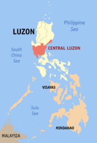
Central Luzon
 |
|
| Regional center | City of San Fernando, Pampanga |
|---|---|
| Population | 8,204,742 |
| – Density | 382.1 per km² |
| Area | 21,470.30 km² |
| Divisions | |
| – Provinces | 7 |
| – Cities | 13 |
| – Municipalities | 118 |
| – Barangays | 3,102 |
| – Cong. districts | 20 |
| Languages | Tagalog, Kapampangan, Ilokano, Sambal, others |
Central Luzon (or "Gitnang Luzon" in Filipino) , also known as Region III (or Region 3), is an administrative division or region of the Republic of the Philippines, primarily serve to organize the 7 provinces (lalawigan) of the vast central plain of the island of Luzon (the largest island), for administrative convenience. The Region contains the largest plain in the country. The Region produces most of the country's rice supply. That is why it is called the "Rice Bowl" of the Philippines. Its provinces are: Aurora, Bataan, Bulacan, Nueva Ecija, Pampanga, Tarlac, and Zambales.
Central Luzon Region is located north of Manila, the nation's capital. Bordering the region are the regions of Ilocos, Cordillera Administrative Region and Cagayan Valley regions to the north; National Capital Region and CALABARZON to the south; and of waters of Manila Bay to the south; South China Sea to the west; and The Philippine Sea and Pacific Ocean to the east.
There are thirteen cities which include: Balanga in Bataan; Malolos, Meycauayan and San Jose del Monte in Bulacan; Cabanatuan, Gapan, Muñoz, Palayan and San Jose in Nueva Ecija; Angeles and San Fernando in Pampanga; Tarlac in Tarlac; and Olongapo in Zambales.
The City of San Fernando, in Pampanga, is the regional center.
Aurora was transferred from Region IV by Executive Order No. 103.
Contents |
Political Divisions

| Province/City | Capital | Population (2000) |
Area (km²) |
Pop. density (per km²) |
|---|---|---|---|---|
| Aurora | Baler | 173,797 | 3,239.5 | 53.6 |
| Bataan | Balanga City | 557,659 | 1,202.7 | 463.67 |
| Bulacan | City of Malolos | 2,234,088 | 2,625.0 | 851.1 |
| Nueva Ecija | Palayan City | 1,659,883 | 5,284.3 | 314.1 |
| Pampanga | City of San Fernando | 1,882,730 | 2,118.74 | 888.6 |
| Tarlac | Tarlac City | 1,068,783 | 3,053.4 | 350.0 |
| Zambales | Iba | 433,538 | 3,714.4 | 116.7 |
| Angeles City | — | 263,971 | 62.16 | 4,246.6 |
| Olongapo City | — | 194,260 | 170.30 | 1141 |
¹ Angeles City and Olongapo City are highly urbanized cities; figures are excluded from Pampanga and Zambales respectively.
Cities
The Central Luzon Region has thirteen cities.
- Angeles City, Pampanga
- Balanga City, Bataan
- Cabanatuan City, Nueva Ecija
- Gapan City, Nueva Ecija
- Malolos City, Bulacan
- Meycauayan City, Bulacan
- Science City of Muñoz, Nueva Ecija
- Olongapo City, Zambales
- Palayan City, Nueva Ecija
- City of San Fernando, Pampanga
- San Jose City, Nueva Ecija
- San Jose del Monte City, Bulacan
- Tarlac City, Tarlac
Provinces
The Province of Aurora is as small and thinly populated as Quezon is large and populous. It is located just north of Quezon on the east coast of Luzon --known to the Spanish as the "contra costa." Its population is roughly 173,000 spread amongst eight towns. Aurora is named for Aurora Quezon, the wife of former President Manuel Quezon of the Commonwealth of the Philippines; both were born in the capital town of Baler, since renamed Naval. The Catholic church of the town was defended by four Spanish officers and fifty men for nearly a year, June 1898 to June 1899, and was the last Spanish outpost in the Philippines to surrender. The Filipinos admire this heroic defense, and have set up a monument to it. Aurora became a sub-province of Quezon in 1951, and a full province in 1979, so the image above is very likely obsolete. Aurora is heavily forested, and the cleared land is used mostly for farming; there seems to be no dominating industry. The province is exposed to Pacific typhoons, and is hit by an average of four per year, some of devastating severity. On the other hand it is a fine place for surfing, as well as scuba-diving and snorkeling, though local support services are not readily found. It also has dramatic scenery along the mountainside. The principal products are copra, rice, banana, coffee, pepper, and citrus, plus various wood products and fish. There is some cottage weaving, and the provincial government is trying to develop food-processing and wood-processing industries.
Pampanga has a mixed economy: agricultural and industrial. The principal crops are rice, sugar cane, maize, melons, vegetables, and bamboo. Industries include food-processing, leather tanning, textiles, shoemaking, ceramics, chemicals, metals and machinery production. Handicrafts are also made, and there is much fishing -- both fresh-water and salt-water. The early inhabitants of Pampanga apparently came in several waves from Java. They still speak a distinct language. Before the Spanish arrived, the Kampampangans practiced irrigation, grew rice, sugar cane, fruit trees, fiber, and ornamental plants and spices. They wove useful and attractive fabrics, smelted metals, and made tools and jewelry. They wrote their language with a syllabary, and had a written code of laws. Farming and fishing are the main economic activities; Pampanga still grows rice and sugar cane, along with maize, fruits, vegetables, melons, and root crops. The Pampanga River and commercial fishponds yield carp, crabs, and shrimp. Pampanga Agricultural College is located in Magalang. Woodcarving, furniture-making, lantern-making, ceramics, and other crafts are also widely practiced. The oldest vocational school in the Far East is in Bacolor. U.S. Clark Air Base, and two other local military bases, were located in Pampanga, and their structures still stand, now constituting a special economic zone. During World War II, the Japanese had a kamikaze base in Pampanga, and there are memorials to the kamikaze pilots.
Continuing through Region III, from the basis of the least populous province to the most populous, brings us to Tarlac -- population 1,045,000 by the 2000 census; based on 3,053 sq.km. divided into seventeen towns, of which Tarlac is the capital and the only city of the province. The province is landlocked and mostly agricultural. The easternmost soil zone is the biggest, well-drained soil that grows rice, sugar cane, maize, tobacco, and some minor crops and livestock. To the west, this soil gives way to clay, which is challenging for agriculture but useful for ceramics and bricks. Westernmost is the Zambales range. The area is heavily forested, yielding some wood (which get turned into furniture and wooden clogs), and is home to some of the native Aeta. Tarlac contains the place of internment for the survivors of the Bataan Death March, and a large monument salutes their sacrifice.
North along the west coast of Luzon from Bataan is the province of Zambales, which, with 623,000 by the 2000 census, is the second least populous, but at 3,714 sq.km. it is about three times as big as Bataan. 194,000 of its inhabitants live in the city of Olongapo; the rest are divided among thirteen towns. Iba is its capital. Like Bataan, Zambales is overwhelmingly agricultural. Its principal products are maize, rice, sugar cane, vegetables, poultry, and swine. The inhabitants also create various handicrafts, which are sold. There are also three large mining operations concentrating on chromite, though Zambales also has reserves of gold, iron, nickel, and other resources. Zambales is quite ethnically diverse: There are surviving populations of Aetas, apparently the earliest inhabitants of the province, who still practice their hunter-gatherer lifestyle without fixed abodes in the mountains; the Sambals, for whom the province was named, also maintain a presence. It is also the location of Subic Bay, where the Spanish once built a navy base in 1895. This was passed on to the United States a few years later. It was destroyed during the eruption of Mount Pinatubo in 1991, and a Philippine Free Port was built in its place. Zambales is also working to develop its potential for tourism. There is a marine life sanctuary offshore in San Salvador Island. There is also a variety of ecosystems inland, including the area recovering from Mount Pinatubo's eruption. There are many miles of varied shoreline.
Among the seven provinces in the Region, Bulacan is among the most progressive provinces in the country, and most populous in the region (second largest in the country) with 2,826,926 Bulakenyos as of 2007 census[1]. Bulacan prides itself for its rich historical heritage. The province figures prominently in Philippine History. Many national heroes and political figures were born in Bulacan. The province was also one of the first to revolt against Spain (The province is honored as one of the 8 rays of the sun in the national flag). In 1899, the historic Barasoain Church in Malolos City (capital city) is the birthplace of the First Constitutional Democracy in Asia. It is also the cradle of the nation's noble heroes, of great men and women; also home to many of the country's greatest artists, with a good number elevated as National Artists. Dubbed as the "Northern Gateway from Manila," Bulacan is indeed an ideal investment destination owing largely to the following factors: Strategic Location; Highly Productive Human Resources; Abundant Natural Resources; Well-Developed Infrastructure Support; Reasonable Cost for Doing Business; Effective Government and Private Sector Partnership for Investments; Favorable Peace and Order Situation; and Attractive Investments Incentives. BULACAN got the top place for LGU's with Highest Gross Income (PhP 1,717,600,000.00) and Top Spender by LGU's (PhP 1,349,420,000.00), and third (3rd) among the Top Provinces with Generated Biggest Net Income (PhP 368,180,000.00) according to the 2006 ANNUAL FINANCIAL REPORT - LOCAL GOVERNMENTS of the Commission of Audit[2]; making the province as one of the richest in the country. Bulacan has fast become an ideal tourist destination, owing to its vital role in Philippine history, and its rich heritage in culture and the arts. The province is popularly known for its historical sites; nostalgic old houses and churches; idyllic ecological attractions; religious attractions; colorful and enchanting festivals; swimming and various themed attractions; and a wide selection of elegant native crafts and sumptuous delicacies. It is also home to numerous resorts, hotels, restaurants, and other recreational facilities.
Governors
- Bellafor Angara-Castillo - Aurora
- Enrique T. Garcia jr. - Bataan
- Joselito R. Mendoza - Bulacan
- Aurelio Matias-Umali - Nueva Ecija
- Eduardo Panlilio - Pampanga
- Victor Yap - Tarlac
- Amor Deloso - Zambales
See also
- 2007 Central Luzon hog cholera outbreak
- Super regions of the Philippines
External links
- Central Luzon Local Search - Diiscover Central Luzon
- Executive Order No. 561: FORMATION OF THE "SUPER" REGIONS AND MANDATE OF THE SUPERREGIONAL DEVELOPMENT CHAMPIONS
- North Luzon Super Region: Potentials
- North Luzon Super Region: Projects
References
- ↑ Cavite's 2.86 million population tops other provinces...
- ↑ http://www.coa.gov.ph/Reports/AFR/2006AFR-LGUs.asp 2006 ANNUAL FINANCIAL REPORT OF LOCAL GOVERNMENTS (Provinces, Cities and Municipalities) Volume III-A (full text report) Pages 44, 53 & 58
|
|||||||||||