Caroline County, Maryland
| Caroline County, Maryland | |
 |
|
| Map | |
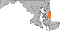
 Location in the state of Maryland |
|
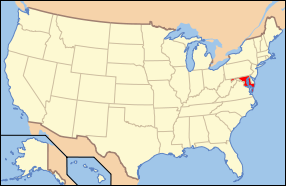
 Maryland's location in the U.S. |
|
| Statistics | |
| Founded | 1773 |
|---|---|
| Seat | Denton |
| Largest Town | Federalsburg |
| Area - Total - Land - Water |
326 sq mi (844 km²) 320 sq mi (829 km²) 6 sq mi (16 km²), 1.82 |
| Population - (2000) - Density |
29,772 93/sq mi (36/km²) |
| Time zone | Eastern: UTC-5/-4 |
| Website: www.carolinemd.org | |
| Named for: Caroline Eden | |
Caroline County is a wholly rural county located in the U.S. state of Maryland on its Eastern Shore. It is bordered by Queen Anne's County to the north, Talbot County to the west, Dorchester County to the south, Kent County, Delaware, to the east, and Sussex County, Delaware, to the southeast.[1] As of 2000, the population was 29,772. Its county seat is Denton.[2]
The newspaper of record is The Times-Record. A second local publication, the Caroline Review, circulates monthly and is free of charge.
Contents |
History
Caroline County was created in 1773 from parts of Dorchester and Queen Anne's Counties. The county derives its name from Lady Caroline Eden, wife of Maryland's last colonial governor Robert Eden. [3] At the time of its creation, seven commissioners were appointed: Charles Dickinson, Benson Stainton, Thomas White, William Haskins, Richard Mason, Joshua Clark, and Nathaniel Potter. These men bought 4 acres (16,000 m2) of land at Pig Point (now Denton) on which to build a courthouse and jail.[4]
Until the completion of these buildings, court was held at Melvill's Warehouse, approximately 1.5 miles (2.4 km) above Pig Point. Elections and other business transactions were completed there, and the town became the center of the county. The first court session was held on March 15, 1774, at Melvill's Warehouse. In 1777, court was moved to Bridgetown (now Greensboro), but in the interest of convenience, court was moved back to Melvill's. [4]
Disagreements arose concerning the permanent location of the county seat. The General Assembly reached a compromise in 1785 and ordered that 2 acres (8,100 m2) of land at Melvill's Landing should be purchased for a courthouse and jail. In 1790, the county court and its belongings moved to Pig Point. The courthouse was completed in 1797.[4]
The county features seventeen Maryland "Registered Historic Places." The National Park Service is considering organizing a site in the southern half of Caroline County dedicated to interpreting the Underground Railroad.
Law and Government
Caroline County was granted home rule in 1984 under state code in an initiative led by County Commissioner Charles T. Dean, Sr.
The current county commissioners through 2010 are:
- Jack Cole - Republican
- Roger Layton - Republican
- Jeff Ghrist - Republican
A major issue that Caroline County and several other Mid-Shore counties are facing is growth. More and more people are moving to the area to retire or to commute to regional urban areas. The county commissioners have fought to preserve the rural nature of the Caroline County, but are embroiled in a dispute with the town government of Denton over the placement of big box retail stores and the annexation of a property outside of current town limits to develop.
It is the only county in the state not represented by a resident legislator in the Maryland General Assembly. Caroline last enjoyed a home delegate in the 1994 session. Redistricting and a sparse population are to blame.
Former Maryland Lt. Governor Kathleen Kennedy Townsend confirmed during a 2002 trip to the county during her campaign for governor that Caroline Kennedy, the daughter of 35th president John F. Kennedy, was so named because of ties to the county that included a campaign swing through the Eastern Shore of Maryland in 1960 -- but moreso because previous family members through the Bouvier side had lived there and enjoyed it so.
Geography
According to the U.S. Census Bureau, the county has a total area of 326 square miles (844 km²), of which, 320 square miles (829 km²) of it is land and 6 square miles (15 km²) of it (1.82%) is water. Notable waterways include the Choptank River and Tuckahoe Creek as well as the man-made Lake Todd.
Caroline County currently ranks seventh nationally in terms of land protected under the Ag Preservation Program.
Its eastern border is the Mason-Dixon Line.
Caroline is the only Eastern Shore county not to touch either the Chesapeake Bay or Atlantic Ocean; it is one of three Maryland counties that does not have an interstate or U.S. Highway running through it. Caroline County is the only county east of the Mississippi River to never feature any heavy industry besides agriculture.
Tuckahoe State Park and Martinak State Park are located in Caroline County.
John Smith gazed upon the county during his 1608 voyage up the Nanticoke River.
Adjacent Counties
- Kent County, Delaware (northeast)
- Sussex County, Delaware (southeast)
- Dorchester County (south)
- Talbot County (west)
- Queen Anne's County (northwest)
 |
Queen Anne's County | Kent County, Delaware |
|
||||
| Talbot County | |||||||
| Dorchester County | Sussex County, Delaware |
Demographics
As of the census[5] of 2000, there were 29,772 people, 11,097 households, and 8,156 families residing in the county. The population density was 93 people per square mile (36/km²). There were 12,028 housing units at an average density of 38 per square mile (15/km²). The racial makeup of the county was 81.69% White, 14.77% Black or African American, 0.37% Native American, 0.55% Asian, 0.02% Pacific Islander, 1.26% from other races, and 1.34% from two or more races. 2.65% of the population were Hispanic or Latino of any race. 17.4% were of United States or American, 14.8% English, 14.4% German and 9.9% Irish ancestry according to Census 2000.
There were 11,097 households out of which 34.80% had children under the age of 18 living with them, 54.30% were married couples living together, 13.60% had a female householder with no husband present, and 26.50% were non-families. 21.50% of all households were made up of individuals and 9.40% had someone living alone who was 65 years of age or older. The average household size was 2.64 and the average family size was 3.03.
In the county the population was spread out with 26.80% under the age of 18, 7.70% from 18 to 24, 28.90% from 25 to 44, 23.10% from 45 to 64, and 13.50% who were 65 years of age or older. The median age was 37 years. For every 100 females there were 95.90 males. For every 100 females age 18 and over, there were 91.70 males.
The median income for a household in the county was $38,832, and the median income for a family was $44,825. Males had a median income of $31,119 versus $21,915 for females. The per capita income for the county was $17,275. About 9.00% of families and 11.70% of the population were below the poverty line, including 14.50% of those under age 18 and 12.30% of those age 65 or over. It is regularly ranked among the poorest of all 23 Maryland counties.
Notable natives and residents
- William Richardson, hero of the Battle of Harlem Heights in the Revolutionary War.
- Charles Dickinson, who was killed in a duel in 1806 by future President Andrew Jackson.
- Infamous slave kidnapper Patty Cannon operated out of the county, owning a house in Reliance. Runaway slaves Harriet Tubman and Frederick Douglass also lived in the county for part of their lives.
- Thomas Alexander Smith, early 20th century Congressman and businessman.
- Sophie Kerr, early 20th Century author and benefactor of the largest undergraduate literary prize in the nation -- at Washington College in Chestertown, MD.
- Harry R. Hughes, Governor of Maryland from 1979-1987.
- Sherman W. Tribbitt, Governor of Delaware from 1973-1977.
- Two dogs owned by former president Bill Clinton, Buddy and Seamus, were born in Caroline County.
- Thomas Alan Goldsborough, noted jurist and Congressman.
- George A. Waggaman, US Senator from Louisiana.
Schools
- North Caroline High School
- Colonel Richardson High School
- Caroline Career & Technology Center
- Lockerman Middle School
- Colonel Richardson Middle School
- Denton Elementary School
- Federalsburg Elementary School
- Greensboro Elementary School
- Preston Elementary School
- Ridgely Elementary School
- Wesleyan Christian School
Cities and towns
This county contains the following incorporated municipalities:
- Denton (incorporated 1802)
- Federalsburg (incorporated 1823)
- Goldsboro (incorporated 1906)
- Greensboro (incorporated 1826)
- Henderson (incorporated 1949)
- Hillsboro (incorporated 1853)
- Marydel (incorporated 1929)
- Preston (incorporated 1892)
- Ridgely (incorporated 1896)
- Templeville (incorporated 1865) (This town is partly in Caroline County and partly in Queen Anne's County.)
All ten of these are classified as towns under Maryland law.
The United States Census Bureau recognizes no Census-Designated Places in Caroline County, which is unusual for Maryland counties, which usually have many unincorporated population centers.
Other unincorporated communities include:
- American Corner
- Andersontown
- Baltimore Corner
- Bethlehem
- Burrisville
- Choptank
- Gilpin Point
- Grove
- Harmony
- Hickman
- Hobbs
- Jumptown
- Ninetown
- Oakland
- Oil City
- Tanyard
- Tuckahoe Neck
- Two Johns
- Reliance
- Whiteleysburg
- Williston
Maryland State Highways in Caroline County
- Caroline's "major artery" is Maryland Route 404, four lanes in some parts but two lanes in others. It is chiefly used in the summertime by non-local beachgoers heading to Ocean City, Maryland, or Rehoboth Beach, Delaware.
- Maryland Route 16
- Maryland Route 287
- Maryland Route 302
- Maryland Route 304
- Maryland Route 306
- Maryland Route 307
- Maryland Route 308
- Maryland Route 311
- Maryland Route 312
- Maryland Route 313
- Maryland Route 314
- Maryland Route 315
- Maryland Route 317
- Maryland Route 328
- Maryland Route 331
- Maryland Route 404
- Maryland Route 454
- Maryland Route 480
Entertainment
- The citizens of the towns of Hickman & Preston were once recognized by the TV show Hee Haw. In fact, the Hickman segment is the episode featured in the comedy wing of the Country Music Hall of Fame.
- Baseball Hall of Famer Jimmie Foxx began his career as a semipro catcher in Ridgely.
- Rocker George Thorogood played Caroline County bars while in college at the University of Delaware before hitting the big time.
- The 2004 South Caroline baseball team made it to the Little League World Series in Williamsport, Pennsylvania, and placed third in the nation.
- Summerfest is held each August in Denton.
- The Caroline County Fair is held each August in Williston.
See also
- USS Caroline County (LST-525)
References
- ↑ Map of Denton, MD by MapQuest
- ↑ Caroline County Government - Office of the County Commissioners
- ↑ Maryland, Caroline County "She's waiting for you"
- ↑ 4.0 4.1 4.2 Formation of Caroline County
- ↑ "American FactFinder". United States Census Bureau. Retrieved on 2008-01-31.
External links
|
|||||||||||||||||
|
