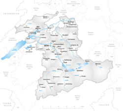
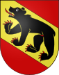
Canton of Berne
| Bern Berne |
|||
|
|||
| Capital | Berne | ||
| Population (2007) | 962,982 (Ranked 2nd) | ||
| - Density | 161 /km² | ||
| Area | 5959 km² (Ranked 2nd) | ||
| Highest point | 4274 m - Finsteraarhorn | ||
| Lowest point | 401.5 m - Aar at Wynau | ||
| Joined | 1353 | ||
| Abbreviation | BE | ||
| Languages | German , French, Berndeutsch | ||
| Executive | Regierungsrat, Conseil exécutif (7) | ||
| Legislative | Grosser Rat, Grand conseil (160) | ||
| Municipalities | 399 municipalities | ||
| Districts | 26 Amtsbezirke, Districts | ||
| Website | www.BE.ch | ||
 |
|||
The Swiss Canton of Berne is bilingual (German: Kanton Bern,pronunciation; French: Canton de Berne) and has a population of about 962,982 (2007) of which 119,930 (or 12.45%) are foreigners[1]. The canton is located in west-central Switzerland and the city of Berne is its capital.
Contents |
Geography


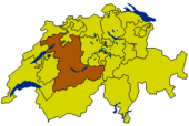
The canton of Berne is the second largest of all Swiss cantons. It borders the Canton of Jura and the Canton of Solothurn to the north. To the west lie the Canton of Neuchâtel, the Canton of Fribourg and Vaud. To the south lies the Valais. East of the canton of Berne lie the cantons of Uri, Nidwalden, Obwalden, Lucerne and Aargau.
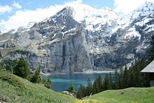
The canton of Berne is mainly drained by the River Aar and its tributaries. The area of the canton is commonly divided into three areas. The Bernese Oberland (German: Berner Oberland) lies in the south of the canton and is part of the Alps (Bernese Alps and Urner Alps). The highest mountain in the Bernese Oberland is the Finsteraarhorn (4,274 m; 14,022 ft). The famous hiking and ski resorts in the eastern Oberland around Interlaken and the Jungfrau (4,158 m) are located within this area, such as car-free Wengen and Mürren, and Gimmelwald and Grindelwald. Further east are the Aareschlucht and the town of Meiringen, famous for the fateful scene of Sherlock Holmes's 'death' at the hands of Professor Moriarty on the nearby Reichenbach Falls. In the Western Bernese Oberland there are many other resorts and small villages catering to visitors who prefer greater isolation. These are accessed from the large scenic lake town of Thun, and the most notable of them are Kandersteg and the Oeschinensee, as well as Kiental and Adelboden. Going further west up the even more secluded Simmental river valleys, one reaches Zweisimmen, Lenk, Gstaad, and Saanen.


The whole area in the south is very mountainous, with steep cliffs, many glaciers, and countless waterfalls. It is renowned for its scenic beauty and the charm of the small Swiss villages that dot the area. As a result of this, tourism is one of the main sources of income in the Bernese Oberland. Even when going over a remote pass one often finds a small farmhouse on the way up, or a mountain cabin willing to give accommodation and dinner to the passerby. Typically these sell the local cheeses and specialty products, with glacier or spring water pouring out of the copious fountains and taps for the hikers to quench their thirst. The region also has an extensive train network as well as many cable cars, gondolas, lifts, and funiculars, with the highest train station in Europe, the longest funicular in Europe, and the longest gondola cableway in the world.
Mountains in Berne include:
The Bernese Midlands (Berner Mittelland) is made up of the valley of the rivers Aare, the river Emme, some of the foothills of the Bernese Alps, as well as the plain around the capital Berne, and has many small farms and hilly forested regions with mid-sized to small towns scattered throughout. It is perhaps best known by foreigners and visitors for the Emmental. The classic mild Swiss cheese with holes Emmentaler comes from this region's forests and pastures, of hilly and low mountainous countryside in the 1000 to 2000 m range.
In the north of the canton of Berne lies the third more liberal French influenced region: the Lake Region (Seenland) concentrated around Lake Biel which rises from the plain up to the northernmost Swiss mountain chain of the Jura. This area has more relaxed geography, although still some lower mountains and some waterfalls, and large lakes.
The area of the canton is 5959 km².
History


See also: History of Berne, Heraldry of Berne, Swiss peasant war of 1653
The area of the canton of Berne consists of lands acquired by its capital, mostly between the 14th and the 16th century, both by conquest and purchase. Acquired districts include (with dates of acquisition):
- Laupen (1324)
- Hasli and Meiringen (1334)
- Thun and Burgdorf (1384)
- Unterseen and the Upper Simme valley (1386)
- Frutigen, etc. (1400)
- Lower Simme valley (1439 - 1449)
- Interlaken, with Grindelwald, Lauterbrunnen and Brienz (1528, all the suppression of the Austin Canons of Interlaken)
- Saanen or Gessenay (1555)
- Köniz (1729)
- the Bernese Jura with Biel/Bienne (1815, from the bishopric of Basel).
Some regions previously left the canton: Aargau (1415), Aigle and Grandson (1475), Vaud (1536), and the Pays d'En-Haut including Château-d'Œx (1555). From 1798 to 1802 the Oberland formed a separate canton of the Helvetic Republic called canton of Thun with Thun as its capital. Certain French-speaking portions of the canton of Berne broke away from the canton only in the late 20th century and since 1979 comprise the Canton of Jura.
Berne joined the Swiss Confederation in 1353 and was between 1803 and 1814 one of the six direcorial cantons of the Swiss Confederation.
Politics


Legislative Branch
The Grand Council (German: Grosser Rat / French: Grand conseil) is the parliament of the canton of Berne. It consists of 160 representatives elected by proportional representation for a four-year term of office. The French-speaking part of the canton, the Bernese Jura, has 12 seats guaranteed and 3 seats are guaranteed for the French-speaking minority of the bilingual district of Biel/Bienne.
Executive Branch
The Executive Council (German: Regierungsrat / French: Conseil-éxecutif) is the government of the canton of Berne. This seven-member collegial body is elected by the people for a period of four years. The cantonal constitution reserves one seat in the Executive Council for a French-speaking citizen from the Bernese Jura.
Judicial Branch
The canton has a two-tiered court system, consisting of district courts and a cantonal Supreme Court (German: Obergericht, French: Cour suprême). There is also an administrative court (German:Verwaltungsgericht, French:Tribunal administratif) as well as other specialised courts and judicial boards. See [1] for details.
Economy

Tourism is the main source of income in the Bernese Oberland. Other important sectors are agriculture (especially cattle breeding), cheese making, and hydroelectric power generation. The Bernese cheese Emmental cheese is known around the world.
In the Bernese Midlands the lands are more fertile. Agriculture is of great importance, but this part of the canton is also the most industrialized. Small and middle-sized businesses are important employers in this part of the canton of Berne. There is a nuclear power plant at Mühleberg.
The area around the Lake Bienne is renowned for its wine production.
The 3 French-speaking districts of the Bernese Jura and the bilingual district of Biel/Bienne are renowned for their worldwide well known watch industry and its mechanical industry (high precision machine tools, automation and machining).
Language
The canton of Berne is bilingual: Both German (22 districts, with 84% of the population) and French (three districts, 8.2%) are spoken. The German-speaking majority speaks Bernese German, a Swiss German dialect. French-speakers live in the northern part of the canton, in the Bernese Jura. Both German and French are spoken in the bilingual city of Biel/Bienne. In the government and administration, both languages are official languages of equal standing.
Religion
Protestantism

Most Bernese are Protestant, and most Protestants belong to the Swiss Reformed Church, which is officially recognised as a state church (German: Landeskirche), although it is autonomous in its governance and is organised along democratic principles.
The canton is also home to a great number of small Evangelical Christian denominations unaffiliated with the state church. Bernese evangelical groups are mostly found in the Emmental and Berner Oberland, where they have a long tradition; several contemporary American religious groups, such as the Amish and Mennonites, were founded or co-founded by Bernese emigrants to the United States. Two small Evangelical political parties are represented in the Bernese cantonal parliament.
Other faiths
Berne features substantial Roman Catholic and Christian Catholic minorities. These churches also have state church status, and the small Jewish community is similarly recognised by law.
As everywhere in Switzerland, there are also significant religious communities of immigrants, including Sikhs (who have a prominent Gurdwara, or temple, in Langenthal), Mormons (who worship at the Bern Switzerland Temple) and Muslims. As of 2006, the plans to expand a backyard mosque in Langenthal with a symbolical minaret have, as elsewhere in Switzerland, caused a public stir due to vocal opposition from local conservative and evangelical leaders.[2]
Districts and municipalities
As of April 2004, there are 398 municipalities of the canton of Berne within the following 26 administrative districts:

- Aarberg with capital Aarberg
- Aarwangen with capital Aarwangen
- Berne with capital Berne
- Biel with capital Biel
- Büren with capital Büren an der Aare
- Burgdorf with capital Burgdorf
- Courtelary with capital Courtelary
- Erlach with capital Erlach
- Fraubrunnen with capital Fraubrunnen
- Frutigen with capital Frutigen
- Interlaken with capital Interlaken
- Konolfingen with capital Konolfingen
- Laupen with capital Laupen
- Moutier with capital Moutier
- La Neuveville with capital La Neuveville
- Nidau with capital Nidau
- Niedersimmental with capital Wimmis
- Oberhasli with capital Meiringen
- Obersimmental with capital Blankenburg
- Saanen with capital Saanen
- Schwarzenburg with capital Schwarzenburg
- Seftigen with capital Belp
- Signau with capital Langnau im Emmental
- Thun with capital Thun
- Trachselwald with capital Trachselwald
- Wangen with capital Wangen an der Aare
Photographs
References
- ↑ Bundesamt fur Statistik (Federal Department of Statistics) (2008). "Ständige Wohnbevölkerung nach Staatsangehörigkeit, Geschlecht und Kantonen" (Microsoft Excel). Retrieved on November 5, 2008.
- ↑ "Minaret row rumbles on in Switzerland", Swissinfo (2006-09-05). Retrieved on 2006-10-02.
See also
- Bernese newspapers:
- Berner Zeitung
- Der Bund
- Bieler Tagblatt
External links
- Official website (German) (French)
- Official statistics
- Berner Oberland Tourism
- Biel/Bienne and Seeland Tourism
- Bernese Jura Tourism
|
|||||