Camarines Sur
| Province of Camarines Sur | |
 Provincial seal of Camarines Sur |
|
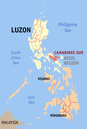 Map of the Philippines with Camarines Sur highlighted |
|
| Region | Bicol Region (Region V) |
| Capital | Pili |
| Divisions | |
| - Highly urbanized cities | 0 |
| - Component cities | 2 |
| - Municipalities | 35 |
| - Barangays | 1,063 |
| - Congressional districts | 4 |
| Population | 15th largest |
| - Total (2007) | 1,693,821 (2007) |
| - Density | 295 /km² (764 /sq mi) (22nd highest) |
| Area | 17th largest |
| - Total | 5,266.8 km2 (2,034 sq mi) |
| Founded | — |
| Spoken languages | Central Bicolano, Iriga Bicolano, Albay Bicolano, Tagalog, Mt. Isarog Agta, and Mt. Iriga Agta |
| Governor | Luis Raymond F. Villafuerte, Jr. (Lakas-CMD) |
Camarines Sur is a province of the Philippines located in the Bicol Region in Luzon. Its capital is Pili and the province borders Camarines Norte and Quezon to the north, and Albay to the south. To the east lies the island province of Catanduanes across Maqueda Channel.
Camarines Sur is the largest among the six provinces in the Bicol Region both in terms of population and land area. It's territory encompasses two cities: Naga City, the lone chartered city, is the province's and the region's commercial, educational, financial, and cultural center, while Iriga City, a component city, is the center of the Rinconada area. Lake Buhi is where the smallest commercially-harvested fish can be found, the Sinarapan (Mistichthys luzonensis).
Contents |
People and culture
Population. According to the May 2000 census, there are a total of 1,693,821 residents in Camarines Sur, making it the most populous in the region and the 15th most populous in the whole country. The same census also states that Camarines Sur has 288,172 households with an average household size of 5.37 persons, significantly higher than the national average of 4.99. The annual growth rate is 1.86%, much lower than the national growth rate of 2.36%. This rate of growth will double the population of Camarines Sur in 38 years.
Languages. Being in the Bicol Region, the main language spoken in Camarines Sur is Bikol. Filipino linguists consider the dialect of Bikol spoken around Naga City, Bicol Central, the standard Bikol easily understood by all Bicolanos, also known as Bikol Naga, not to be confused with Bikol Canaman, the purest dialect of Bikol according to Jesuit Anthropologist Frank Lynch, S.J.). Some of the other dialects spoken in the province are Buhi-non (a dialect of Bicol Albay), spoken in the southern part of the province around Lake Buhi, and Rinconada Bikol (also known as Bikol Nabua), which is used in the area around Nabua. A dialect of Naga Bikol, called Partido is used in the eastern portion of the province around Lagonoy Gulf. Most inhabitants understand Tagalog and English.
History
In 1942, Japanese forces entered and occupied Camarines Sur.
On March 8, 1942, three months after Japanese Imperial Forces landed in Legazpi and Naga City, the famous Tangcong Vaca Guerilla Unit (TVGU) was organized in San Nicolas, Canaman with Juan Miranda as the Commanding Officer, Leon Aureus as the Executive Officer and Elias Madrid as the Finance Officer. Among the numerous Canamanons who joined-up soon afterwards either in the unit’s intelligence or combat components were Jose and Antonio Madrid, Mamerto Sibulo, Andres Fortaleza, Marcos Severo, Damaso Avenilla, Federico Crescini, Nicolas Vargas, Venancio Begino, Eugenio Ragodon, Juan Pachica, Santiago Amaro, Jose Gervas, Pedro Angeles, Aproniano Lopez, Andres Alzate, Modesto Sanchez, Blas Alcantara, Andres Aguilar, Florencio Frondozo, Alfredo de la Torre and Flaviano Estrada.
In 1945, Filipino and American troops along with the Bicolano guerrillas, liberated Camarines Sur from the Japanese forces towards the end of WW II.
Economy
Agri-based, producing rice, corn, feedmeal, freshwater fish, livestock. Entrepreneurs engage in trading, often branching out towards neighboring provinces in the south as local demand might be limited, indicated by its mostly 3rd-5th income class municipalities.
Geography and climate
Terrain
Camarines Sur lies at the center of the Bicol Peninsula. The province is also the largest in the Bicol Region with a land area of 5,266.8 square kilometers. At the center of the province is Bicol Plain. Surrounding it are mountains, two of which are Mount Isarog and Mount Iriga. The eastern part of the province lies on the mountainous Caramoan Peninsula, which faces the island of Catanduanes to the east.
The Bicol River drains the central and southern parts of the province into San Miguel Bay. Mt. Asog is surrounded by three lakes: Buhi, Bato, and Baao.
Climate
The climate in Camarines Sur like most of the rest of the country is very tropical. It is dry from March to May and wet the rest of the year. June to October marks the typhoon season. Annual average rainfall is 2,565 millimeters. Camarines Sur has an average temperature of 27.0 °C and a relative humidity of 25.8%.
Tourist Attractions
For religious tourism- Our Lady of Peñafrancia Church in Naga, 19th century churches in Goa, San Jose and Sagñay. For eco-tourism The world's smallest fish is found in Lake Buhi. There are two active (or considered dormant) volcanoes with trails: Mt. Isarog and Mt. Asog. The beaches of Sagñay and Caramoan have coral reefs, and white and black sand beaches. Naga city has night life and metropolitan needs.
The Camarines Sur Watersports Complex and the Eco Village at the Provincial Capitol located at Cadlan Pli Camarines Sur are very suitable destinations. We also have some hidden wonders of nature. We have the Concocep Falls(entrance in Hanawan, Ocampo), In Naga City is a lot of good places to visit like the Magsaysay Strip, Different Historical Churches and Shrines, the Penafrancia Festival, etc. In Pasacao there are a lot of beaches and resorts, in Libmanan is the Malinaw Nature Resort and Brgy. Palong's water source at the base of Mt. LIbmanan(Tangkumbaka)
Restaurants Range from First Class Cuisine, Vegetarian Organic (green Earth Cafe), Ihaw-Ihaw, Fast Food Chains, and a variety of Local Delicacies.
Political
Camarines Sur is subdivided into 35 municipalities and 2 cities.
| City/Municipality | No. of Barangays |
Area (km²) |
Population (2007) |
Mayor (2007-2010) |
|---|---|---|---|---|
| Baao |
|
|
|
|
| Balatan |
|
|
|
|
| Bato |
|
|
|
|
| Bombon |
|
|
|
|
| Buhi |
|
|
|
|
| Bula |
|
|
|
|
| Cabusao |
|
|
|
|
| Calabanga |
|
|
|
|
| camaligan |
|
|
|
|
| Canaman |
|
|
|
|
| Caramoan |
|
|
|
|
| Del Gallego |
|
|
|
|
| Gainza |
|
|
|
|
| Garchitorena |
|
|
|
|
| Goa |
|
|
|
|
| Iriga City |
|
|
|
|
| Lagonoy |
|
|
|
|
| Libmanan |
|
|
|
|
| Lupi |
|
|
|
|
| Magarao |
|
|
|
|
| Milaor |
|
|
|
|
| Minalabac |
|
|
|
|
| Nabua |
|
|
|
|
| Naga City |
|
|
|
|
| Ocampo |
|
|
|
|
| Pamplona |
|
|
|
|
| Pasacao |
|
|
|
|
| Pili |
|
|
|
|
| Presentacion |
|
|
|
|
| Ragay |
|
|
|
|
| Sagñay |
|
|
|
|
| San Fernando |
|
|
|
|
| Sipocot |
|
|
|
|
| Siruma |
|
|
|
|
| Tigaon |
|
|
|
|
| Tinambac |
|
|
|
|
External links
|
|||||||||||