Butuan City
| City of Butuan Dakbayan sa Butuan Lungsod ng Butuan |
|||
|
|||
| Nickname(s): Timber City of the South | |||
 |
|||
 City of Butuan
|
|||
| Coordinates: | |||
| Country | Philippines | ||
|---|---|---|---|
| Region | Northern Mindanao (CARAGA Region XIII) | ||
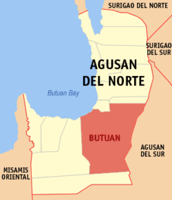
| Province | Agusan del Norte | ||
| Districts | First District of Agusan del Norte | ||
| Barangays | 86 | ||
| Incorporated (town) | |||
| Incorporated (city) | August 02, 1950 | ||
| Government | |||
| - Mayor | Democrito D. Plaza II (1992-2000, 2001-2003 & 2007-2010) | ||
| - Vice Mayor | Dino Claudio M. Sanchez (2007-2010) | ||
| - Congress | Ompong Plaza (2007-2010) | ||
| Area | |||
| - Total | 817.28 km² (315.6 sq mi) | ||
| Population (August 2007) | |||
| - Total | 298,378 | ||
| - Density | 365/km² (945.3/sq mi) | ||
| Time zone | PST (UTC+8) | ||
| ZIP code | 8600 | ||
| Area code(s) | 65 | ||
| Website: www.butuan.gov.ph | |||
The City of Butuan (Tagalog: Lungsod ng Butuan) is the regional center of the Caraga Region in the Philippines. It is located at the northeastern part of Agusan Valley in northern Mindanao, sprawling across the Agusan River. It is bounded to the north, west and south by Agusan del Norte, to the east by Agusan del Sur and to the northwest by Butuan Bay. According to the 2000 census, it has a population of 267,279 people in 50,273 households.
The name "Butuan" is believed to have originated from the sour fruit "Batuan". Other etymology sources say that it comes from a certain "Datu Buntuan", a chieftain who once ruled over Butuan.
Contents |
History
As early as the 10th century, people from Butuan had already established trading relations with the Kingdom of Champa (now southern Vietnam) and Srivijaya empire of Java.
By the 11th century, Butuan was the center of trade and commerce in the Philippines. The evidence to prove this fact is the discovery of 9 balangays (the Butuan Boat) and other archaeological find in the vicinities of Butuan City, particularly in Ambangan, Libertad near the old El Rio de Butuan and Masao River.
Much controversy and debate have been generated with regard to the holding of the first mass. Whether it was held in San Vicente (City of Angels), Leyte or in Masao, Butuan City or in the hidden isle made up of barangays Pinamanculan and Bancasi inside Butuan, and the latest discovered site in between agusan sur and surigao sur, the little barangay of Barobo, it is sure, however, that Ferdinand Magellan did not drop anchor by the mouth of Agusan River in 1521 and held mass to commemorate the event which was held at Mazaua, an island separate from 1521 Butuan which was in the geographical conception of Europeans who wrote about it was a larger entity than what it is now. Antonio Pigafetta who wrote an eyewitness account of Magellan's voyage described in text and in map a Butuan that stretched from today's Surigao up to the top edge of Zamboanga del Norte.
The first municipal election in Butuan took place on March 1902 in accordance with Public Law No. 82 which coincided with the American occupation of the place.
During the Japanese occupation of the Philippines in World War II, Butuan was razed to the ground when the guerrilla forces attacked the enemy garrison during the middle of 1943. In 1945, entered of the Philippine Commonwealth troops in Butuan together with the Allied Filipino guerrillas attacked the Japanese forces during the Battle of Agusan. On October 20, 1948, still recovering from the war, the entire municipality was ruined by a fire.
The boom of the logging industry during the 1950s up the middle of 1970s has made Butuan the "Timber City of the South". The outcome of which was the influx of business and fortune seekers from other provinces. The once lethargic town suddenly became a bustling locality. The flourishing logging industry inspired and prompted Congressman Marcos M. Calo to file a bill converting Butuan into a city. On August 2, 1950, Butuan became a city by virtue of Republic Act No. 523 otherwise known as the City Charter of Butuan.
From being a chartered city, Butuan was reclassified into a highly urbanized city on February 7, 1995 pursuant to the provision of section 166 and 168 of Local Government code of 1991 and Memorandum circular 83-49 of the ministry of local Government. The re-classification was based on its outcome and population as certified by the ministry of finance and national census and statistics office.
Geography
Topography
Butuan City has a land area of 10816.62 km², which is roughly 4.1% of the total area of the Caraga region. With an estimated total population of 300,000, it has an average density of 367 persons per km², higher than the regional average density of 101 persons per km².
The existing land use of the city consists of the following uses: agriculture areas (397.23 km²), forestland (268 km²), grass/shrub/pasture land (61.14 km²) and other uses (90.242 km²). Of the total forestland, 105 km² is production forest areas while 167.5 km² is protection forest areas.
The forestland, as mentioned earlier, comprised both the production and protection forest. The classified forest is further specified as production forest and protection forest. In the production forest industrial tree species are mostly grown in the area. The production forest on the other hand, is preserved to support and sustain necessary ecological performance. One is the watershed areas will dry up and during heavy rain, rapid water run-off will occur creating flash floods. And in sunny days, rapid evaporation happens, leaving the area arid.
The city is endowed with swamplands near its coastal area. These swamp areas are interconnected with the waterways joined by the Agusan River. Most of the swamplands are actually mangroves that served as habitat to different marine species.
Filling material needs of the city are extracted usually river from the riverbank of Taguibo River. Others are sourced out from promontories with special features and for special purpose.
The fishing ground of Butuan is the Butuan Bay of which two coastal barangays are located. It extends some two kilometers to the sea and joins the Bohol Sea. These are barangays Lumbocan and Masao.
Barangays
Butuan City is politically subdivided into 87 barangays. Of these, 27 are classified as urban and the remaining 60 are classified as rural.
|
|
|
Highlights
Father Saturnino Urios University
The first university in Butuan city is Father Saturnino Urios University. It is located in San Francisco street where it is near the St.Joseph Cathedral. Since Father Urios establish a school for the Manobos, it became more progressive through out the years. On his death in 1906, Father Urios became "The Apostle of Agusan" and his school was named after him. On September 19, 2006, the school became the first university of Butuan city and the Caraga Region.
Agusan River
Butuan River is the widest, deepest and longest navigable river in Mindanao. A cruise along the river barangays reveals much about Butuan's history, culture, arts, and people, and as a tribute to the Patroness of the Agusan River Senora Sta. Ana, the Abayan Festival was born – a day-long celebration of baroto races and fluvial procession at the Agusan River.
Balangay Shrine Museum
Five kilometers east of the city proper lays the graveyard of the Balangay 1 dated 320 A.D. or 1688 years old. This wooden plank-build and edge-pegged boats measured an average of 15 meters in length and 3 meters wide across the beam. To date, 9 Balangays have already been discovered in Ambangan, Libertad sites. Three have been excavated and others are still in Situ.
Butuan Regional Museum
This museum is the repository of historical and cultural materials and artifacts that proves Butuan's prehistoric existence and rich cultural heritage. There are two exhibit galleries. The Archaeological Hall and Ethnological Hall specimens of stone crafts, metal crafts, woodcrafts, potteries, goldsmith, burial coffins, and other archaeological diggings are exhibited. At the Ethnological Hall are exhibits of contemporary cultural materials the Butuanon or every Filipino for matter used for a living.
Mount Mayapay
Looming southwest of the Agusan Valley is this majestic mountain plateau. It rises to 2,214 feet (675 m) above sea level. Mount Mayapay got its name from the ancient Madjapahit Empire. The history behind the Sri-Vishaya period bears much meaning and influence of Butuan's pre-historic and archaeological discoveries.
The Officials
The Butuan City Officials (2007-2010)
- City Mayor: HON. DEMOCRITO D. PLAZA
- Vice-Mayor: HON. DINO CLAUDIO M. SANCHEZ
- SP Members:
- HON. RAMON P. CARAMPATANA
- HON. LOPE A. BUÑOL
- HON. RANDOLPH B. PLAZA
- HON. JOSEPHINE M. SALISE
- HON. SALVADOR V. CALO
- HON. RODRIGO DAYADAY
- HON. AUDIE BERNABE
- HON. RAUL o. AMOC
- HON. ERWIN DANO
- HON. LAW FORTUN
- Liga President:
- (to be added)
- SK Federation President:
- (to be added)
- City Secretary:
- (to be added)
The Mayors of the city of Butuan
- ROMULO A. ROSALES- 1948-1950
- RODOLFO DUMAGO CALO- 1952-1953(Appointed)1902-1941.
- ZACARIAS PIZARRO- 1953-1955(Appointed) 1955-1959(Elected).
- SALVADOR L. CALO- 1959-1963 and 1963-1967.
- GUILLERMO R. SANCHEZ- 1968-1969.
- SYLVESTRE M. OSIN- 1969-1971.
- FIGURADO O. PLAZA- 1971-1986.
- HORACIO MARCOS V. CALO- Feb.1986-May 1986 (This was the transition period after EDSA-I).
- GUILLERMO R. SANCHEZ- 1986-1992(Re-Elected).
- DEMOCRITO D. PLAZA- 1992-2000 and 2001-2003.
- DAISY PLAZA- 2004-2006(First Woman Mayor).
- DEMOCRITO D. PLAZA- 2007-?(Re-Elected).
Festivals
The Kahimunan Festival is celebrated every third Sunday of January in celebration of the city patron Sr. Sto. Niño. This celebration is the version of the Sinulog festival of Cebu City. Kahimunan is a Lumad term which means "gathering".
Cultural festival/tourism consciousness week is a long celebration that lasts from the last week of July up to August 2 in celebration of the Charter Day of Butuan.
Abayan Festival is part cultural festival in celebration of St. Anne patroness of Agusan River celebrated every last Sunday of July.
Adlaw Hong Butuan is the charter day celebration of Butuan, which includes a thanksgiving mass, motorcade, palagsing festival, street party recognitions of outstanding Butuanons and city government employees night.
Butuan celebrates its annual fiesta for the celebration of city patron St. Joseph every May 19 of the year. Many events will be seen such as summer league basketball championship game, thanksgiving mass, and more.
Sister Cities
 Bacolod City, Philippines
External links
- A History of Butuan City at the Agusan–Surigao Historical Archive
- Butuan statistics at the Philippines National Statistical Coordination Board
- Butuan City by Gerard Piepenbrock
- More photos and information on Butuan City
|
|||||||||||