Brownsville, Texas
| City of Brownsville | |
| Nickname(s): The Green City | |
| Motto: On the Border by the Sea | |
 |
|
 |
|
| Coordinates: | |
| Country | United States |
|---|---|
| State | Texas |
| County | Cameron |
| Government | |
| - Mayor | Patricio M. Ahumada, Jr. |
| Area | |
| - City | 83.0 sq mi (215.0 km²) |
| - Land | 80.4 sq mi (208.2 km²) |
| - Water | 2.6 sq mi (6.8 km²) |
| Elevation | 33 ft (10 m) |
| Population (2006) | |
| - City | 172,806 (city proper) |
| - Density | 1,737.9/sq mi (671.0/km²) |
| - Metro | 387,717 |
| Time zone | CST (UTC-6) |
| - Summer (DST) | CDT (UTC-5) |
| Area code(s) | 956 |
| FIPS code | 48-10768[1] |
| GNIS feature ID | 1372749[2] |
| Website: http://www.ci.brownsville.tx.us/ | |
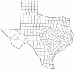
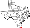
Brownsville is a city in and the county seat of Cameron County, Texas, United States.[3] Brownsville is the 15th largest city in the state of Texas and the 130th largest in the United States. The 2000 United States Census population was 139,722, with a July 1, 2007 Census estimate of 172,806; which reflects growth rate of 23.7 percent. Brownsville is also the southernmost city in Texas.
Brownsville is the principal city of the Brownsville–Harlingen Metropolitan Statistical Area, which is part of the larger Brownsville–Harlingen–Raymondville Combined Statistical Area.
Contents |
Geography and climate
| for Brownsville | |||||||||||||||||||||||||||||||||||||||||||||||
|---|---|---|---|---|---|---|---|---|---|---|---|---|---|---|---|---|---|---|---|---|---|---|---|---|---|---|---|---|---|---|---|---|---|---|---|---|---|---|---|---|---|---|---|---|---|---|---|
| J | F | M | A | M | J | J | A | S | O | N | D | ||||||||||||||||||||||||||||||||||||
|
1.4
69
51
|
1.2
72
53
|
0.9
78
60
|
2
82
65
|
2.5
87
72
|
3
91
75
|
1.8
92
75
|
3
93
75
|
5.3
89
73
|
3.8
84
66
|
1.8
77
59
|
1.1
70
52
|
||||||||||||||||||||||||||||||||||||
| temperatures in °F precipitation totals in inches |
|||||||||||||||||||||||||||||||||||||||||||||||
|
Metric conversion
|
|||||||||||||||||||||||||||||||||||||||||||||||
Brownsville is located at (25.930307, -97.484424),[4] on the U.S.-Mexico border (marked here by the Rio Grande or Río Bravo del Norte) from Matamoros, Tamaulipas. The low latitude and elevation give Brownsville a subtropical climate. Broadleaf evergreen plants, including palms, dominate Brownsville neighbourhoods to a greater degree than is seen elsewhere in Texas -- even in nearby cities such as Harlingen and San Benito. Soils are mostly of clay to silty clay loam texture, moderately alkaline (pH 8.2) to strongly alkaline (pH8.5) and with a significant degree of salinity in many places.[1]
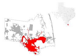
According to the United States Census Bureau, the city has a total area of 83.0 square miles (215.0 km²), making it by far the largest city in the Rio Grande Valley. 80.4 square miles (208.2 km²) of it is land and 2.6 square miles (6.8 km²) of it (3.16%) is water.
| Month | Jan | Feb | Mar | Apr | May | Jun | Jul | Aug | Sep | Oct | Nov | Dec | Year |
|---|---|---|---|---|---|---|---|---|---|---|---|---|---|
| Record high °F (°C) | 91 (33) |
94 (34) |
106 (41) |
102 (39) |
102 (39) |
103 (39) |
103 (39) |
104 (40) |
105 (41) |
99 (37) |
98 (37) |
94 (34) |
106 (41) |
| Average high °F (°C) | 68.7 (20) |
72.2 (22) |
78.0 (26) |
82.3 (28) |
86.9 (31) |
90.5 (33) |
92.4 (34) |
92.6 (34) |
89.4 (32) |
84.0 (29) |
76.8 (25) |
70.2 (21) |
82.0 (28) |
| Average low °F (°C) | 50.5 (10) |
53.3 (12) |
59.5 (15) |
65.2 (18) |
71.6 (22) |
74.9 (24) |
75.4 (24) |
75.3 (24) |
72.6 (23) |
65.9 (19) |
58.6 (15) |
52.0 (11) |
64.6 (18) |
| Record low °F (°C) | 18 (-8) |
12 (-11) |
28 (-2) |
37 (3) |
41 (5) |
56 (13) |
57 (14) |
63 (17) |
51 (11) |
35 (2) |
27 (-3) |
16 (-9) |
12 (-11) |
| Precipitation inches (mm) | 1.36 (34.5) |
1.18 (30) |
0.93 (23.6) |
1.96 (49.8) |
2.48 (63) |
2.99 (75.9) |
1.77 (45) |
2.99 (75.9) |
5.31 (134.9) |
3.78 (96) |
1.75 (44.4) |
1.11 (28.2) |
27.55 (699.8) |
| Source: National Weather Service[5] | |||||||||||||
Demographics
As of the census[1] of 2000, there were 139,722 people, 38,174 households, and 32,180 families residing in the city. The population density was 1,737.8 people per square mile (671.0/km²). There were 42,323 housing units at an average density of 526.4/sq mi (203.2/km²). The racial makeup of the city is 81.65% White, 0.41% African American, 0.42% Native American, 0.54% Asian, 0.03% Pacific Islander, 14.66% from other races, and 2.29% from two or more races. Hispanic or Latino of any race were 91.28% of the population.
There were 38,174 households out of which 50.1% had children under the age of 18 living with them, 59.3% were married couples living together, 20.9% had a female householder with no husband present, and 15.7% were non-families. 13.7% of all households were made up of individuals and 6.7% had someone living alone who was 65 years of age or older. The average household size was 3.62 and the average family size was 3.99.
In the city the population was spread out with 34.6% under the age of 18, 11.2% from 18 to 24, 27.5% from 25 to 44, 17.2% from 45 to 64, and 9.5% who were 65 years of age or older. The median age was 28 years. For every 100 females there were 89.0 males. For every 100 females age 18 and over, there were 82.5 males.
The median income for a household in the city was $24,468, and the median income for a family was $26,186. Males had a median income of $21,739 versus $17,116 for females. The per capita income for the city was $9,762. About 32.4% of families and 36.0% of the population were below the poverty line, giving it the highest poverty rate of any city in the country,[6] including 45.0% of those under age 18 and 31.0% of those age 65 or over.
In 2000, the median gross rent paid for housing in Brownsville was $405 per month. This was the lowest of any city in the United States with more than 100,000 people.[7]
The Census Bureau ranks Brownsville as the most impoverished city in the nation, according to the bureau's 2006 American Community Survey. According to the U.S. Census Bureau, only 51.7% of the population has a high school diploma and 87.2% speak a language other than English at home.[8]
History

In 1845, construction of a fort on the Mexican border was commissioned, due to increased instability in the region. Before completion, the Mexican Army began the Siege of Fort Texas, during the first active campaign in the Mexican-American War, between May 3-9, 1846. The first battle of the war occurred on May 8, 1846, when General Zachary Taylor received word of the siege of the fort. They rushed to help, but were intercepted, resulting in the Battle of Palo Alto about 5 miles north of present-day Brownsville. The next morning the Mexican forces had retreated, and Taylor's troops caught up with them, resulting in the Battle of Resaca de la Palma, which was fought within the present city limits. When Taylor finally arrived at the besieged Fort Texas, it was found that 2 soldiers had died, one of which was the fort's commander, Major Jacob Brown. In his honor, General Taylor renamed the fort Fort Brown. An old cannon at the University of Texas at Brownsville and Texas Southmost College marks the spot where Major Brown was fatally wounded.
Contrary to popular belief, however, there is few, if any, evidence that said Fort was called "Fort Texas". In fact, most official correspondence from the time describes the fort as "camp near Matamoros"
The city of Brownsville was originally established late in 1848 by Charles Stillman, and was made the county seat of the new Cameron County on January 13, 1849. The city was originally incorporated by the state on January 24, 1850. This was repealed on April 1, 1852, due to a land ownership dispute between Stillman and the former owners. The state reincorporated the city on February 7, 1853, which remains in effect. The issue of ownership was not decided until 1879, when the U.S. Supreme Court ruled in favor of Stillman.
On July 13 1859, the First Cortina War started. Juan Nepomuceno Cortina would become one of the most important historical figures of the area, and continued to exert a decisive influence in the local events until his arrest in 1875. The First Cortina War ended on December 27, 1859. In May 1861, the brief Second Cortina War took place.
During the Civil War Brownsville was used as a smuggling point for Confederate goods into Mexico, most importantly cotton smuggled to European ships waiting at the Mexican port of Bagdad. Fort Brown was controlled by the Confederates. In November 1863, Union troops landed at Port Isabel and marched for Brownsville to stop the smuggling. Confederate forces abandoned the fort, blowing it up with 8000 pounds of explosives. In 1864, the town was reoccupied by the Confederates under John Salmon 'Rip' Ford. On May 15, 1865, a month after the surrender had been signed at Appomattox Court House, the Battle of Palmito Ranch was fought and won by the Confederades.
On August 13 and 14, 1906, Brownsville was the site of the Brownsville Affair. Racial tensions were high between white townsfolk and black infantrymen stationed at Fort Brown. On the night of August 13th, one white bartender was killed and a white police officer was wounded by rifle shots in the street. Townsfolk, including the mayor, accused the infantrymen as the murderers. Without a chance to defend themselves in a hearing, President Theodore Roosevelt dishonorably discharged the entire 167 member regiment due to their accused "conspiracy of silence". Further investigations in the 1970s found that they were not at fault, and the Nixon Administration reversed all dishonorable discharges.
On September 8, 1926, The Junior College of the Lower Rio Grande Valley (later known as Texas Southmost College) admitted its first class. In 1945 Fort Brown was decommissioned and in 1948 the City and College acquired the land. Between 1945 to 1970 Brownsville population continued to grow gradually, doubled from 25,000 to 52,000 people. In 1991 Brownsville receives a University via the partnership between the University of Texas at Brownsville and Texas Southmost College.
Brownsville was declared an All-America City in the year 2001.
On December 25, 2004, Brownsville had its first instance of measurable snow in 109 years, with 1 1/2 inches, and the first recorded White Christmas. This was part of the 2004 Christmas Eve Snowstorm. The snow was subsequently sold on eBay.[2]
City government

Brownsville has a Council-Manager style of Government. The Mayor and six City Commissioners, two At-Large and four District, serve staggered four year terms. With elections for one At-Large and two District seats every two years. Municipal elections are held on the first Saturday of May in odd numbered years.
As of 2006, the members of the Commission are:
- Mayor: Pat Ahumada (Since 2007)
- Commissioner At-Large "A": Anthony Troiani(Since 2007)
- Commissioner At-Large "B": Leo T. Garza (Since 2007)
- Commissioner District 1: Ricardo Longoria Jr. (Since 2003)
- Commissioner District 2: Charlie Atkinson (Since 2006)
- Commissioner District 3: Carlos Cisneros (Since 2002)
- Commissioner District 4: Edward Camarillo (Since 2005)
The next regular elections for the City will occur in the following years:
- Mayor: 2011
- At-Large "A": 2011
- At-Large "B": 2009 (*)
- District 1: 2011
- District 2: 2011
- District 3: 2009
- District 4: 2009
(*) Leo T. Garza will run for the At-Large "B" position again in 2009 as he is completing the remainder of the term left by Ernie Hernandez resigning his commission seat.
The City Commission appoints the City Manager. As of 2006, the City Manager is Charlie Cabler.
The City Commission also appoints a six member Public Utilities Board for a four-year term. Members are limited to two consecutive or non-consecutive terms. The Mayor is an ex-officio member of the Board.
Education
Universities and colleges

- The University of Texas Health Science Center at Houston, School of Public Health (UTSPH), Brownsville Regional Campus
The university opened in 2001 as part of the legislated Regional Academic Health Center program, or RAHC and is phyically located on the campus of the University of Texas at Brownsville. UTSPH - Brownsville is a regional campus of the University of Texas School of Public Health statewide network which offer students a graduate certificate in public health and the Master of Public Health (M.P.H.) graduate degree in a subtropical, multicultural, bilingual, bordertown community. Major public health concerns of the faculty and researchers found here in the Lower Rio Grande Valley Texas include diabetes, tuberculosis, obesity, cardiovascular disease and hepatitis. Other public health concerns include occupation health and safety (especially among the migrant and international communities), behavioral and lifestyle concerns among adolescents (pregnancy, STDs, and otherwise reckless decisions), air and environmental pollution, as well as examining the impacts and issues that are affected as a result of cross-border health, health care and prescription services. To date, over $10 million in research funding has been received by the Brownsville Regional Campus to address these local concerns. http://www.sph.uth.tmc.edu/brownsville).
- University of Texas at Brownsville and Texas Southmost College
- South Texas Vocational Technical Institute
Primary and secondary schools
Public schools
Most of Brownsville is served by Brownsville Independent School District. The BISD counted its total enrollment in the 2003-04 at 45,986 students in 50 schools. It is the 17th largest school district in Texas. A portion of northern Brownsville is served by the Los Fresnos Consolidated Independent School District.
In addition, Brownsville residents are allowed to apply to magnet schools operated by the South Texas Independent School District, as well as BISD magnet schools. Each BISD high school has a magnet school within the school (example, Homer Hanna High School, a BISD high school, has the district's medical magnet program).
State charter schools
- Raul Yzaguirre School For Success
- Sentry Technology Prep Charter High School
- IDEA Public Schools Frontier Academy and College Prep
- Harmony Science Academy-Brownsville (K-12)
Private and parochial Schools
Grades 9-12:
- Livingway Christian School (grades K3-12)
- Saint Joseph Academy (grades 7 through 12)
- Valley Christian High School
- First Baptist High School
Grades 1-8:
- Brownsville SDA School
- Episcopal Day School
- First Baptist School
- Faith Christian Academy
- Guadalupe Regional Middle School
- Incarnate Word Academy
- Kenmont Montessori School
- St. Luke's Catholic School
- St. Mary's Catholic School
The Roman Catholic Diocese of Brownsville operates area Catholic schools.
Transportation

Mass transit
Established in mid-Brownsville in 1978, with expanding bus service to rapidly developing North Brownsville. The Brownsville Urban System (BUS) consists of 14 buses running 11 routes covering a large portion of Brownsville. [3]
Highways
Brownsville is served by the following U.S. Highways:
- U.S. Route 77/U.S. Route 83 (U.S. 77 is a proposed part of the North American Free Trade Agreement's future Interstate 69).
- U.S. Route 281
International bridges
Brownsville has three international bridges:
- The Brownsville & Matamoros International Bridge (B&M), known locally as the "Old Bridge".
- The B&M International Bridge also serves as an international railway for Union Pacific
- Gateway International Bridge, known locally as the "new bridge" despite the fact that it's no longer the city's newest international bridge.
- The Veteran's International Bridge at Los Tomates, or locally simply known as the "Los Tomates" or "Veteran's" bridge.
Airport
Brownsville has its own city-owned airport, the Brownsville/South Padre Island International Airport. The airport is used for general aviation and is served by one commercial airline, Continental Airlines, with an average of seven flights to Houston-Intercontinental (depending on the day of the week).
Art and culture
The Brownsville area is full of well-established art galleries and museums that represent not only art of the region and Mexico but feature traveling exhibits from around the world. The Brownsville Heritage Complex.
Simon Vega operates the "Little Graceland" Museum, replete with Elvis Presley memorabilia in Los Fresnos just north of Brownsville.
Media and journalism
Television
The Brownsville area is served by numerous local television affiliates.
- KVEO-TV (NBC 23) - Brownsville
- KGBT-TV (CBS 4) - Harlingen
- KRGV-TV (ABC 5) - Weslaco
- KNVO-TV (Univision 48) - McAllenOfficial Site
- XHRIO-TV (FOX 2) - Matamoros, Tamaulipas Official Site
- KTLM (Telemundo 40) - McAllen
- KMBH-TV (PBS 60) - Harlingen
- KVTF-CA (Telefutura 20) - Brownsville
- KLUJ-TV (TBN 44) - Harlingen
- KBDF-LP (Azteca America 64) - Brownsville
Radio
- KURV 710 AM News Talk
- KFRQ 94.5FM
- KKPS 99.5FM
- KNVO 101.1FM
- KVLY 107.9FM
- KBFM 104.1FM
- KBNR 88.3 FM Radio Manantial (Spanish Christian)
Newspapers
- The Brownsville Herald
- Valley Morning Star
- The Monitor
- Island Breeze
- The UTB/TSC Collegianhttp://blue.utb.edu/collegian/
Points of interest

Local attractions include the Gladys Porter Zoo, Camille Lightner Playhouse, a historical downtown with buildings over 150 years old, the Port of Brownsville and the Children's Museum of Brownsville. There is also easy access to South Padre Island and the Mexican city of Matamoros, Tamaulipas.
Sunrise Mall is the largest shopping mall in the city of Brownsville. Since being remodeled in 2000 the mall has become the primary mall in the Brownsville-Harlingen metroplex. Brownsville previously had another shopping mall, Amigoland Mall by Simon, though the building has since been purchased by the University of Texas at Brownsville after many of its tenants moved from Amigoland to Sunrise.
Notable natives of Brownsville
- Judge Reynaldo G. Garza (1915-2004) [4] of Brownsville was first appointed to the United States District Court in 1961 by President Kennedy, and to the United States Court of Appeals by President Carter in 1978. Garza's biography All Rise: The First Mexican-American Federal Judge was written by Louise Ann Fisch, also a Brownsville native.[9]
- The US Ambassador to Mexico, Antonio Oscar Garza, was born in Brownsville.
- Federico Peña, former U.S. Transportation Secretary, former U.S. Energy Secretary and former mayor of Denver, Colorado, was raised in Brownsville.
- Actor and singer Kris Kristofferson was born in Brownsville on June 22, 1936.
- Actress Elka Walker,[10] best known for "The Real World" series, was born in Brownsville on February 2, 1978.
External links
- National Weather Service - Brownsville, TX
- City of Brownsville
- Brownsville Area Parks
- Brownsville Convention and Visitors Bureau
- Brownsville Chamber of Commerce
- Brownsville Economic Development Council
- Brownsville History
- The Art of Brownsville Blog
- The Brownsville Herald
- Search the Brownsville Daily Herald
- The Handbook of Texas Online Brownsville, Texas
- Rio Grande Valley Wing of the Commemorative Air Force
- Brownsville, Texas is at coordinates
References
- ↑ 1.0 1.1 "American FactFinder". United States Census Bureau. Retrieved on 2008-01-31.
- ↑ "US Board on Geographic Names". United States Geological Survey (2007-10-25). Retrieved on 2008-01-31.
- ↑ "Find a County". National Association of Counties. Retrieved on 2008-01-31.
- ↑ "US Gazetteer files: 2000 and 1990". United States Census Bureau (2005-05-03). Retrieved on 2008-01-31.
- ↑ National Weather Service Brownsville
- ↑ 2000 Census
- ↑ Census Bureau News
- ↑ Brownsville City Fact Sheet
- ↑ All Rise
- ↑ IMDB link
|
||||||||||||||||||||
|
|
||||||||||||||||||||||||||||||||||||||||||||||||||||||||||||||
|
|||||||||||||