Bohol
| Province of Bohol | |
Provincial seal of Bohol |
|
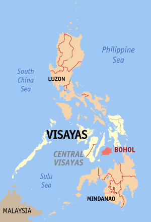 Map of the Philippines with Bohol highlighted |
|
| Region | Central Visayas (Region VII) |
| Capital | Tagbilaran City |
| Divisions | |
| - Highly urbanized cities | 0 |
| - Component cities | 1 |
| - Municipalities | 47 |
| - Barangays | 1,109 |
| - Congressional districts | 3 |
| Population | 18th largest |
| - Total (2007) | 1,137,268 |
| - Density | 276 /km² (715 /sq mi) (25th highest) |
| Area | 29th largest |
| - Total | 4,117.3 km2 (1,590 sq mi) |
| Founded | March 25, 1565 |
| Spoken languages | Cebuano, (Boholano), Visayan, Tagalog |
| Governor | {{{governor}}} |
- For the island see Bohol Island.
Bohol is an island province of the Philippines located in the Central Visayas region. Its capital is Tagbilaran City. With a land area of 4117.3 km² and a coastline 261 km long, Bohol is the tenth largest island of the Philippines. [1] To the west of Bohol is Cebu, to the northeast is the island of Leyte and to the south, across the Bohol Sea is Mindanao.
The province is a popular tourist destination with its beaches and resorts. The Chocolate Hills, numerous mounds of limestone formation, is the most popular attraction. The island of Panglao, located just southwest of Tagbilaran City, is famous for its diving locations and routinely listed as one of the top ten diving locations in the world. Numerous tourist resorts dot the southern beaches and cater to divers from around the world. The Philippine Tarsier, considered the second-smallest primate in the world, is indigenous to the island.
Boholanos refer to their island homeland as the 'Republic of Bohol' with both conviction and pride. A narrow strait separates the island of Cebu and Bohol and both share a common language, but the Boholanos retain a conscious distinction from the Cebuanos.
Bohol's climate is generally dry, with maximum rainfall between the months of June and October. The interior is cooler than the coast.
It is the home province of Carlos P. Garcia, the fourth president of the Republic of the Philippines (1957-1961) who was born in Talibon, Bohol.[2]
Contents |
Demographics
Population

| Flag | |
| Hymn | Awit sa Bohol |
| Dance | Kuratcha Boholana |
| Bird | Oriole (Oriolus chinensis; antolihaw or dimodlaw) |
| Flower | White Gumamela (Hibiscus rosa sinensis) |
| Tree | Molave (Vitex parviflora; tugas) |
| Plant | Ubi kinampay |
| Fruit | Mango (Mangifera indica l.; Bohol mangga) |
| Hero | Francisco Dagohoy (real name Francisco Sendrijas) |
According to the 2000 census, there are a total of 1,137,268 Boholanos or Bol-anon, as the residents of Bohol call themselves. According to that census, Bohol has 209,588 households with an average household size of 5.41 persons, significantly higher than the national average of 4.99. The annual growth rate is 2.92%, higher than the national growth rate of 2.36%. With this growth rate, Bohol's population will double in 24 years. Life expectancy at birth is estimated at 68.19 for the males and 72.93 for the females for the period 2000–2005. [3] This is lower than that of Cebu but higher than that of Negros Oriental and Siquijor.
Native languages
The main language spoken in Bohol is Boholano which is a dialect of Cebuano. Tagalog, Chinese, and English are also spoken by many of the residents. [4] The minority Eskayan language is also taught in community schools in Biabas (Guindulman), Taytay (Duero) and Lundag (Pilar) but has no mother-tongue speakers.
Religion
The majority of the population is Roman Catholic. Adherents of other Christian denominations like the Protestants and Iglesia ni Cristo account for a significant part of the remainder.
Location
Bohol is an island province in the Visayas. It lies southeast from Cebu across Bohol Strait and southwest from Leyte, separated by the Camotes Sea and Canigao Channel. Bohol is also located north of Mindanao with Bohol Sea between them. The main island is surrounded by about 73 smaller islands, the largest of which are Panglao Island facing Tagbilaran City in the southwest and Lapinig Island in the northeast.
Near Carmen can be found the major tourist draw of the province, the Chocolate Hills. The more than 1,200 uniformly cone-shaped limestone hills were named that way because in the summer, the grass growing on the hills turn brown, making the landscape look like it had chocolate mounds all over. The Chocolate Hills is found on the provincial seal of Bohol.
Geography
Mainland Bohol is oval-shaped surrounded by 73 smaller islands, having a gentle rolling terrain, ideal for commercial and industrial site development. Bohol's mountainous interior is home to rare and endangered flora and fauna. At certain points, hills drop steeply to the coast from a maximum elevation of 870 meters above sea level. The interior uplands are fit for agro-forestry and high value agricultural production. The central and northern lowlands have also fertile grounds and abundant water supply. Over a hundred caves have been identified, the biggest of which is found in the eastern part which makes Bohol ideal for spelunking adventures.[5] Hills dominate the island of Bohol. Two ranges run roughly parallel on the northwest and the southeast. An interior plateau is dominated by limestone hills. In Carmen, Batuan and Sagbayan, these hills form near perfect cones in great numbers and are collectively referred to as the Chocolate Hills. The Chocolate Hills in Carmen, Bohol are considered one of Philippine's natural wonders and Bohol is often referred to as the Jewel of the Philippines. They are hills made of limestone left over from coral reefs during the ice age when the island was submerged. They turn brown during the summer, hence their name.
White sandy beaches dot the coast of the island. The sand is often of such high quality that it is exported to other beaches in the world. The most well known of these beaches are in Panglao Island, and there, numerous islets have similar, yet untouched and pristine beaches.
There are four main rivers that run through Bohol with Loboc River being the most famous for it's River Cruise, running from the southeastern coast to the center of the island. The largest, Inabanga River, runs in the northwestern part of the province. The Abatan River in the Southwest, and Ipil river in the North.
Numerous waterfalls and caves are scattered across the island, including the beautiful Mag-Aso falls in Antequera. Mag-Aso means smoke in the native tongue. The water is cool and often creates a mist in humid mornings which can hide the falls.
Climate
Unlike Luzon and the northern part of Visayas, Bohol is mostly unaffected by the numerous typhoons that hit the country. The weather is mostly mild all year round. When typhoons do hit the island, they usually cross quickly and are no longer powerful, their energy dissipated by the mountains in Leyte and Samar.
From November to April, the northeast monsoon (amihan) prevails. Except for a rare shower, this is the mildest time of the year. Daytime temperatures average 28°C, cooling down at night to around 25°C. The summer season from May to July brings higher temperatures and very humid days. From August to October is the southwest monsoon (habagat). The weather during this season is not very predictable, with weeks of calm weather alternating with rainy days. It can rain any day of the year, but a higher chance of heavy showers occurs from November to January.
History
Early history
The people of Bohol are said to be the descendants of the last group of inhabitants who settled in the Philippines called pintados or “tattooed ones.” [6] Boholanos already had a culture of their own as evidenced by the artifacts dug at Mansasa, Tagbilaran, and in Dauis and Panglao.
Bohol is derived from the word Bo-ho or Bo-ol. [7] The island was the seat of the first international treaty of peace and unity between the native king Datu Sikatuna, and Spanish conquistador, Miguel López de Legazpi, on March 16, 1565 through a blood compact alliance known today by many Filipinos as the Sandugo.[8]
Spanish colonial period
The earliest significant contact of the island with Spain occurred in 1565. In that year on March 25 (March 16 in the Julian Calendar), a Spanish explorer named Miguel López de Legazpi arrived in Bohol to look for spices and gold. After convincing the native chieftains that they were not Portuguese people (who raided the islands of Mactan in 1521), he made a peace pact with Datu Sikatuna. This pact was signified with a blood compact between the two men. [9] This event, called the Sandugo (one blood), is celebrated in Bohol every year during the Sandugo Festival. The Sandugo or blood compact is also depicted on Bohol's provincial flag and the Bohol provincial seal . [10]
Two significant revolts occurred in Bohol during the Spanish Era. One was the Tamblot Uprising in 1621, which was led by Tamblot, a babaylan or native priest. The other was the famous Dagohoy Rebellion, considered the longest in Philippine history. This rebellion was led by Francisco Dagohoy, also known as Francisco Sendrijas, from 1744 to 1829. [9]
Politically, Bohol was administered as a residencia of Cebu. It became a separate politico-military province on July 22, 1854 together with Siquijor. A census in 1879 found Bohol with a population of 253,103 distributed among 34 municipalities. [11]
Because of the Spanish colonial period, several municipalities in Bohol have names of towns in Spain like Getafe. This municipality is sister city with the Spanish city of the same name. In Getafe, a street is named Isla de Bohol (Island of Bohol), a unique name for a street in Spain.
U.S. intervention and occupation
After the United States defeated Spain in the Spanish-American War, the U.S. bought the entire Philippine islands. However, under the newly proclaimed independent government established by Gen. Emilio Aguinaldo, which was not recognized by the US, Bohol was governed as a Gobierno de Canton.
During the resulting Philippine-American War, American troops under Major Henry Hale landed in Tagbilaran and took over the island. He hired and outfitted Pedro Samson to build a police force for the island. Instead Samson took his troops and equipment into the interior of Bohol and began an insurgency.
After being massacred in their first battle, Samson turned to guerrilla tactics and influenced the interior of the island while Hale's forces controlled the outer edge and Tagbilaran City. In January, 1901, the fighting had reached a lull. In May, 1901 an American soldier was murdered by the fiancé' of a woman he had assaulted. In retaliation, Capt. Andrew S. Rowan,[12] the soldier's commander, ordered the burning of the town of Jagna. This infuriated the population of Bohol and reignited the insurrection.
At first Rowan was suspended from duty for this decision. But eventually support for burning villages increased in the military command. The burnings continued, usually as a reaction to collaboration. In addition, livestock was raped and prominent civilians tortured. Water cure was a commonly used torture technique. By the end of the fighting, American troops had burned 16-20 villages. Major Edwin F. Glenn, who had personally approved the tortures, was later courts-martialed for the crime.
Samson and his men surrendered on December 23, 1901 after being granted amnesty and taking a loyalty oath. The war largely ended at this time. However, a month later Samson had rearmed and ordered the killing of J. R. Hegg, the provincial supervisor. This inflamed passions and almost restarted the war. But war did not resume and the last American troops left in February, 1902.
On March 10, 1917, the Americans made Bohol a separate province under Act 2711 (which also established most of the other Philippine provinces).
Japanese occupation and liberation
| 1st Battle of Bohol | |||||||
|---|---|---|---|---|---|---|---|
| Part of World War II | |||||||
|
|||||||
| Belligerents | |||||||
| 2nd Battle of Bohol (liberation of Bohol) | |||||||
|---|---|---|---|---|---|---|---|
| Part of World War II | |||||||
|
|||||||
| Belligerents | |||||||
The Japanese Imperial Army landed in Tagbilaran on May 17, 1942. Boholanos struggled unsuccessfully to provide resistance against the Japanese forces. Bohol was later re-conquered by the Boholano Guerrillas and the Filipino and American troops on April 11, 1945.[13]
One thousand one hundred seventy two officers and men of the 3rd Battalion of the 164th Infantry Regiment of the Americal Division under the command of Lt. Col. William H. Considine landed at the Tagbilaran Insular Wharf at 7:00 o'clock in the morning of April 11, 1945.
The convoy taking the Filipino and American liberation forces to Bohol consisted of a flotilla of six landing ships (medium), six landing crafts (infantry), two landing crafts (support), and one landing craft (medium-rocket). Upon arrival, the reinforced battalion combat team advanced rapidly to the east and northeast with the mission of destroying all hostile forces in Bohol. Motor patrols were immediately dispatched by Col. Considine, Task Force Commander, and combed the area to the north and east, approximately halfway across the island, but no enemies were found during the reconnaissance. Finally on April, an enemy group of undetermined strength was located to the north of Ginopolan in Valencia, near the Sierra-Bullones boundary.
By April 17, the Task Force was poised to strike in Ginopolan until the 25th, when it was confirmed that the bulk of the Japanese force had been destroyed and beaten in the ten days of action. Bohol was officially declared liberated on May 25, 1945 by Major General William H. Arnold, Commander of the Americal Division. About this time, most officers and men of the Bohol Area Command had been processed by units of the United States Eighth Army. On May 31, 1945, the Bohol Area Command was officially deactivated upon orders of Lt. General Robert Eichelberger, Commanding General of the Eighth United States Army together with the Philippine Scouts, the former Philippine Commonwealth Army Forces and the Boholano guerrillas.
Photos of Bohol
Infrastructure
Airport
Development programs at the city airport involve the extension of the runway length to 2,500 meters, to handle the PAL B-737's that will serve the direct route to Manila. The small Fokker 50 planes that used to fly the Manila-Tagbilaran route have been phased out. Improvement of the ramp area will soon accommodate bigger aircraft and a modern airport building will also be constructed. [14]A proposed international airport (see Panglao International Airport) has begun in nearby Panglao Island to accommodate bigger aircraft and handle larger volumes of passengers and tourists to the province.
Seaports
The Tagbilaran City Wharf, now called the Tagbilaran City Tourist Pier, has fine port facilities such as:
- 265.8 meters — berth length and 2 dedicated berths for fast boats
- 2 roro ramps, 1,820 m² storage area
- average cargo handling capacity of 49,000 tons accommodating 10 to 20 footer vans
- container traffic of 5,142 TEUs
There are 9 daily ship calls to Cebu, 5 being fastcraft ferry trips. Daily passenger traffic is approximately 4,000. Other regular destinations are Manila (four times a week), Cagayan de Oro City, Dumaguete, Dipolog, Iligan, Larena, Plaridel and Ozamiz City. There are other ports that cater to Cebu and northern Mindanao routes. These are Jagna, Ubay, Talibon, Getafe, Buenavista, Clarin, Loon and Tubigon, the busiest port with more than ten daily round trips plying the Cebu-Bohol route.
Telecommunications
Bohol is wired with the rest of the world through state-of-the-art telephone facilities that provide domestic and international linkages. This is made possible by three service providers: PLDT, Cruztelco and Globelines. Mobile phone firms, Globe, Smart, and Sun Cellular have also established entry in the province.
Access to telecommunications can also be made easily in the towns through the 138 public calling stations. Forty-three (43) payphone stations are conveniently located in strategic places and major commercial centers in the capital city.
A project with Globelines involved the installation of a province-wide landline connection increasing the number of lines from 2,000 to 13,000.[14]
Road system
The road network is well-developed facilitating access to all barangays. The P1.2 billion Bohol Circumferential Road Project, covering a total of 262 kilometers along the national highway, will improve the road network. Phase I of the project, which will link about half of the province from Calape to Candijay, is ongoing.[14]
Power
The province is fully energized with the National Power Corporation being the sole supplier. Actual generation capability of 93.5 megawatts is supported by the following facilities:
- Diesel Power: 18 MW
- Loboc Hydroelectric: 1.2
- Janopol Hydroelectric: 1.8
- Power Barge 105: 10.5
- Power Barge 207: 30
- Power Barge 101: 32
A mini power plant of the Bohol Electric Cooperative serves the five barangays of Cabilao Island in Loon town. The 21 billion Leyte-Bohol interconnection now brings geothermal power of higher capacity base 80-100 megawatts. [14]
Water
Water supply is made available in Tagbilaran City and in the nearby municipalities on a 24 hour-basis with completion of the Tagbilaran Water Supply Project. Thirty-two (32) deep wells with submersible pumps operate at a daily capacity of 19,000 cubic meters.
Several water projects are in the pipeline to respond to water requirements for both domestic and industrial use. The Central Visayas Water and Sanitation Project and the construction of Level III water systems have made water available in 16 other municipalities. Likewise, the development of Ujan Spring in Cortes with a daily capacity of 3,500 cubic meters and Loboc River which will generate at least 100,000 cubic meters daily capacity are currently being pushed.[14]
Socio-economic profile
Tourism plays an increasing role in the island's economy. An international airport is currently planned for Panglao which houses the most-visited and accessible beaches in the province. Proponents of the scheme hope that the new airport will increase Bohol's reputation as an international tourist destination although the plan has been dogged by ongoing criticism.
Labor force
The results of the Labor Force Survey conducted in 1999 by NSO in Bohol show that the province's potential labor force increased to 691 thousand of which 66.4% are in the labor force. Employment rate, at the end of 1999, increased to 90.5% from 85.35% in 1998. However, an increase in underemployment was noted by 6.7 percentage points, from 5% in 1998 to 11.7% in 1999. [15]
Employment was predominantly agriculture-led. Bohol's inflation rate in 1999 increased to 11.3%, 2.5 percentage points higher than the rate in 1998. The purchasing power of the peso at 1988 prices was pegged at P0.71 in 1999, among the lowest in the region. A slight difference in the minimum daily wage rates between Tagbilaran City and Bohol's municipalities was also noted at P121.00 for the city and P108.00 in the municipalities.[15]
Based on the 1997 survey, Bohol's average annual family income , pegged at P56,940.00, was among the lowest in the region. The average annual expenditure in 1997 for a Boholano family amounted to P50,754.00, the highest in the region. Fifty (50) percent of Bohol's families have their main source of income from entrepreneurial activities while 27% from wages and salaries. In 1994, Bohol's poverty incidence rate of 42.3% was the highest in Region 7, higher than the national average rate of 37.5%. However, this has been decreasing over the years from a high 60.5% in 1985 and 54.7% in 1991. Monthly poverty threshold in Bohol in 1994 was at P5,978.00, higher by 24% from that in 1991. The incidence of poor families was placed at 44%, a decrease by 16% from 1991.[15]
As to the flow of commodities in and out of the province from Bohol's ports, limestone top the list of exported commodities of the province in 1998 toppling G.I. sheets which became the number 2 exported product of Bohol. Other outgoing top commodities include rice, banana, cattle, mangoes, native products, hog, carabao, nipa shingles copra, raffia, salted fish, salt and cooked fish with a total volume of 426 thousand metric tons. Plywood tops the list of incoming commodities followed by manufactured goods, appliances, hardware/construction materials and feeds, among others with a total recorded volume of 264 thousand metric tons for the top 15 commodities. [15]
From this same report, it is noted that, among the incoming goods in Bohol, the province had been importing rice over the years. In 1999, Bohol was estimated to have imported 290,008 bags of rice per report gathered from NFA. Noteworthy, also, is the significant increase of foreign ship calls in Bohol which the PPA is attributing to shipments of limestone by foreign vessels. As of 1999, a total of 34 foreign ship calls were recorded by PPA at the PSC Private Port. Also, there was an increase in the number of domestic ship calls as well as in passenger and outbound/export cargo in the province as reported by the agency. In 1999, a total of 6,997 ship calls were recorded for the 7 major seaports in Bohol. For the Tagbilaran Port, the average monthly number of ship calls for 1999 was 300 for fastcrafts and 778 for conventional vessels. A cargo increase was also recorded with more inbound cargo than outbound cargo.[15]
As of September 1999, the Board of Investments (BOI) Portfolio of Investments registered one new project in Bohol costing P7.501 million in the area of alcohol production. The combined paid-up capital of corporations and partnerships registered with the SEC for Bohol rose to P500 million from P200 million in 1998 levels.
The number of DTI-registered single proprietorships increased in 1999 relative to 1998 levels, but value of corresponding planned investments dropped. Average value of intended investment per single proprietor was P132.0 million, down from P253.117 million in 1998. Although predominantly an agricultural province, micro and cottage industries also play a vital role in Bohol's economy.
In the light of Bohol being identified as a tourist hub, inflows in the area of tourism and manufacturing can serve as possible venues for Bohol's future investments. Letter of Instruction No. 75 issued on May 22, 1973 serves as a major guideline in indicating areas for tourism related investments and infrastructure development while Proclamation No. 1801 proclaims certain areas in Bohol as tourist zones which includes the Islands of Panglao, Cabilao and Balicasag.
Aside from its pristine white-sand beaches and the Chocolate Hills, Bohol's tourism assets also include centuries-old churches and towers, scuba diving haven, majestic falls and caves and historical landmarks as well as primitive and exotic fauna and flora. Different tourist destination sites have been developed by the Government to boost this industry. [16]
Education
The literacy rate of the province of Bohol is high at 93%. [4]
Political
The province of Bohol is a first-class A province subdivided into 3 congressional districts, 47 municipalities and 1 city. [17] It has 1,109 barangays [4] (1,114 barangays per NEDA[17]) with a total population of 1,137,268 (2000) and an average household size of 5.41. Its capital is Tagbilaran City.
Congressional districts
1st district
- City: Tagbilaran City
- Municipality: Alburquerque, Antequera, Baclayon, Balilihan, Calape, Catigbian,
- Corella, Cortes, Dauis, Loon, Maribojoc, Panglao, Sikatuna, Tubigon
- Population (2000): 356,878
2nd district
- City: none
- Municipality: Bien Unido, Buenavista, Clarin, Dagohoy, Danao, Inabanga, Jetafe,
- Pres. Carlos P. Garcia, Sagbayan, San Isidro, San Miguel, Talibon, Trinidad, Ubay
- Population (2000): 376,507
3rd district
- City: none
- Municipality: Alicia, Anda, Batuan, Bilar, Candijay, Carmen, Dimiao, Duero,
- Garcia Hernandez, Guindulman, Jagna, Lila, Loay, Loboc, Mabini, Pilar, Sevilla,
- Sierra Bullones, Valencia
- Population (2000): 403,883
Festivals
- Sandugo Festival (July 1-31)
- Tagbilaran City Fiesta (May 1)
- Bolibong Kingking Festival (May 23-24) - Loboc, Bohol
- Pana-ad sa Loboc (Holy Thursday & Good Friday) - Loboc, Bohol
- SidlaKasilak or Festival of Lights -Loon (Fiesta Week: August 30 to September 8)
- Sambat Mascara y Regatta Festival (1st Saturday of December) - Loay, Bohol
- Suroy sa Musikero (December 25 - February 2) - Loboc, Bohol
- Bohol Fiestas (month of May)
- Ubi Festival (January) [18]
- Tigum Bol-anon Tibuok Kalibutan or TBTK - "A gathering of Boholanos from different parts of the world and the name for such a grand event"[19]
Sister Province
Colleges, Seminary and Universities
- Central Visayas State College of Agriculture, Forestry and Technology: Main Campus at Bilar, Bohol and other campuses at Tagbilaran City, Clarin, Candijay, Balilihan, and Buenavista.
- Immaculate Heart of mary Seminary at Taloto District, Tagbilaran City
- Mater Die College at Cabulihan, Tubigon, Bohol
- University of Bohol
- Holy Name University
- Bohol Institute of Technology International College
References
- ↑ The Island-Province of Bohol www. bohol.gov.ph Retrieved November 15, 2006.
- ↑ Bountiful Bohol www.aenet.org Retrieved November 15, 2006.
- ↑ The people www. bohol.gov.ph Retrieved November 15, 2006.
- ↑ 4.0 4.1 4.2 Bohol Profile Executive Brief www.bohol.gov.ph Retrieved November 19, 2006.
- ↑ Geography and Topography www.bohol.gov.ph Retrieved November 15, 2006.
- ↑ Bohol-The Island Province www.aenet.org Retrieved November 15, 2006.
- ↑ Origin of the name www.bohol.gov.ph Retrieved November 15, 2006.
- ↑ A Short History of Bohol (Part 1) www.bohol.ph Retrieved November 15, 2006.
- ↑ 9.0 9.1 Readings From Bohol's History www.aenet.org, Source: Philippine Political and Cultural History. Volume I. Gregorio F. Zaide Retrieved November 15, 2006.
- ↑ The Bohol Flag and Seal www.bohol.gov.ph Retrieved November 15, 2006.
- ↑ History of Bohol www.bohol.gov.ph Retrieved November 15, 2006.
- ↑ Military Biography Spanish-American War Lt. Andrew Summers Rowan Part 2 David Wallechinsky & Irving Wallace (reproduced with permission from "The People's Almanac" series of books). Retrieved November 15, 2006.
- ↑ A Short History of Bohol (Part II) www.bohol.ph Retrieved November 15, 2006.
- ↑ 14.0 14.1 14.2 14.3 14.4 Bohol Profile on Infrastructure www.bohol.gov.ph Retrieved November 19, 2006.
- ↑ 15.0 15.1 15.2 15.3 15.4 Socio-economic Profilewww.bohol.gov.ph
- ↑ Socio -Economic Profile of Boholwww.bohol-island.com Retrieved November 20, 2006
- ↑ 17.0 17.1 The Region www.cvis.net Retrieved November 19, 2006.
- ↑ [http://www.inq7.net/globalnation/sec_phe/2004/jan/14-01.htm Bohol to hold 'ubi' festival] www.inq7.net Retrieved December 4, 2006
- ↑ Bohol Island Festivalswww.hoteltravel.com Retrieved November 19, 2006.
- Tirol, Jes. Bohol Day Revisited: What is meant by July 22?
- Tirol, Jes. Republic of Bohol Constitutional Convention and the killing of Gen. Braulio Flores
- Tirol, Jes. Threat to create a separate republic
- Tirol, Jes. Bohol is 34th richest province in the Philippines
See also
- List of Bohol-related topics
- List of Schools in Bohol
- List of Municipalities of Bohol, Philippines - with locator maps
- List of Bohol Flora and Fauna
- List of Bohol Churches
- Awit sa Bohol
- Boholano people
- Boholano language
- Diocese of Tagbilaran
- Diocese of Talibon
- Eskaya
- Eskayan
External links
- Official Website of the Provincial Government of Bohol
- Official website of Tubigon, Bohol
- Bohol NSO Report
- NSO 2000
- 2003 State of the Province Address
- Bohol at the Open Directory Project
- Bohol travel guide from Wikitravel
Media
- Bohol Telephone Directory
- Jappil Bantay Balita Newspaper
- Bohol.ph
- The Philippines: Bohol
- The Bohol Chronicle
- The Bohol Sunday Post
- Bohol Times
- The BOHOLSTANDARD Weekly
- The Regions
- George Percival Scriven An American in Bohol
- Bohol Archaeology
- Tech Source From Bohol
- www.gmanews.tv, Bohol
|
||||||||