Atkinson County, Georgia
| Atkinson County, Georgia | |
| Map | |
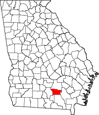 Location in the state of Georgia |
|
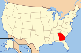 Georgia's location in the U.S. |
|
| Statistics | |
| Founded | 1917 |
|---|---|
| Seat | Pearson |
| Largest city | Pearson |
| Area - Total - Land - Water |
344 sq mi (891 km²) 388 sq mi (876 km²) 6 sq mi (16 km²), 1.76% |
| PopulationEst. - (2006) - Density |
8,047 22/sq mi (9/km²) |
| Time zone | Eastern: UTC-5/-4 |
| Congressional district | 1st |
Atkinson County is a county located in the U.S. state of Georgia, and was formed in 1917 from parts of Coffee and Clinch Counties. As of 2000, the population is 7,609. The 2007 Census Estimate placed the population at 8,223 [1]. The county seat is Pearson, Georgia[1].
Contents |
History
The county is named for William Yates Atkinson, Democratic governor of Georgia from 1894 to 1898.
Geography
According to the U.S. Census Bureau, the county has a total area of 344 square miles (891 km²), of which, 338 square miles (876 km²) of it is land and 6 square miles (16 km²) of it (1.76%) is water.
Major highways
 U.S. Highway 82
 U.S. Highway 221
 U.S. Highway 441
 Georgia State Route 64
 Georgia State Route 90
Adjacent counties
- Coffee County, Georgia - north
- Ware County, Georgia - east
- Clinch County, Georgia - southeast
- Lanier County, Georgia - south
- Berrien County, Georgia - west
Demographics
As of the census[2] of 2000, there were 7,609 people, 2,717 households, and 1,980 families residing in the county. The population density was 22 people per square mile (9/km²). There were 3,171 housing units at an average density of 9 per square mile (4/km²). The racial makeup of the county was 66.79% White, 19.61% Black or African American, 0.37% Native American, 0.12% Asian, 0.03% Pacific Islander, 12.03% from other races, and 1.06% from two or more races. 16.95% of the population were Hispanic or Latino of any race.
There were 2,717 households out of which 38.80% had children under the age of 18 living with them, 55.10% were married couples living together, 12.80% had a female householder with no husband present, and 27.10% were non-families. 23.30% of all households were made up of individuals and 9.10% had someone living alone who was 65 years of age or older. The average household size was 2.78 and the average family size was 3.27.
In the county the population was spread out with 30.30% under the age of 18, 10.90% from 18 to 24, 29.60% from 25 to 44, 19.90% from 45 to 64, and 9.30% who were 65 years of age or older. The median age was 31 years. For every 100 females there were 98.00 males. For every 100 females age 18 and over, there were 97.40 males.
The median income for a household in the county was $26,470, and the median income for a family was $32,688. Males had a median income of $24,763 versus $18,434 for females. The per capita income for the county was $12,178. About 18.10% of families and 23.00% of the population were below the poverty line, including 27.10% of those under age 18 and 31.00% of those age 65 or over.
Cities and towns
Incorporated
- Pearson
- Willacoochee
Unincorporated
- Axson
- Henderson Still
- Kirkland
- Leliaton
- Oberry
- Sandy Bottom
- Stokesville
External links
|
|||||||||||
|