Albany County, New York
| Albany County, New York | |
| Map | |
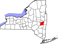
 Location in the state of New York |
|
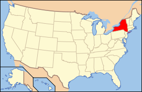
 New York's location in the U.S. |
|
| Statistics | |
| Founded | November 1, 1683 |
|---|---|
| Seat | Albany |
| Area - Total - Land - Water |
533 sq mi (1,380 km²) 523 sq mi (1,355 km²) 10 sq mi (26 km²), 1.83% |
| Population - (2000) - Density |
294,565 562/sq mi (217/km²) |
| Website: www.albanycounty.com | |
Albany County is a county located in the U.S. state of New York, and is part of the Albany-Schenectady-Troy Metropolitan Statistical Area. The name is from the title of the Duke of York and Albany, who became James II of England. As of the 2000 census, the population was 294,565. As originally established, Albany County had an indefinite amount of land, but has only 530 square miles (1,372.69 km²) as of March 3, 1888.
Contents |
History
Albany County was one of the original twelve counties created by the Province of New York on November 1, 1683.[1] At that time it included all of the present Bennington County, Vermont, all of New York state north of the counties of Dutchess and Ulster, and theoretically stretched west to the Pacific Ocean.[2]
On May 27, 1717, Albany County was adjusted to gain an indefinite amount of land from Dutchess County and other non-county lands.[3]
On October 7, 1763, King George III, as part of his Proclamation of 1763, created the new province of Quebec, implicitly setting the northern limit of New York at the parallel of 45 degrees north latitude from the Atlantic-St. Lawrence watershed westward to the St. Lawrence River, implicitly setting the northern limit of Albany County, but it was never mapped.[4]
On July 20, 1764, King George III established the boundary between New Hampshire and New York along the west bank of the Connecticut River, north of Massachusetts and south of the parallel of 45 degrees north latitude. Albany County implicitly gained present-day Vermont. Although disputes occasionally broke out later, this line became the boundary between New Hampshire and Vermont, and has remained unchanged to the present. When New York refused to recognize land titles through the New Hampshire Grants (towns created earlier by New Hampshire in present Vermont), dissatisfied colonists organized in opposition, which led to the creation of independent Vermont in 1777.[5]
On July 3, 1766, Cumberland County was partitioned from Albany County to cover all territory to the northern and eastern limits of the colony, including Windsor County, most of Windham County, and parts of Bennington and Rutland counties in present-day Vermont.[6]
On June 26, 1767, Albany County regained all of Cumberland County.[7]
On March 19, 1768, Albany County was re-partitioned, and Cumberland County restored.[8]
On March 16, 1770, Albany County was again partitioned. Gloucester County was created to include all of Orange, Caledonia and Essex counties, most of Washington County, and parts of Orleans, Lamoille, Addison and Chittenden counties in present-day Vermont.[9]
On March 12, 1772, Albany County was partitioned again, this time into the counties of Albany, Tryon (now Montgomery), and Charlotte (now Washington). This established a definite area for Albany County of 5,470 sq mi (14,167.23 km²).[10]
On March 24, 1772, Albany County was partitioned again, with an additional 50 sq mi (129.5 km²) handed over to Cumberland County.[11]
On March 9, 1774, Albany County was partitioned again, this time passing 1,090 sq mi (2,823.09 km²) to Ulster County.[12]
On April 1, 1775, Albany was again partitioned, this time giving up 60 sq mi (155.4 km²) to Charlotte County, who then exchanged this land with a like parcel in Cumberland County.[13]
On January 15, 1777, Albany County was again partitioned, this time on account of the independence of Vermont from New York, reducing Albany County by an additional 300 sq mi (777 km²).[14]
On June 26, 1781, Bennington County, Vermont attempted to annex a portion of Albany County that today includes portions of Washington and Rensselaer counties to form what they called "The West Union"[15]. The fledgling United States - under the Articles of Confederation - arbitrated this annexation, and condemned it, resulting in Vermont ceasing the annexation on 1782-02-23.[16]
On April 4, 1786, Columbia County was created from 650 square miles (1,685 km²) of Albany County land.[17]
On March 7, 1788, New York, refusing to recognize the independence of Vermont, and the attendant elimination of Cumberland County, attempted to adjust the line that separated Cumberland from Albany County in present-day Vermont, but to no effect.[18]
On February 7, 1791, Albany County was partitioned again, this time to form Rensselaer and Saratoga counties. Rensselaer received 660 square miles (1,700 km²), while Saratoga received 850 square miles (2,200 km²). Also the town of Cambridge was transferred to Washington County. A total of 1,680 sq mi (4,351.18 km²) changed hands.[19]
On June 1, 1795, Albany County was once again partitioned, this time losing 460 sq mi (1,191.39 km² ) to Schoharie County.[20]
On April 5, 1798, another partition took place, with 90 sq mi (233.1 km²) passing to Ulster County.[21]
On March 25, 1800, once again Albany County was partitioned, with 360 sq mi (932.4 km² being used to create Greene County.[22]
On April 3, 1801, all New York counties were redefined, with Albany County gaining 10 sq mi (25.9 km² ).[23]
On March 3, 1808, Albany County turned Havre Island over to Saratoga County, with no resultant loss in land.[24]
On March 7, 1809, Schenectady County was created from 230 sq mi (595.7 km²) of Albany County land.[25] The result was the production of Albany County as it exists today.[2]
Geography
Albany County is in the east central part of New York State, extending southward and westward from the point where the Mohawk River joins the Hudson. Its eastern boundary is the Hudson River; a portion of its northern boundary is the Mohawk River.
According to the U.S. Census Bureau, the county has a total area of 533 square miles (1,381 km²), of which, 523 square miles (1,356 km²) of it is land and 10 square miles (25 km²) of it (1.83%) is water.
The terrain of the county ranges from flat near the Hudson and Mohawk Rivers to high and hilly to the southwest, where the Catskills begin. The highest point is one of several summits near Henry Hill at approximately 2,160 feet (658 m) above sea level; the lowest point is slightly above sea level along the Hudson.
Adjacent counties
- Schenectady County, New York - north
- Saratoga County, New York - northeast
- Rensselaer County, New York - east
- Columbia County, New York - southeast
- Greene County, New York - south
- Schoharie County, New York - west
Demographics
| Historical populations | |||
|---|---|---|---|
| Census | Pop. | %± | |
| 1790 | 75,980 |
|
|
| 1800 | 34,043 | −55.2% | |
| 1810 | 34,661 | 1.8% | |
| 1820 | 38,116 | 10% | |
| 1830 | 53,520 | 40.4% | |
| 1840 | 68,593 | 28.2% | |
| 1850 | 93,279 | 36% | |
| 1860 | 113,917 | 22.1% | |
| 1870 | 133,052 | 16.8% | |
| 1880 | 154,890 | 16.4% | |
| 1890 | 164,555 | 6.2% | |
| 1900 | 165,571 | 0.6% | |
| 1910 | 173,666 | 4.9% | |
| 1920 | 186,106 | 7.2% | |
| 1930 | 211,953 | 13.9% | |
| 1940 | 221,315 | 4.4% | |
| 1950 | 239,386 | 8.2% | |
| 1960 | 272,926 | 14% | |
| 1970 | 286,742 | 5.1% | |
| 1980 | 285,909 | −0.3% | |
| 1990 | 292,594 | 2.3% | |
| 2000 | 294,565 | 0.7% | |
| Est. 2007[26] | 299,307 | 1.6% | |
| Source[27] | |||
As of the census[28] of 2000, there were 294,565 people, 120,512 households, and 70,981 families residing in the county. The population density was 563 people per square mile (217/km²). There were 129,972 housing units at an average density of 248 per square mile (96/km²). The racial makeup of the county was 83.19% White, 11.08% Black or African American, 0.21% Native American, 2.75% Asian, 0.03% Pacific Islander, 1.05% from other races, and 1.70% from two or more races. 3.08% of the population were Hispanic or Latino of any race. 19.2% were of Irish, 16.0% Italian, 11.0% German, 6.1% English and 5.1% Polish ancestry according to Census 2000 [1] . 90.4% spoke English, 2.7% Spanish and 1.0% Italian as their first language.
There were 120,512 households out of which 27.9% had children under the age of 18 living with them, 43.2% were married couples living together, 12.2% had a female householder with no husband present, and 41.1% were non-families. 33.0% of all households were made up of individuals and 11.3% had someone living alone who was 65 years of age or older. The average household size was 2.32 and the average family size was 2.99.
In the county the population was spread out with 22.6% under the age of 18, 11.3% from 18 to 24, 28.8% from 25 to 44, 22.8% from 45 to 64, and 14.5% who were 65 years of age or older. The median age was 37 years. For every 100 females there were 91.7 males. For every 100 females age 18 and over, there were 87.8 males.
The median income for a household in the county was $42,935, and the median income for a family was $56,724. Males had a median income of $39,838 versus $30,127 for females. The per capita income for the county was $23,345. About 7.2% of families and 10.6% of the population were below the poverty line, including 12.9% of those under age 18 and 7.3% of those age 65 or over.
Government and politics
Albany County was governed by a board of supervisors until 1976, when a new county charter went into effect with provisions for a county executive and a 39-seat county legislature.[29] Albany County is governed by a County Executive and a 39-member County Legislature. The current County Executive is Michael G. Breslin (D) and the Chair of the Legislature is Charles Houghtailing (D). Other county elected officials include County Sheriff James Campbell, County District Attorney David Soares, and County Comptroller Michael Conners.
| Name | Party | Term |
|---|---|---|
| James J. Coyne, Jr. | Democrat | January 1, 1976 – December 31, 1991 |
| Michael J. Hoblock | Republican | January 1, 1992 – December 31, 1994 |
| Michael G. Breslin | Democrat | January 1, 1995 – |
Educational institutions
- Albany College of Pharmacy
- Albany Law School
- Albany Medical College
- Bryant and Stratton College
- Excelsior College
- The College of Saint Rose
- Sage College of Albany
- Sage Graduate School
- Siena College
- State University of New York at Albany
Cities, Towns, Villages, and Hamlets
- City of Albany
- Town of Berne
- Town of Bethlehem, containing
- Hamlet of Bethlehem Center
- Hamlet of Delmar
- Hamlet of Elsmere
- Hamlet of Glenmont
- Hamlet of Normansville
- Hamlet of Selkirk
- Hamlet of Slingerlands
- Town of Coeymans, containing
- Village of Ravena
- City of Cohoes
- Town of Colonie, containing
- Hamlet of Boght Corners
- Village of Colonie
- Hamlet of Crescent Station
- Hamlet of Dunsbach Ferry
- Hamlet of Latham
- Hamlet of Loudonville
- Village of Menands
- Hamlet of Verdoy
- Town and Village of Green Island
- Town of Guilderland, containing
- Village of Altamont
- Hamlet of Guilderland Center
- Hamlet of Klarsfeld
- Hamlet of Westmere
- Town of Knox
- Town of New Scotland, containing
- Hamlet of Clarksville
- Hamlet of New Salem
- Village of Voorheesville
- Town of Rensselaerville
- Hamlet of Medusa
- Hamlet of Potter Hollow
- Hamlet of Preston
- City of Watervliet
- Town of Westerlo
| North: Mohawk River Schenectady and Saratoga Counties |
||
| West: Schoharie County | Albany County | East: Hudson River Rensselaer County |
| South: Greene County |
See also
- Albany County Sheriff's Department
Sources
- ↑ (N.Y. Col. Laws, ch 4/1:122)
- ↑ 2.0 2.1 Thorne, Kathryn Ford, Compiler & Long, John H., Editor: New York Atlas of Historical County Boundaries; The Newbury Library; 1993.
- ↑ (N.Y. Col. Laws, ch 333/1:915).
- ↑ (Cappon, Petchenik, and Long, 1, 77, 90; Shortt and Doughty, 119—120).
- ↑ (Slade, 13—19; Van Zandt, 63).
- ↑ (N.Y. Col. Laws, ch. 1297/4:904).
- ↑ (N.Y. Col. Laws, ch. 1297/4:903).
- ↑ (N.Y. Col. Laws, ch. 1559/5:400).
- ↑ (N.Y. Col. Laws, ch. 1559/5:401).
- ↑ (N.Y. Col. Laws, ch. 1534/5:321).
- ↑ (N.Y. Col. Laws, ch. 1559/5:402).
- ↑ (N.Y. Col. Laws, ch. 1665/5:662).
- ↑ (N.Y. Col. Laws, ch. 1719/5:779).
- ↑ (Slade, 70-73; Van Zandt, 64; C. Williamson, 82-84, map facing 95, 100-102, 112-113).
- ↑ (Vt. State papers, 13:45-46).
- ↑ (Vt. State papers, vol 3, pt. 2; pp. 67-68).
- ↑ (N.Y. Laws 1786, 9th sess., ch. 28/p. 49).
- ↑ (N.Y. Laws 1788, 11th sess., ch. 63/pp. 746-747).
- ↑ (N.Y. Laws 1791, 14th sess., ch. 4/p. 201).
- ↑ (N.Y. Laws 1795, 18th sess., ch. 42/p. 588).
- ↑ (N.Y. Laws 1798,21st sess., ch. 93/p. 273).
- ↑ (N.Y. Laws 1800, 23rd sess., ch. 59/p. 503).
- ↑ (N.Y. Laws 1801,24th sess., ch. 123/p. 290).
- ↑ (N.Y. Laws 1888, 111th sess., ch. 42/p. 85).
- ↑ (N.Y. Laws 1808, 32nd sess., ch. 65, sec. 1/p. 458).
- ↑ Population Estimates as of July 1, 2007 by U.S. Census Bureau
- ↑ New York State Department of Economic Development
- ↑ "American FactFinder". United States Census Bureau. Retrieved on 2008-01-31.
- ↑ "3 MORE COUNTIES ADOPT CHARTERS", The New York Times (New York, New York): 59, 1973-11-25
External links
- Albany County official website
- Albany County at the Open Directory Project
- Summary early history of Albany County, NY
- Early history of Albany County towns
|
|||||||||||||||||||
|
|||||||||||||||||||||||
|
