Abbeville County, South Carolina
| Abbeville County, South Carolina | |
| Map | |
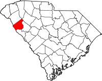
 Location in the state of South Carolina |
|
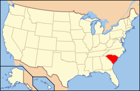
 South Carolina's location in the U.S. |
|
| Statistics | |
| Founded | 1785 |
|---|---|
| Seat | Abbeville |
| Area - Total - Land - Water |
511 sq mi (1,323 km²) 508 sq mi (1,316 km²) 3 sq mi (8 km²), 0.59% |
| Population - (2000) - Density |
26,167 52/sq mi (20/km²) |
| Website: www.abbevillecountysc.com | |
Abbeville County is a county located in the U.S. state of South Carolina. In 2000, its population was 26,167; in 2005, the U.S. Census Bureau estimated its population to have reached 26,133[1] Its county seat is Abbeville.[2] It is the first county in the United States alphabetically.
Contents |
History
Both Abbeville County and the county seat, Abbeville, SC, get their name from the town of Abbeville, France[3]. The county was originally part of Ninety-Six District, South Carolina, but was designated Abbeville County in 1785, with parts of the county later going to the creation of the counties of Greenwood and McCormick[3]. Abbeville County was settled by mostly Scotch Irish and French-Huguenot farmers in the mid-eighteenth century[3].
- There was a historic treaty with the Cherokee Indians that was signed in Dewitt's Corner, which is now known as Due West[3].
- Abbeville County was a hotbed of secession before the Civil War and was also where the last Confederate council of war was held[3]
Law/Government
Mr. Ray Gunnells is the chairman of the Abbeville County Council, who also represents District 1[4]. The other members and their districts are as following:
- John Calhoun- District 2[4]
- Claude Thomas- District 3[4]
- William Norris- District 4[4]
- Mike Davis- District 5[4]
- Jeff Simpson- District 6[4]
- Bryan McClain- District 7[4]
Geography
The county seat of Abbeville County is Abbeville, SC. According to the U.S. Census Bureau, the county has a total area of 511 square miles (1,324 km²), of which, 508 square miles (1,316 km²) of it is land and 3 square miles (8 km²) of it (0.59%) is water.
Adjacent Counties
- Greenville County, South Carolina - north
- Anderson County, South Carolina - north
- Laurens County, South Carolina - northeast
- Greenwood County, South Carolina - east
- McCormick County, South Carolina - southeast
- Elbert County, Georgia - west
Major Highways
 SC 20
SC 20 SC 28
SC 28 SC 72
SC 72 US 178
 SC 81
SC 81 SC 184
 SC 185
 SC 284
Demographics
As of the census[5] of 2000, there were 26,167 people, 10,131 households, and 7,284 families residing in the county. The population density was 52 people per square mile (20/km²). There were 11,656 housing units at an average density of 23 per square mile (9/km²). The racial makeup of the county was 68.33% White, 30.29% Black or African American, 0.10% Native American, 0.23% Asian, 0.03% Pacific Islander, 0.31% from other races, and 0.71% from two or more races. 0.83% of the population were Hispanic or Latino of any race.
There were 10,131 households out of which 31.70% had children under the age of 18 living with them, 52.20% were married couples living together, 15.30% had a female householder with no husband present, and 28.10% were non-families. 25.30% of all households were made up of individuals and 11.30% had someone living alone who was 65 years of age or older. The average household size was 2.51 and the average family size was 3.00.
In the county, the population was spread out with 25.30% under the age of 18, 9.50% from 18 to 24, 26.70% from 25 to 44, 23.80% from 45 to 64, and 14.70% who were 65 years of age or older. The median age was 37 years. For every 100 females there were 92.10 males. For every 100 females age 18 and over, there were 88.00 males.
The median income for a household in the county was $32,635, and the median income for a family was $38,847. Males had a median income of $30,452 versus $21,045 for females. The per capita income for the county was $15,370. About 10.10% of families and 13.70% of the population were below the poverty line, including 17.20% of those under age 18 and 16.90% of those age 65 or over.
Cities and towns
- Abbeville
- Antreville (Unincorporated)
- Calhoun Falls
- Donalds
- Due West
- Lake Secession (Unincorporated)
- Lowndesville
- Ware Shoals (Abbeville/Greenwood/Laurens Counties)
Education

.
Unified School Districts
All of Abbeville County schools fall into one district where the district superintendent is Dr. Ivan Randolph[6]. The following schools are within the district:
- Abbeville County Adult Education[6]
- Abbeville High School(9-12)[6]
- Abbeville County Career Center(9-12)[6]
- Calhoun Falls High School(7-12)[6]
- Cherokee Trail Elementary(K-7)[6]
- Diamond Hill Elementary(K-7)[6]
- Dixie High School(8-12)[6]
- John C. Calhoun Elementary(K-6)[6]
- Long Cane Elementary(K-5)[6]
- Westwood Elementary(K-5)[6]
- Wright Middle School(6-8)[6]
Colleges and Universities
- Erskine College, a four-year Christian liberal arts college, with 575 undergraduates, is located in Due West, South Carolina
- Piedmont Technical College, in Abbeville, SC
Notable residents

- John C. Calhoun, (1782-1850), born in the Abbeville District, United States Congressman and United States Senator from South Carolina, Secretary of War, Secretary of State, and Vice President of the United States [7]
- Langdon Cheves, (1776-1857), born in Abbeville County at Rocky River, banker and United States Congressman from South Carolina[7]
- Francis Alanson Cunningham, (1804-1864), born in the Abbeville District, physician and United States Congressman from Ohio [7]
- Joshua Hill, (1812-1891), born in the Abbeville District, United States Senator from Georgia [7]
- Abner Smith Lipscomb, (1816-1890), born in the Abbeville District, member of the Alabama Legislature and Supreme Court Justice of both Alabama and Texas. [7]
- James L. Petigru, (1789-1863), born in the Abbeville District, was the attorney general of South Carolina and a member of the South Carolina House of Representatives. He was the leader of the anti-nullificationalists in the state house. [7]
See also
- Russell Lake
References
- ↑ ""Census Population Estimates"".
- ↑ "Find a County". National Association of Counties. Retrieved on 2008-01-31.
- ↑ 3.0 3.1 3.2 3.3 3.4 Mary Morgan (2007-03-19). ""Abbeville County"". Retrieved on 2007-10-15.
- ↑ 4.0 4.1 4.2 4.3 4.4 4.5 4.6 ""County Council"". Retrieved on 2007-10-15.
- ↑ "American FactFinder". United States Census Bureau. Retrieved on 2008-01-31.
- ↑ 6.00 6.01 6.02 6.03 6.04 6.05 6.06 6.07 6.08 6.09 6.10 6.11 ""Abbeville County School District Listing"". Retrieved on 2007-10-15.
- ↑ 7.0 7.1 7.2 7.3 7.4 7.5 Who Was Who in America, Historical Volume, 1607-1896. Chicago: Marquis Who's Who. 1963.
External links
- Abbeville County's Official Website
- Abbeville County Development Board
- Greater Abbeville Chamber of Commerce
|
||||||||||||||||||||
|
