Image:Upmap.png
From Wikipedia, the free encyclopedia
No higher resolution available.
Upmap.png (500 × 389 pixels, file size: 158 KB, MIME type: image/png)
| | This is a file from the Wikimedia Commons. The description on its description page there is shown below.
|
 |
This map image should be recreated using vector graphics as an SVG file. This has several advantages; see Commons:Media for cleanup for more information. If an SVG form of this image is already available, please upload it. After uploading an SVG, replace this template with template {{Vector version available|new image name.svg}} in this image. |
|
العربية | Български | Català | Česky | Dansk | Deutsch | English | Esperanto | Español | Français | 한국어 | Italiano | Magyar | Lietuvių | Nederlands | 日本語 | Polski | Português | Română | Русский | Suomi | Svenska | Türkçe | Українська | Tiếng Việt | मराठी | 中文(繁體) | 中文(简体) | +/- |
|
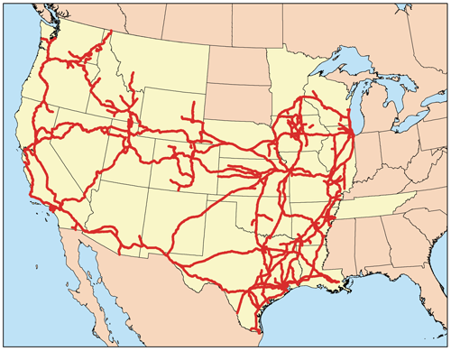
This is a map of the Union Pacific Railroad Network I made using DOT data.
[edit] Licensing
|
File history
Click on a date/time to view the file as it appeared at that time.
| Date/Time | Dimensions | User | Comment | |
|---|---|---|---|---|
| current | 13:46, 11 July 2007 | 500×389 (158 KB) | Kmusser | (corrected shading for Dakotas) |
| 17:50, 10 August 2006 | 300×233 (24 KB) | Kmusser | (This is a map of the Union Pacific Railroad Network I made using DOT data. Category:Maps == Licensing == {{self|cc-by-sa-2.5}}) |
File links
The following pages on the English Wikipedia link to this file (pages on other projects are not listed):

