Transport in Egypt
From Wikipedia, the free encyclopedia
|
Life in |
|---|
| Communications |
| Cinema |
| Culture |
| Cuisine |
| Demography |
| Economy |
| Education |
| Holidays |
| Human rights |
| Languages |
| Military |
| Parliament |
| People |
| Politics |
| Religion |
| Sports |
| Transportation |
| Wildlife |
| edit box |
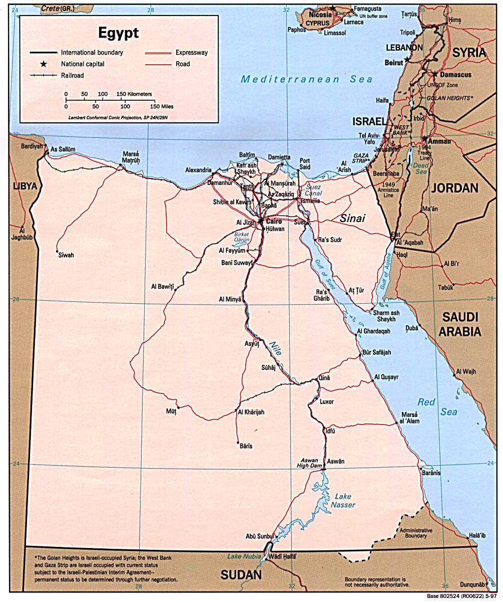
Transport facilities in Egypt are centered in Cairo and largely follow the pattern of settlement along the Nile. The main line of the nation's 4,800-kilometer (2,800-mi.) railway network runs from Alexandria to Aswan and operated by Egyptian National Railways. The badly maintained road network has expanded rapidly to over 21,000 miles, covering the Nile Valley and Nile Delta, Mediterranean and Red Sea coasts, the Sinai, and the Western oases.
Egypt Air provides reliable domestic air service to major tourist destinations from its Cairo hub, in addition to overseas routes. The Nile River system (about 1,600 km. or 1,000 mi.) and the principal canals (1,600 km.) are important locally for transport.
The Suez Canal is a major waterway of international commerce and navigation, linking the Mediterranean and Red Sea. The ministry of transportation, along with other governmental bodies are responsible for transportation in Egypt. Major ports are Alexandria, Port Said, and Damietta on the Mediterranean, and Suez and Safaga on the Red Sea.
Contents |
[edit] Regional highways
Two routes in the Trans-African Highway network originate in Cairo. Egypt is also the only country in Africa which has highway links with a neighbouring continent
[edit] Railways
The Egyptian railway system is the oldest railway network in Africa. The first line between Alexandria and Kafer Eassa was opened in 1854. Today the system is about 5,063 km long and is operated by the Egyptian National Railways. ENR carries about 500 million passengers and 12 million tonnes of freight annually. A major investment programme is planned to begin in 2007 with the aim of modernising the rail network and improving safety standards.[1]
The city of Cairo is served by the Cairo Metro, which is run by the National Authority for Tunnels.
[edit] Maps
[edit] Waterways
3,500 km (including the Nile, Lake Nasser, Alexandria-Cairo Waterway, and numerous smaller canals in the delta).
Suez Canal, 193.5 km (including approaches), used by oceangoing vessels, drawing up to about 7295.2 m of water.
[edit] Pipelines
crude oil 6666 km; petroleum products 596 km; natural gas 460 km
[edit] Ports and harbors
[edit] Mediterranean Sea
- Alexandria Port - Port Authority
- Port Said Port - Port Authority
- Damietta Port - Port Authority
- Marsa Matruh
[edit] Red Sea
- Red Sea Ports Authority
- Suez Port
- Petroleum Dock Port
- Adabieh Port
- Sokhna Port
- Hurghada Port - Al Ghardaqah
- Safaga Port - Bur Safajah
- Noueibah Port
- Al-Tour Port
- Sharm El-Sheikh Port
[edit] Nile River
[edit] Merchant marine
total: 180 ships (with a volume of 1,000 gross register tons (GRT) or over) totaling 1,348,148 GRT/2,014,483 metric tons of deadweight (DWT)
[edit] Ships by type
- bulk carrier: 25
- cargo ship: 63
- container ship: 1
- Liquified Gas Carrier: 1
- passenger ship: 57
- petroleum tanker: 14
- roll-on/roll-off ship: 16
- short-sea passenger: 3 (1999 est.)
[edit] Airports
- 90 (1999 est.)
[edit] Airports with paved runways
total: 71
over 3,047 m: 12
2,438 to 3,047 m: 36
1,524 to 2,437 m: 16
914 to 1,523 m: 3
under 914 m: 4 (1999 est.)
[edit] Airports with unpaved runways
total: 19
2,438 to 3,047 m: 2
1,524 to 2,437 m: 2
914 to 1,523 m: 6
under 914 m: 9 (1999 est.)
[edit] Heliports
- 2 (1999 est.)
[edit] See also
[edit] External links
[edit] References
This article contains material from the CIA World Factbook which, as a U.S. government publication, is in the public domain.

