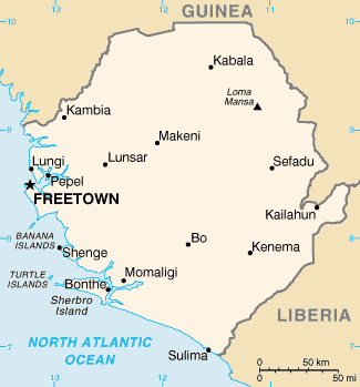
Image:Sierra-Leone-map-blank.png
From Wikipedia, the free encyclopedia

No higher resolution available.
Sierra-Leone-map-blank.png (330 × 355 pixels, file size: 7 KB, MIME type: image/png)
File history
Click on a date/time to view the file as it appeared at that time.
| Date/Time | Dimensions | User | Comment | |
|---|---|---|---|---|
| current | 13:55, 14 October 2007 | 330×355 (7 KB) | Bemoeial2 | ({{Information |Description=Blank map of Sierra Leone |Source=image:Sl-map.gif |Date=~~~~~ |Author=CAI / ~~~ |Permission=PD |other_versions= }} {{CIA-map}} Category:Maps of Sierra-Leone) |
File links
The following pages on the English Wikipedia link to this file (pages on other projects are not listed):
- Pepel
- Bo, Sierra Leone
- Sulima, Sierra Leone
- Kabala, Sierra Leone
- Kenema
- Makeni
- Yengema
- Kailahun
- Falaba
- Port Loko
- Bonthe
- Magburaka
- Marampa
- Kambia, Sierra Leone
- Njala, Sierra Leone
- Aberdeen, Sierra Leone
- Kissy, Sierra Leone
- Lungi, Sierra Leone
- Pendembu
- Yamandu
- Waterloo, Sierra Leone
- Lunsar
- Gandorhun
- Tongo, Sierra Leone
- Pujehun
- Binkolo
- Gbinti
- Mongeri
- Kamabai
- Hastings, Sierra Leone
- Goderich, Sierra Leone
- Tombodu
- Segbwema
- Rotifunk
- Leicester, Sierra Leone
- Moyamba
- Sembehun
- Foindu
- Tikonko
- Kamakwie
- Daru, Sierra Leone
- Template:Location map Sierra Leone
- Gbap, Sierra Leone


