New York State Route 31A
From Wikipedia, the free encyclopedia
 |
|||||||||||||||||
| NY Route 31A |
|||||||||||||||||
| Length: | 22.89 mi[1] (36.84 km) | ||||||||||||||||
|---|---|---|---|---|---|---|---|---|---|---|---|---|---|---|---|---|---|
| Formed: | 1930s[2] | ||||||||||||||||
| West end: | |||||||||||||||||
| East end: | |||||||||||||||||
| Counties: | Orleans, Monroe | ||||||||||||||||
|
|||||||||||||||||
New York State Route 31A is an east-west state highway located in the western part of New York. Route 31A connects the western part of Orleans County to the western part of Monroe County.
Route 31A diverges from New York State Route 31 south of the Village of Medina and parallels Route 31 eastward over a more southerly course until it reconnects to Route 31 southwest of the Village of Brockport at its eastern terminus.
Both Routes 31 and 31A roughly parallel the Erie Canal.
Contents |
[edit] Route description
[edit] Orleans County
| Communities |
|---|
NY 31A begins at a four-way intersection south of Medina. At this junction, NY 31 travels to the west and to the north (eastbound), NY 63 travels to the north and to the south, and NY 31A travels to the east as Maple Ridge Road. The road gradually travels to the east, intersecting NY 98 and becoming Lee Road along the way.
The road continues eastward, turning to the south east of Rich's Corners Road but returning to the east near Mathes Road. NY 31A retains its west-east alignment as it enters Clarendon, where it intersects NY 237. East of this intersection, NY 31A is known as Fourth Section Road.
After curving to the northeast outside of Clarendon, NY 31A resumes an east-west alignment as it crosses into Monroe County near Bennetts Corners.
[edit] Monroe County
The stay of NY 31A in Monroe County is very brief as NY 31 overtakes NY 31A on Fourth Section Road a mere 1.5 miles into Brockport at an intersection with Redman Road, marking the eastern terminus of NY 31A.
[edit] History
Most of modern NY 31 west of Rochester was originally designated as NY 3. From Middleport to Medina, NY 3 was instead routed on what is now NY 31E. An alternate route to the south of NY 3 between the two villages along modern NY 31 was designated as New York State Route 3A in the 1930 renumbering. Farther east, the segment of modern NY 31A from Clarendon to Brockport, as well as what is now NY 31 from NY 31A to NY 19, became New York State Route 3B.[3] NY 3A was renumbered to NY 31A while NY 3B became New York State Route 31D in the mid-1930s when NY 3 was replaced with a realigned NY 31 west of Rochester.[2]
NY 31A was extended east by 1952 along its current alignment to Millville, where it then continued northeast on County House Road and Taylor Hill Road before terminating at NY 31 near Knowlesville.[4] The route was later truncated to Medina on its western end by 1962[5] and extended east to Brockport by 1971, replacing NY 31D east of Clarendon.[6] NY 31 was rerouted between 1978 and 1985 to bypass Brockport on NY 31A and Redman Road, resulting in the truncation of NY 31A to its current eastern terminus.[6][7]
[edit] Major intersections
| County | Location | Mile[1] | Roads intersected | Notes |
|---|---|---|---|---|
| Orleans | Medina | 0.00 | ||
| Barre Center | 10.04 | |||
| Clarendon | 17.85 | |||
| Monroe | Brockport | 22.89 |
[edit] References
- ^ a b Traffic Data Report - NY 23 to NY 32 (PDF). NYSDOT (2007-07-16). Retrieved on 2007-09-06.
- ^ a b Automobile Legal Association (ALA) Automobile Green Book, 1938/39 edition, (W.A. Thibodeau, 1938).
- ^ Automobile Legal Association (ALA) Automobile Green Book, 1930/31 and 1931/32 editions, (Scarborough Motor Guide Co., Boston, 1930 and 1931). The 1930/31 edition shows New York state routes prior to the 1930 renumbering
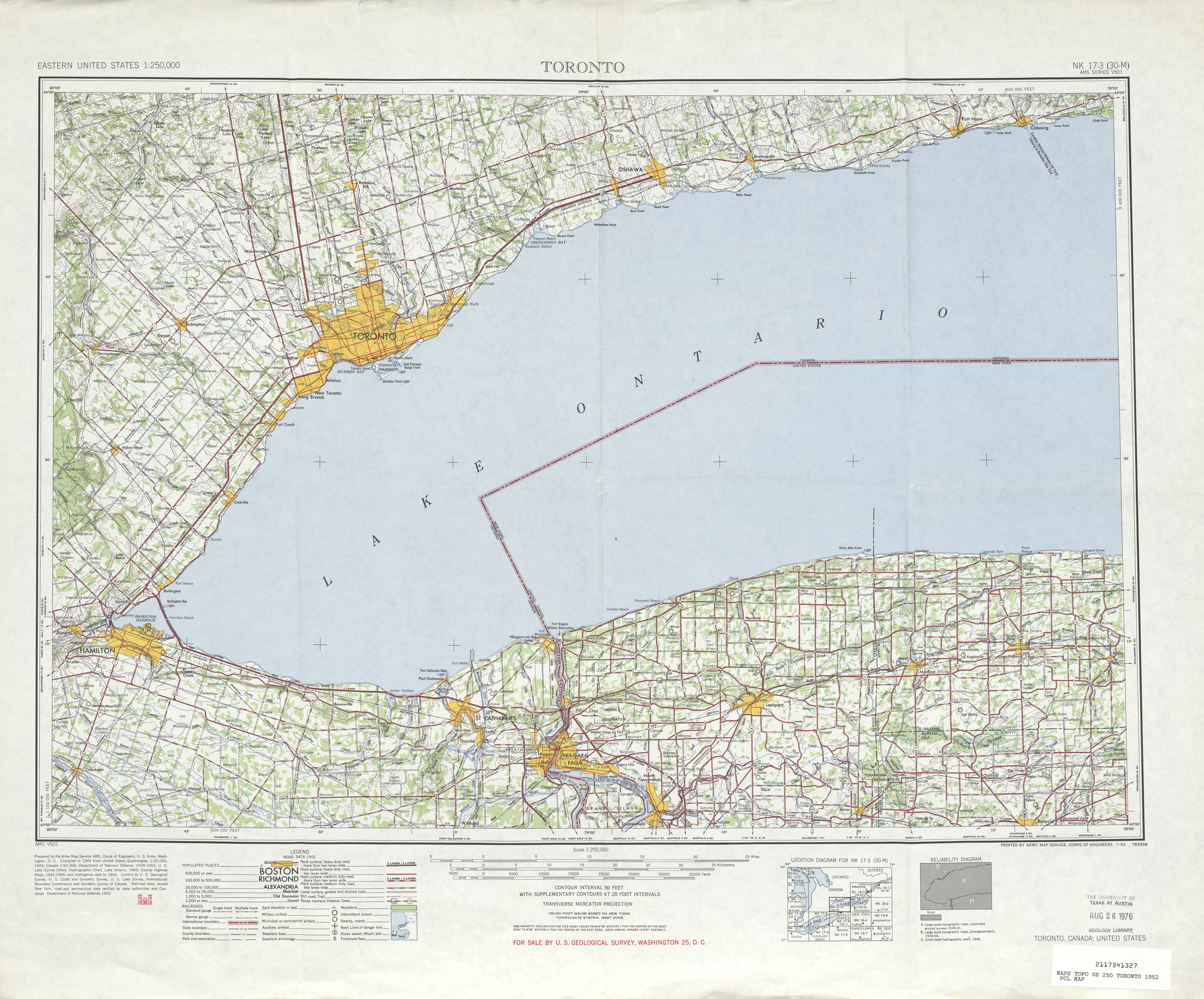
- ^ United States Geological Survey. Toronto, Canada; United States Quadrangle [map], 1:250,000, Eastern United States 1:250,000. (1952) Retrieved on 2007-11-20.
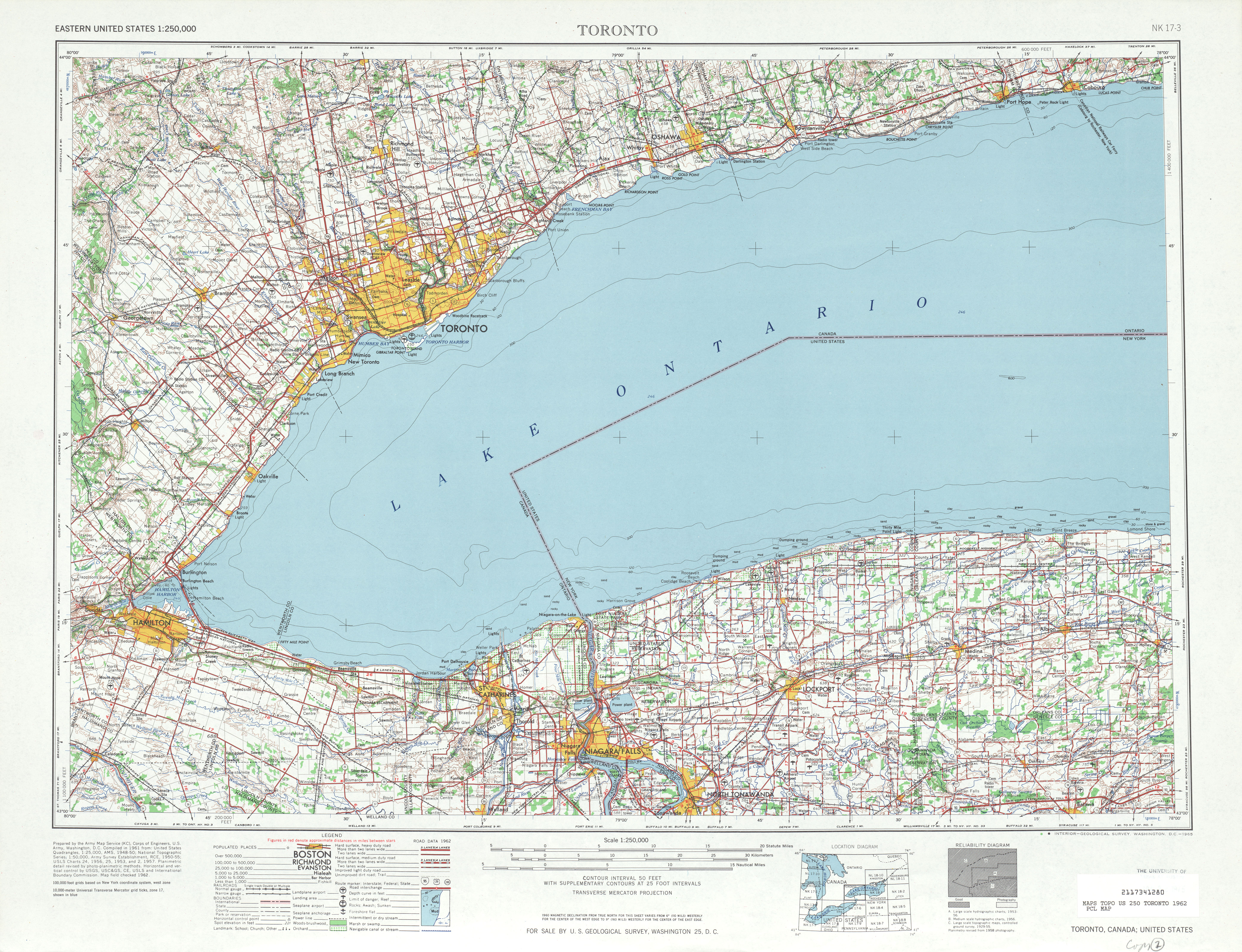
- ^ United States Geological Survey. Toronto, Canada; United States Quadrangle [map], 1:250,000, Eastern United States 1:250,000. (1962) Retrieved on 2007-11-20.
- ^ a b United States Geological Survey. Brockport, New York Quadrangle [map], 7.5 Minute Series (Topographic). (1978)
- ^ Rand McNally. New York [map]. Cartography by Rand McNally. (1985)

