Image:NewZealandPopulationDensity.png

From Wikipedia, the free encyclopedia

Wikimedia Commons logo This is a file from the Wikimedia Commons. The description on its description page there is shown below.
Commons is a freely licensed media file repository. You can help.

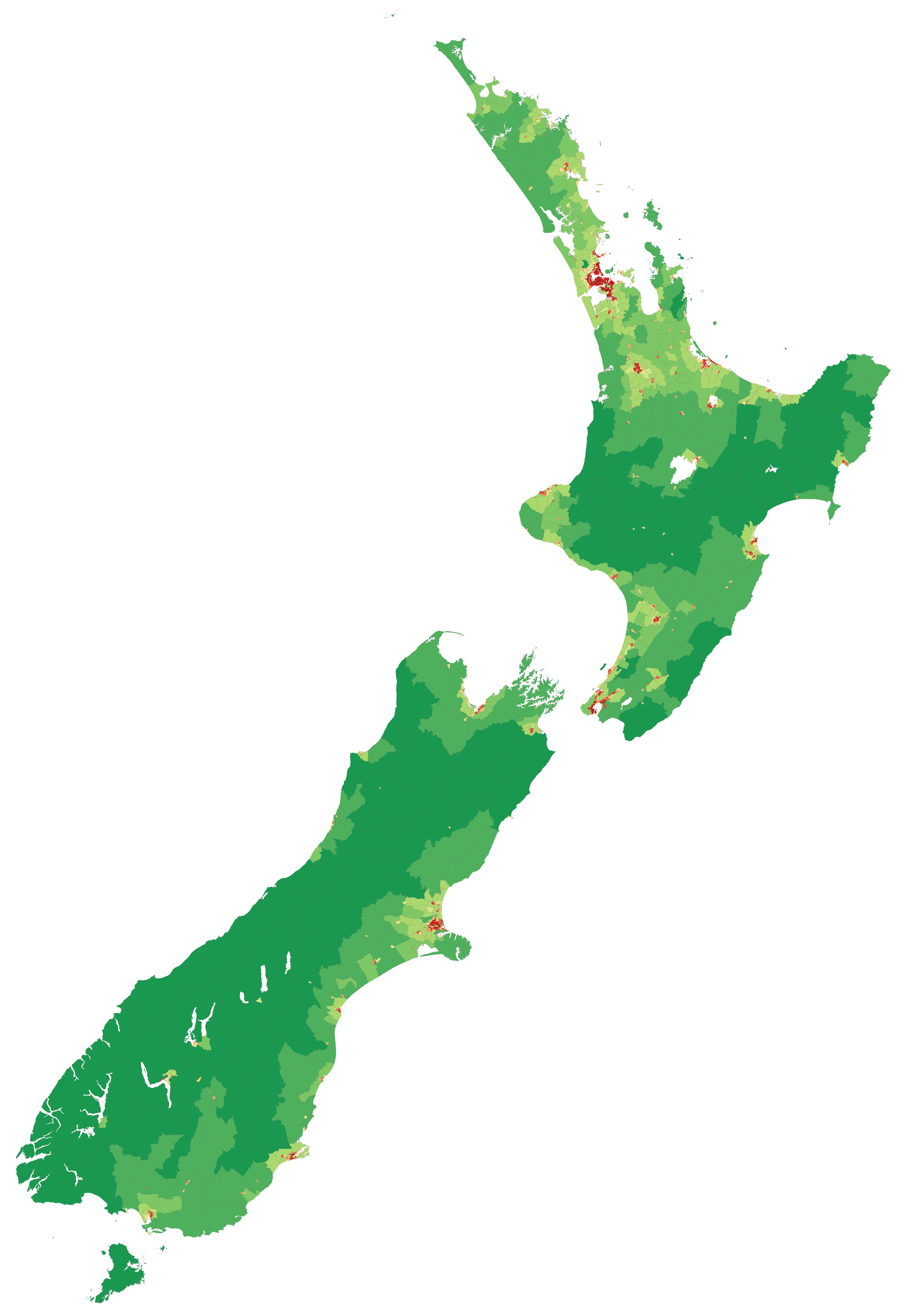
     Less than 1 person per square km      1 person per square km and above      5 people per square km and above      10 people per square km and above      50 people per square km and above      100 people per square km and above      250 people per square km and above      500 people per square km and above      750 people per square km and above      1000 people per square km and above      2000 people per square km and above      3000 people per square km and above      4000 people per square km and above

[edit] Summary

Description

Map showing population density of New Zealand (by Statistics NZ Area Unit) as of the 2006 census

Source

self-made, according to an existing colourscheme for such maps

Date

3 May 2008

Author

Vardion

Permission
(Reusing this image)

see below


[edit] Licensing

I, the copyright holder of this work, hereby publish it under the following licenses:
GNU head Permission is granted to copy, distribute and/or modify this document under the terms of the GNU Free Documentation license, Version 1.2 or any later version published by the Free Software Foundation; with no Invariant Sections, no Front-Cover Texts, and no Back-Cover Texts. A copy of the license is included in the section entitled "GNU Free Documentation license".

Aragonés | العربية | Asturianu | Български | বাংলা | ইমার ঠার/বিষ্ণুপ্রিয়া মণিপুরী | Brezhoneg | Bosanski | Català | Cebuano | Česky | Dansk | Deutsch | Ελληνικά | English | Esperanto | Español | Eesti | Euskara | فارسی | Suomi | Français | Gaeilge | Galego | עברית | Hrvatski | Magyar | Bahasa Indonesia | Ido | Íslenska | Italiano | 日本語 | ქართული | ភាសាខ្មែរ | 한국어 | Kurdî / كوردی | Latina | Lëtzebuergesch | Lietuvių | Bahasa Melayu | Nnapulitano | Nederlands | ‪Norsk (nynorsk)‬ | ‪Norsk (bokmål)‬ | Occitan | Polski | Português | Română | Русский | Slovenčina | Slovenščina | Shqip | Српски / Srpski | Svenska | తెలుగు | ไทย | Türkçe | Українська | اردو | Tiếng Việt | Volapük | Yorùbá | ‪中文(中国大陆)‬ | ‪中文(台灣)‬ | +/-

Some rights reserved
Creative Commons Attribution iconCreative Commons Share Alike icon
This file is licensed under the Creative Commons Attribution ShareAlike license versions 3.0, 2.5, 2.0, and 1.0

Български | Català | Česky | Dansk | Deutsch | Ελληνικά | English | Español | Euskara | Estremeñu | Français | עברית | Italiano | 日本語 | 한국어 | Lietuvių | Nederlands | ‪Norsk (bokmål)‬  | Occitan | Polski | Piemontèis | Português | Русский | 中文 | +/-

You may select the license of your choice.

File history

Click on a date/time to view the file as it appeared at that time.

Date/TimeDimensionsUserComment
current03:58, 3 May 20081,500×2,124 (389 KB)Vardion ({{Information |Description=Map showing population density of New Zealand (by Statistics NZ Area Unit) as of the 2006 census |Source=self-made, according to existing colourscheme for such maps |Date=3 May 2008 |Author= Vardion |Permission=)
The following pages on the English Wikipedia link to this file (pages on other projects are not listed):