Image:MSH07 aerial st helens crater from NE 05-08-07.jpg
From Wikipedia, the free encyclopedia
Size of this preview: 800 × 532 pixels
Full resolution (3,008 × 2,000 pixels, file size: 4.03 MB, MIME type: image/jpeg)
| | This is a file from the Wikimedia Commons. The description on its description page there is shown below.
|
| Description |
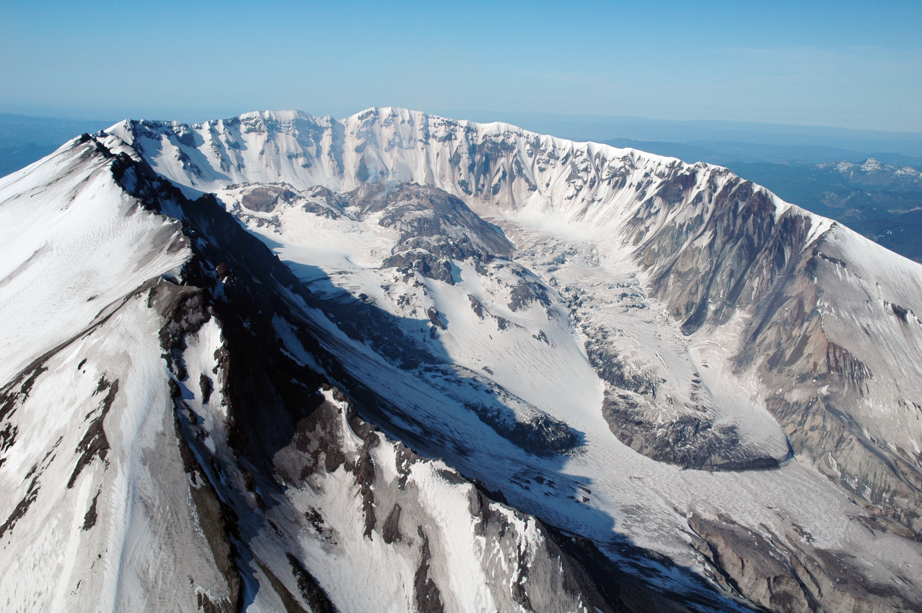
USGS photo of the Mount St. Helens crater taken 8 May 2007. Caption: Aerial view, en:Mount St. Helens crater and dome, as seen from the north. |
|---|---|
| Source | |
| Date |
2007-05-08 (image date); 2007-05-22 (original upload date) |
| Author |
Jon Major, U.S. Geological Survey |
| Permission (Reusing this image) |
PD-USGOV-INTERIOR-USGS. |
[edit] License information
| This image is in the public domain because it contains materials that originally came from the United States Geological Survey, an agency of the United States Department of Interior. For more information, see the official USGS copyright policy |
|
File history
Click on a date/time to view the file as it appeared at that time.
| Date/Time | Dimensions | User | Comment | |
|---|---|---|---|---|
| current | 00:43, 23 May 2007 | 3,008×2,000 (4.03 MB) | MarcoTolo | ({{Information |Description=[http://wrgis.wr.usgs.gov/dds/dds-29/ USGS photo] of the Mount St. Helens crater taken 8 May 2007. '''Caption''': Aerial view, en:Mount St. Helens crater and dome, as seen from the north. [Jon Major, U.S. Geological Survey) |
File links
The following pages on the English Wikipedia link to this file (pages on other projects are not listed):

