Image:Matewan West Virginia aerial view.jpg
From Wikipedia, the free encyclopedia
Size of this preview: 479 × 599 pixels
Full resolution (1,199 × 1,500 pixels, file size: 712 KB, MIME type: image/jpeg)
| | This is a file from the Wikimedia Commons. The description on its description page there is shown below.
|
| Description |
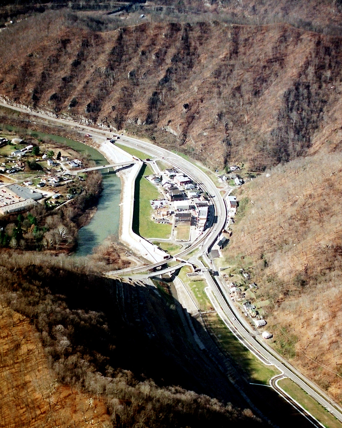
English: Matewan, West Virginia, USA, along the Tug Fork River. The town is protected by a large floodwall constructed by the U.S. Army Corps of Engineers. The river is the border between West Virginia and Kentucky; Kentucky is on the left and West Virginia is on the right.
|
|||
|---|---|---|---|---|
| Source |
U.S. Army Corps of Engineers Digital Visual Library |
|||
| Date |
not specified or unknown |
|||
| Author |
U.S. Army Corps of Engineers, photographer not specified or unknown |
|||
| Permission (Reusing this image) |
|
| Camera location | This and other geocoded Commons images: | (Info) |
|---|
File history
Click on a date/time to view the file as it appeared at that time.
| Date/Time | Dimensions | User | Comment | |
|---|---|---|---|---|
| current | 04:32, 23 March 2007 | 1,199×1,500 (712 KB) | DanMS | ({{Information | Description = {{en|Matewan, West Virginia, USA, along the Tug Fork River. The town is protected by a large floodwall constructed by the U.S. Army Corps of Engineers.}} | Source = U.S. Army Corps of Engineers Digital Visual Libra) |
File links
The following pages on the English Wikipedia link to this file (pages on other projects are not listed):

