Image:LocationBakerIsland.png
From Wikipedia, the free encyclopedia
No higher resolution available.
LocationBakerIsland.png (250 × 158 pixels, file size: 6 KB, MIME type: image/png)
| | This is a file from the Wikimedia Commons. The description on its description page there is shown below.
|
[edit] Summary
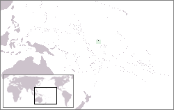
| Description |
Map of the location of the Baker Island in the Pacific Ocean |
|---|---|
| Source | |
| Date |
26.1.2005 |
| Author | |
| Permission (Reusing this image) |
GFDL, because it was in Wikipedia |
[edit] Licensing

File history
Click on a date/time to view the file as it appeared at that time.
| Date/Time | Dimensions | User | Comment | |
|---|---|---|---|---|
| current | 00:24, 20 July 2006 | 250×158 (6 KB) | Zeman | ({{Information |Description=Map of the location of the Baker Island in the Pacific Ocean |Source=lv:Attēls:Beikera vieta.png |Date=26.1.2005 |Author=Feens |Permission=GFDL, because it was in Wikipedia |other_versions= }}) |
File links
No pages on the English Wikipedia link to this file. (Pages on other projects are not counted.)

