Image:LocMap Acadia.png
From Wikipedia, the free encyclopedia
No higher resolution available.
LocMap_Acadia.png (280 × 183 pixels, file size: 31 KB, MIME type: image/png)
| | This is a file from the Wikimedia Commons. The description on its description page there is shown below.
|
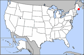
Map of Acadia
| This file has been released into the public domain by the copyright holder, its copyright has expired, or it is ineligible for copyright. This applies worldwide. | |
Note: This tag is obsolete! Nothing is public domain without a reason. Don't use this generic template - please use instead:
العربية | Български | Česky | Deutsch | English | Español | Français | हिन्दी | Italiano | 日本語 | Norsk (bokmål) | Norsk (nynorsk) | Português | Русский | Slovenčina | Slovenščina | Српски / Srpski | Polski | Türkçe | 中文 | +/- |
File history
Click on a date/time to view the file as it appeared at that time.
| Date/Time | Dimensions | User | Comment | |
|---|---|---|---|---|
| current | 16:28, 19 February 2005 | 280×183 (31 KB) | Urban | (Map of Acadia {{PublicDomain}}) |
File links
No pages on the English Wikipedia link to this file. (Pages on other projects are not counted.)

