Image:Kosovo map-en.svg
From Wikipedia, the free encyclopedia
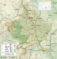
Kosovo_map-en.svg (SVG file, nominally 1777 × 1830 pixels, file size: 3.75 MB)
File history
Click on a date/time to view the file as it appeared at that time.
| Date/Time | Dimensions | User | Comment | |
|---|---|---|---|---|
| current | 09:14, 5 March 2008 | 1,777×1,830 (3.75 MB) | Sémhur | (Added borders, with keys (recognized - disputed)) |
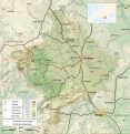
| 09:16, 4 March 2008 | 1,777×1,830 (3.74 MB) | Sémhur | (Remove Kosovo boundaries to neutralize the map, + labels more readable) | |
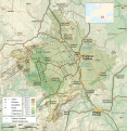
| 14:45, 3 March 2008 | 1,777×1,830 (3.74 MB) | Sémhur | (Correcting few labels) | |
| 19:15, 28 February 2008 | 1,777×1,830 (3.74 MB) | Sémhur | (minor changes) | |
| 11:37, 26 February 2008 | 1,777×1,830 (3.74 MB) | Sémhur | (== Description == {{Information |Description= {{en| Map of the Kosovo.}} {{fr| Carte du Kosovo, en anglais.}} |Source=Own work. {{clr}} Sources : * Topographic background : [http://www2.jpl.nasa.gov/srtm NASA Shuttle Radar To) |
File links
The following pages on the English Wikipedia link to this file (pages on other projects are not listed):


