From Wikipedia, the free encyclopedia

 Click here if you are having problems with this file
| WikiProject India Maps |
The Kadamba Empire 500AD
|
| Description |
Map showing the extent of the Kadamba Empire
██ Extent before being conquered from him by his family
██ Extent after being conquered from him by his family
██ Extent under the feudatory of the Kadambas
|
| Source |
International Borders: University of Texas map library[1]- India Political map 2001
Disputed Borders: University of Texas map library[2]- China-India Borders- Eastern Sector 1988 & Western Sector 1988, Kashmir Region 2004[3].
State and District boundaries: Census of India[4]- 2001 Census State Maps Survey of India Maps.
Other sources: ESRI ArcWeb Explorer, Survey of India Map Explorer, Indian Railways Map
Map specific sources: "The Kadamba Kula, A History of Ancient and Medieval Karnataka, Asian Educational Services, New Delhi, Madras, 1990 ISBN 81-206-0595-0" page 47.
|
| Date |
March 2006
|
| Author |
w:user:Planemad
|
| License |
|
I, the copyright holder of this work, hereby publish it under the following licenses:
You may select the license of your choice.
|
|
[edit] Legend
Projection: Lambert Conical Orthomorphic
[edit] Explanation of disputed boundaries
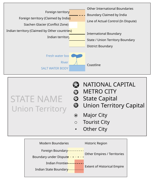
- Boundary of Indian claim : The extent upto which the Indian administration claims as rightfully theirs, but is not recognised by China and Pakistan.
- Line of Control : The defacto boundary recognised by the international community, but not by India, China and Pakistan. This boundary is a temporary solution to the ongoing conflict.
[edit] Borders of disputed regions
The extent of Indian territory depicted on this map may not be accepted by some countries as legal due to ongoing border disputes:
Borders of some minor disputed areas have been omitted for the sake of simplicity:
- Minor areas of Jammu & Kashmir, Himachal Pradesh and Uttarakhand on the Chinese frontier are claimed by China. These areas are under Indian control.
- A small area of Uttarakhand adjoining the Nepal border along the Sarda river is disputed between the two countries.
For a detailed map of all disputed regions in India, see Image:India disputed areas map.svg
[edit] Internal borders
The borders of the state of Meghalaya, Assam and Arunachal Pradesh is shown as interpreted from the North-Eastern Areas (Reorganisation) Act, 1971, but has yet to be verified.
[edit] Territorial Waters
The limit of the territorial waters of India extends to twelve nautical miles measured from the appropriate baseline. See this for more information.
[edit] SVG Support
This document is in the Scalable Vector Graphic format (SVG) and requires a supported browser (Opera 9, Firefox 2) or a SVG plugin for Internet Explorer and other browsers. SVG is an open source format, which means this map can be downloaded and modified/translated completely using a vector graphics editor like Adobe Illustrator or Inkscape (free) or a text editor such as Notepad.
[edit] Errata
If you notice a mistake on the map, please list them here. Please mention the name of the map to be corrected also.
- Uttaranchal is now Uttarakhand
- Pondicherry is now Puducherry
- The capital of the Union Territory of Daman and Diu is at Daman and not Diu.
- The Romanization/pinyin of Tibet is not Xijang, it is Xizang.
File history
Click on a date/time to view the file as it appeared at that time.
| Date/Time | Dimensions | User | Comment |
|---|
| current | 21:08, 31 March 2007 | 1,639×1,852 (438 KB) | PlaneMad | |
| 20:18, 31 March 2007 | 1,639×1,852 (435 KB) | PlaneMad | |
| 20:12, 31 March 2007 | 1,639×1,852 (435 KB) | PlaneMad | |
| 20:04, 31 March 2007 | 1,639×1,852 (436 KB) | PlaneMad | |
| 07:42, 27 March 2007 | 1,639×1,852 (379 KB) | PlaneMad | |
File links
The following pages on the English Wikipedia link to this file (pages on other projects are not listed):


