Image:IK Orte.PNG
From Wikipedia, the free encyclopedia
Size of this preview: 484 × 599 pixels
Full resolution (1,298 × 1,606 pixels, file size: 124 KB, MIME type: image/png)
| | This is a file from the Wikimedia Commons. The description on its description page there is shown below.
|
[edit] Beschreibung
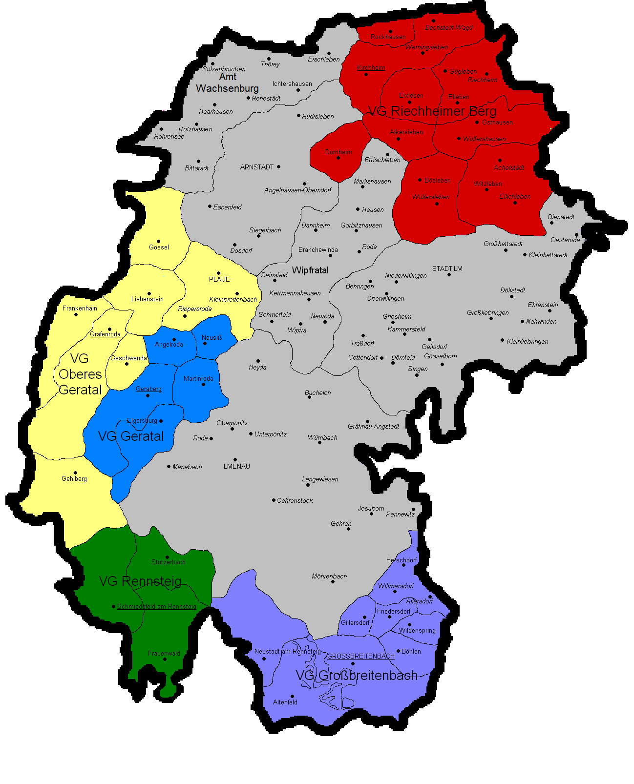
Gemeindekarte Ilm-Kreis mit Verwaltungsgemeinschaften und Ortsteilen. Quelle: selbst gezeichnet.
[edit] Licensing

File history
Click on a date/time to view the file as it appeared at that time.
| Date/Time | Dimensions | User | Comment | |
|---|---|---|---|---|
| current | 18:55, 23 April 2006 | 1,298×1,606 (124 KB) | Michael Sander | (Gemeindekarte Ilm-Kreis mit Verwaltungsgemeinschaften und ''Ortsteilen''. Quelle: selbst gezeichnet.) |
File links
The following pages on the English Wikipedia link to this file (pages on other projects are not listed):

