Image:Gr-triple-occupation.png
From Wikipedia, the free encyclopedia
Size of this preview: 588 × 600 pixels
Full resolution (899 × 917 pixels, file size: 82 KB, MIME type: image/png)
| | This is a file from the Wikimedia Commons. The description on its description page there is shown below.
|
| Description |
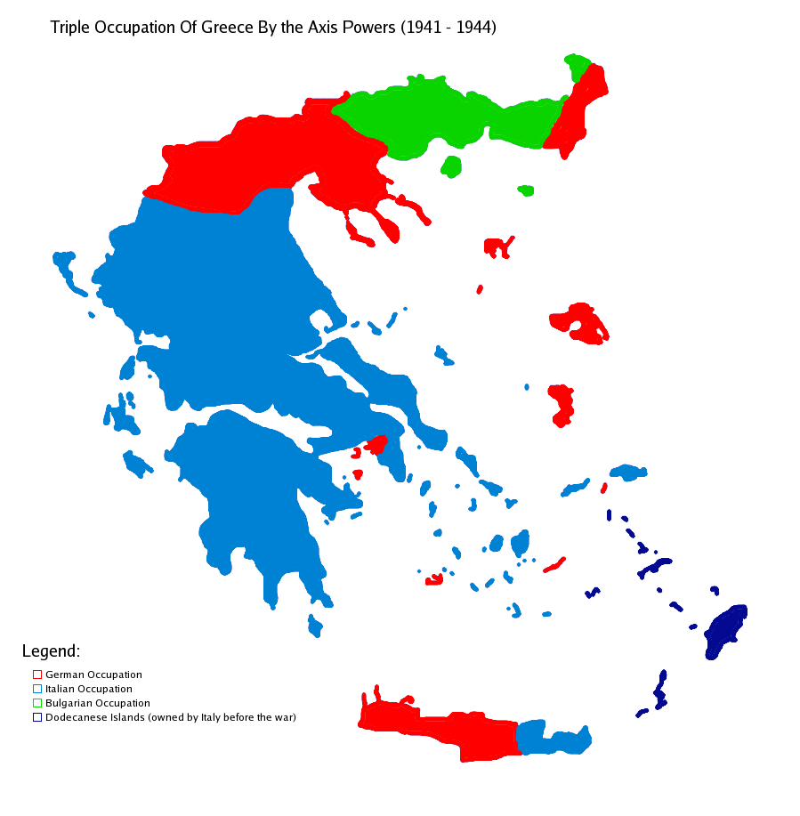
Map showning the zones of control of the three occupying powers in Greece during WW2, from 1941 to 1944. English: Map of Occupied Greece showing the German and Italian occupation zones on Crete.
Svenska: Axelmakternas ockupationszoner under andra världskriget: blått Italien, grönt Bulgarien och rött Tyskland
Türkçe: Üçlü işgâl sürecinde Yunanistan
|
||||
|---|---|---|---|---|---|
| Source |
Own work |
||||
| Date |
17/10/2006 |
||||
| Author | |||||
| Permission (Reusing this image) |
|||||
| Other versions |
|


The image was created by me using another map as a template. This image was created using the Gimp.
File history
Click on a date/time to view the file as it appeared at that time.
| Date/Time | Dimensions | User | Comment | |
|---|---|---|---|---|
| current | 15:48, 22 May 2006 | 899×917 (82 KB) | GhePeU | (slightly reworked image) |
| 16:06, 2 July 2005 | 899×917 (107 KB) | Michalis Famelis | (Map showning the zones of control of the three occupying powers in Greece during WW2, from 1941 to 1944. The image was created by me using another map as a template. This image was created using the Gimp. {{GFDL}}) |
File links
The following pages on the English Wikipedia link to this file (pages on other projects are not listed):

