Image:Fort Wayne Indiana Metro Map.PNG
From Wikipedia, the free encyclopedia
Size of this preview: 428 × 600 pixels
Full resolution (444 × 622 pixels, file size: 49 KB, MIME type: image/png)
| | This is a file from the Wikimedia Commons. The description on its description page there is shown below.
|
| Description |
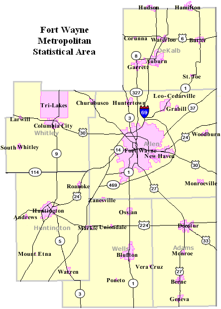
Map of Fort Wayne, Indiana Metropolitan Area |
|---|---|
| Source |
U.S. Census Bureau [1] |
| Date |
August 2007 |
| Author |
U.S. Census Bureau [2] modified by User:Ruhrfisch |
| Permission (Reusing this image) |
Census Maps are U.S. Government work and PD, my modifications are GFDL |
| Other versions | one with only three counties |
[edit] Licensing
|

and
| This image or other media is a work of a United States Census Bureau employee, taken or made during the course of an employee's official duties. As a work of the U.S. federal government, the image is in the public domain |  |
File history
Click on a date/time to view the file as it appeared at that time.
| Date/Time | Dimensions | User | Comment | |
|---|---|---|---|---|
| current | 02:07, 10 August 2007 | 444×622 (49 KB) | Ruhrfisch | (Updated map to include all six counties, all other information remains the same as previous version.) |
| 01:42, 12 August 2006 | 445×457 (31 KB) | Ruhrfisch | ({{Information |Description= Map of Fort Wayne, Indiana Metropolitan Area |Source= U.S. Census Bureau [http://factfinder.census.gov] |Date= August 11, 2006 |Author= U.S. Census Bureau [http://factfinder.census.gov] modified by User:Ruhrfisch |Permissi) |
File links
The following pages on the English Wikipedia link to this file (pages on other projects are not listed):

