Image:Desventuradas islands (Chile).jpg
From Wikipedia, the free encyclopedia
No higher resolution available.
Desventuradas_islands_(Chile).jpg (393 × 175 pixels, file size: 19 KB, MIME type: image/jpeg)
| | This is a file from the Wikimedia Commons. The description on its description page there is shown below.
|
[edit] Information
| Description |
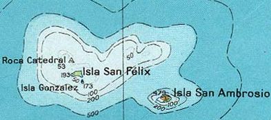
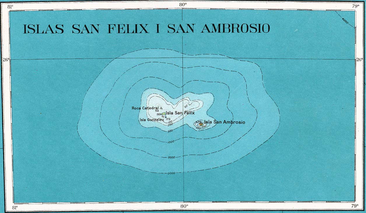
A map of the Desventuradas Islands |
|---|---|
| Source |
http://www.lib.utexas.edu/maps/americas/san_felix_1927.jpg, cropped |
| Date |
1927 |
| Author |
American Geographical Society |
| Permission (Reusing this image) |
see below |
| Other versions | Full version: Image:Map Desventuradas.jpg |
[edit] Licence information
| This work is in the public domain because it was published in the United States between 1923 and 1963 with a copyright notice, and its copyright was not renewed. It is not in the public domain in the following countries that do not apply the rule of the shorter term for US works: Canada, China (not Hong Kong, Macao or Taiwan Area), Germany, Mexico, Switzerland, and other countries with individual treaties. See this page for further explanation. |
|
File history
Click on a date/time to view the file as it appeared at that time.
| Date/Time | Dimensions | User | Comment | |
|---|---|---|---|---|
| current | 18:49, 6 October 2005 | 393×175 (19 KB) | Danielgruen | (*Source: http://www.lib.utexas.edu/maps/americas/san_felix_1927.jpg (as previously uploaded to English Wikipedia by Pascal)) |
File links
The following pages on the English Wikipedia link to this file (pages on other projects are not listed):

