Image:Capitanias.jpg
From Wikipedia, the free encyclopedia
Size of this preview: 443 × 600 pixels
Full resolution (1,500 × 2,031 pixels, file size: 679 KB, MIME type: image/jpeg)
| | This is a file from the Wikimedia Commons. The description on its description page there is shown below.
|
| Description |
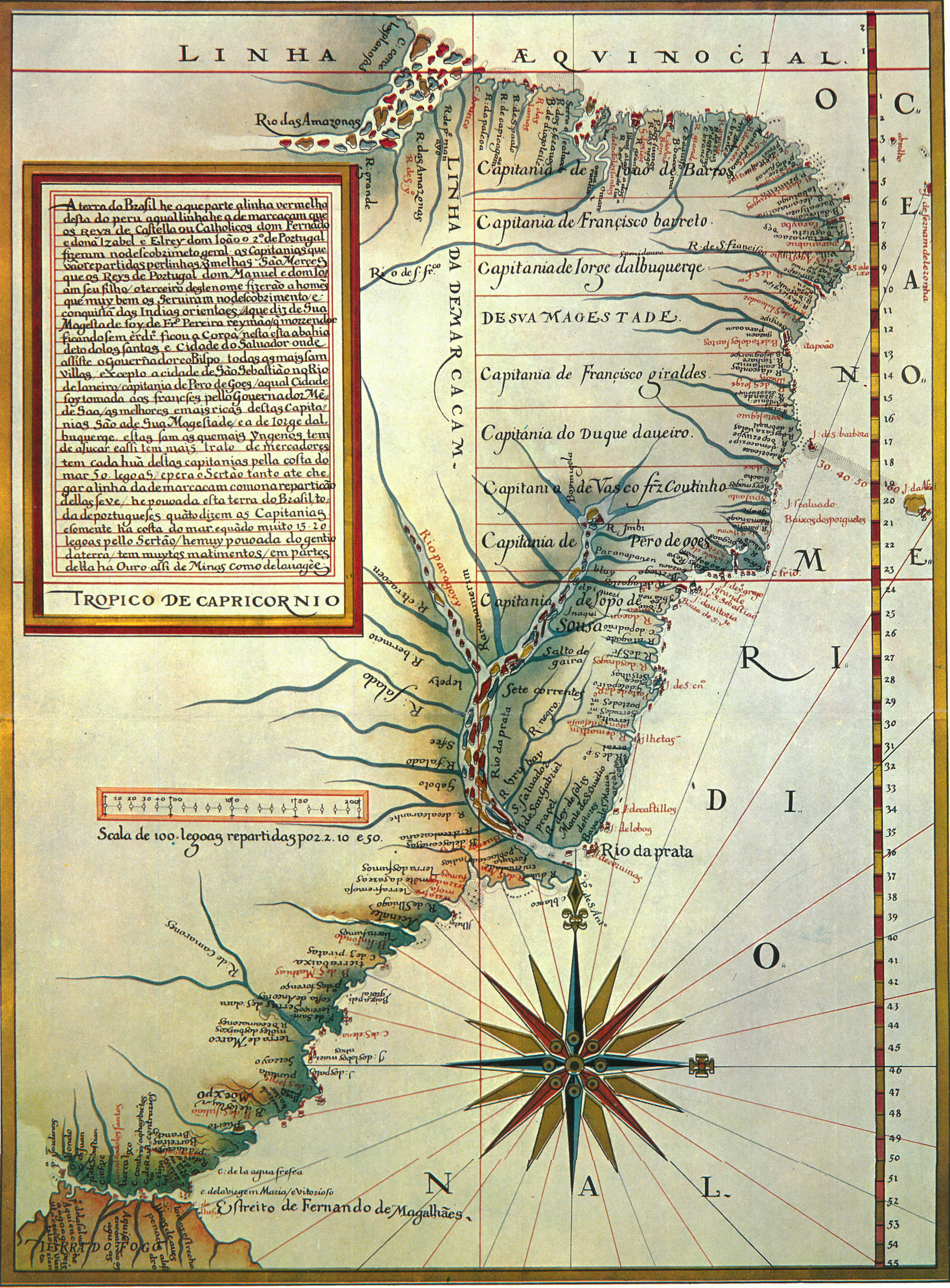
Português: Mapa de Luís Teixeira (c. 1574) com a divisão da América portuguesa em capitanias. A linha de Tordesilhas está deslocada dez graus mais a oeste. Mais informações abaixo.
|
||
|---|---|---|---|
| Source |
Biblioteca da Ajuda (Lisboa) |
||
| Date |
1574 |
||
| Author | |||
| Permission (Reusing this image) |
|
[edit] Transcrição das principais partes
- Manteve-se a ortografia arcaica e erros ortográficos
- LINHA AEQVINOCIAL
- OCEANO MERIDIONAL
- Capitanias
- Capitania de Ioao de Barros
- Capitania de Françisco barreto
- Capitania de Iorge dalbuquerqe
- DE SVA MAGESTADE
- Capitania de Françisco Giraldes
- Capitania do Duque daveiro
- Capitania de Vasco frz Coutinho
- Capitania de Pero de goes
- Capitania de Lopo de Sousa
File history
Click on a date/time to view the file as it appeared at that time.
| Date/Time | Dimensions | User | Comment | |
|---|---|---|---|---|
| current | 19:31, 23 April 2007 | 1,500×2,031 (679 KB) | Dantadd | |
| 01:37, 11 October 2006 | 300×417 (62 KB) | Pikolas | (From en. {{PD}} [www.arara.fr arara.fr] ) |

