Image:Ancient Egypt main map.png
From Wikipedia, the free encyclopedia
Size of this preview: 241 × 598 pixels
Full resolution (1,239 × 3,076 pixels, file size: 417 KB, MIME type: image/png)
| | This is a file from the Wikimedia Commons. The description on its description page there is shown below.
|
[edit] Summary
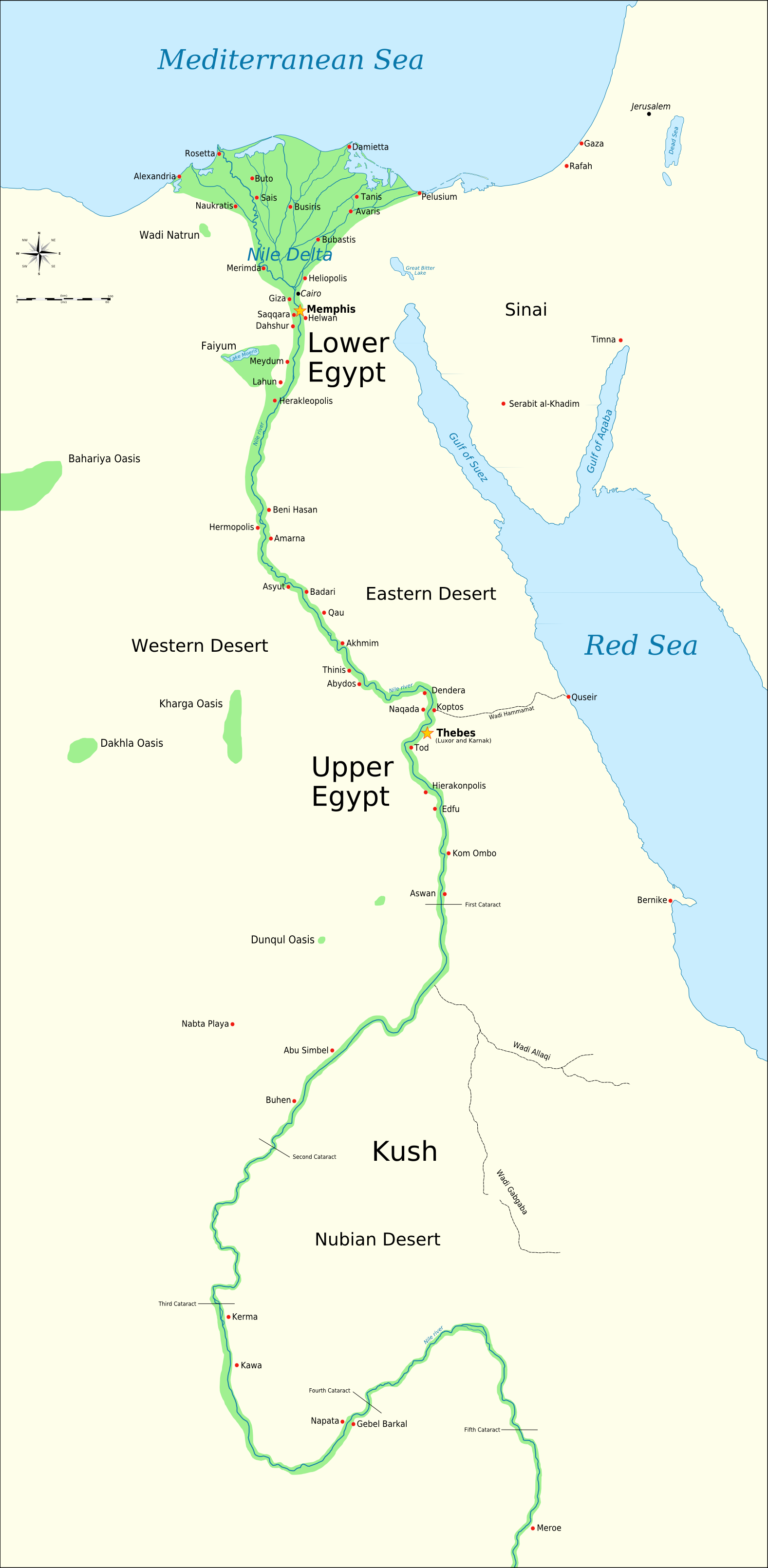
| Description |
A map of ancient Egypt, showing the Sinai, and the nile up to nearly the 5th cataract. The map is annotated with most of the important ancient Egyptian cities. Both Memphis and Thebes are marked as capitals. The colors chosen are based on the standard palette of colors suggested on the maps portal. |
|---|---|
| Source |
self-made. This work was done in photoshop, and I can make many other specialized maps based on this template with different overlays, showing mining regions, territorial control etc. Just ask! Need a translated version? Just tell me the names of as many places you can in your language and I can make one for you. |
| Date |
9-18-07 |
| Author | |
| Permission (Reusing this image) |
see below |
|
It is recommended that the other file be used. Alemannisch | العربية | Български | Česky | Dansk | Deutsch | English | Ελληνικά | Esperanto | Español | Français | Galego | עברית | हिन्दी | Magyar | Bahasa Indonesia | Italiano | 日本語 | 한국어 | Lietuvių | Nederlands | Norsk (nynorsk) | Polski | Português | Română | Русский | Slovenščina | Српски / Srpski | Svenska | Türkçe | 中文(简体) | 中文(繁體) | +/- |
[edit] Licensing

File history
Click on a date/time to view the file as it appeared at that time.
| Date/Time | Dimensions | User | Comment | |
|---|---|---|---|---|
| current | 18:12, 1 October 2007 | 1,239×3,076 (417 KB) | Jeff Dahl | (adding scalebar) |
| 19:21, 20 September 2007 | 1,239×3,076 (416 KB) | Jeff Dahl | (Adding more cities, done in photoshop. ) | |
| 23:38, 19 September 2007 | 1,239×3,076 (377 KB) | Jeff Dahl | (adding the rivulets in lower Egypt, self made in photoshop) | |
| 15:58, 19 September 2007 | 1,239×3,076 (358 KB) | Jeff Dahl | (Adding two oases) | |
| 04:21, 19 September 2007 | 1,239×3,076 (347 KB) | Jeff Dahl | ({{Information |Description=This is a .png map of ancient Egypt, showing the Sinai, and the nile up to nearly the 5th cataract. The map is annotated with most of the important ancient Egyptian cities. Both Memphis and Thebes are marked as capitals. The col) |

