Image:1897 Brooklyn map.jpg
From Wikipedia, the free encyclopedia
Size of this preview: 800 × 597 pixels
Full resolution (4,134 × 3,084 pixels, file size: 4.48 MB, MIME type: image/jpeg)
| | This is a file from the Wikimedia Commons. The description on its description page there is shown below.
|
[edit] Summary
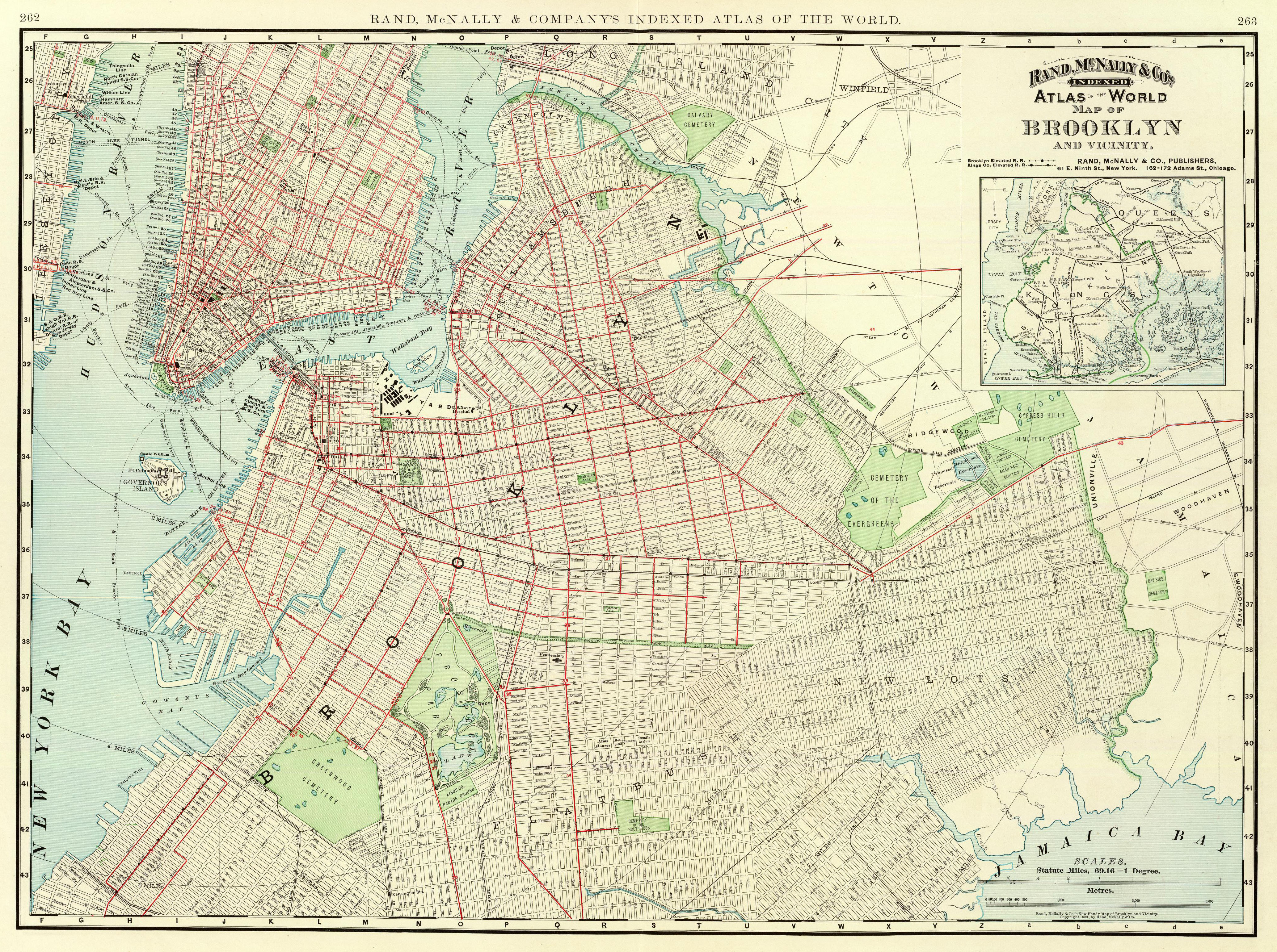
This is a map of Brooklyn and vicinity published by Rand McNally in 1897 as part of their Atlas of the World. The David Rumsey Collection scanned it.
[edit] Licensing
This photographic reproduction is therefore also in the public domain. العربية | Česky | Deutsch | English | Ελληνικά | Español | فارسی | Français | עברית | Bahasa Indonesia | Italiano | 日本語 | 한국어 | Magyar | Nederlands | Polski | Português | Română | Русский | Slovenščina | Српски / Srpski | Basa Sunda | Türkçe | Українська | 中文(繁體) | 中文(简体) | +/- |
File history
Click on a date/time to view the file as it appeared at that time.
| Date/Time | Dimensions | User | Comment | |
|---|---|---|---|---|
| current | 21:12, 24 December 2006 | 4,134×3,084 (4.48 MB) | NE2 | (This is a map of Brooklyn and vicinity published by Rand McNally in 1897 as part of their Atlas of the World. The [http://www.davidrumsey.com/ David Rumsey Collection] scanned it. Category:Maps Category:Brooklyn) |
File links
Metadata
This file contains additional information, probably added from the digital camera or scanner used to create or digitize it. If the file has been modified from its original state, some details may not fully reflect the modified file.
| Orientation | Normal |
|---|---|
| Horizontal resolution | 72 dpi |
| Vertical resolution | 72 dpi |
| Software used | Adobe Photoshop 7.0 |
| File change date and time | 15:28, 24 December 2006 |
| Color space | 65535 |

