Virginia State Route 288
From Wikipedia, the free encyclopedia
 |
|||||||||||||
| State Route 288 |
|||||||||||||
| Length: | 31.77 mi[1][2][3] (51.13 km) | ||||||||||||
|---|---|---|---|---|---|---|---|---|---|---|---|---|---|
| South end: | |||||||||||||
| Major junctions: |
|||||||||||||
| North end: | |||||||||||||
|
|||||||||||||
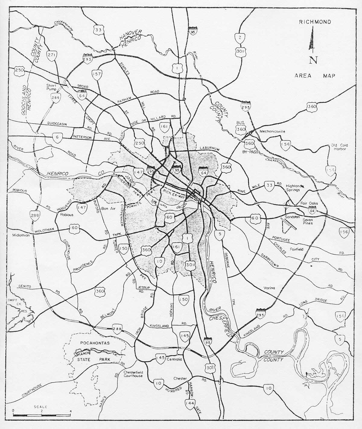
State Route 288 is a primary state highway in the U.S. state of Virginia. It is a freeway-standard partial beltway around the southwest side of Richmond. SR 288 was officially dedicated as the World War II Veterans Memorial Highway in 2004.
Contents |
[edit] Description of route
SR 288 may be thought of as the southwestern "outer beltway" of Richmond. The route begins at Interstate 95 near Chester, and it extends northwesterly through Metropolitan Richmond's Southside area through Chesterfield County and Powhatan County. It crosses the James River on the World War II Veterans Memorial Bridge into Goochland County in Richmond's Far West End area, where it terminates at Interstate 64 near Short Pump, adjacent to the northern terminus of Interstate 295.
The highway has been built entirely to Interstate standards.[citation needed]
[edit] History
Sections of the road were built over a period of more than 15 years. The 17.4-mile-long southern portion of SR 288 in Chesterfield County (from Interstate 95 to State Route 76 near Midlothian) was completed in 1989. Initially, the highway was planned to continue north and west of this temporary terminus to connect with Interstate 64 at Interstate 295, creating a seamless straight connection between SR 288 and I-295. This would have formed a full beltway (I-295 north of I-64 and east of I-95, and SR 288 in the southwest quadrant).[4] There is however no evidence that it was to be an Interstate.
However, this planned corridor and a river crossing into Henrico County was abandoned in 1988 due to heavy development of residential neighborhoods along the intended path in Chesterfield County during the years after initial planning. Instead, a more westerly right-of-way was selected through Powhatan and Goochland Counties, causing a break in what would have been a continuous loop between SR 288 and I-295. In 2004, construction was completed, including a new crossing of the James River.
[edit] Major intersections and points
- Interstate 95 (formerly Richmond-Petersburg Turnpike) in Chesterfield County
- Jefferson Davis Highway (U.S. Route 1 and U.S. Route 301) in Chesterfield County
- State Route 10 (Ironbridge Road) in Chesterfield County
- Courthouse Road in Chesterfield County
- U.S. Route 360 (Hull Street Road) in Chesterfield County
- Powhite Parkway (State Route 76) in Chesterfield County
- Luck's Lane/Charter Colony Road in Chesterfield County
- U.S. Route 60 (Midlothian Turnpike) in Chesterfield County
- State Route 711 Huguenot Trail in Powhatan County
- World War II Veterans Memorial Bridge across the James River
- State Route 6 Patterson Avenue in Goochland County
- U.S. Route 250 (Broad Street Road in Goochland County
- Interstate 64 in Goochland County
[edit] Notes
- The abandoned corridor planned for SR 288 in western Henrico County became the John Rolfe Parkway, a connector street, rather than a limited-access highway.
- Henrico County was able to preserve its planned corridor for Route 288 from development while Chesterfield County was not. This was partially due to the fact that Henrico and Arlington County are the only two counties in Virginia which control and maintain their own secondary highways and streets. VDOT handles this for Chesterfield and all other counties, but has little control of residential development.
[edit] See also
[edit] References
- ^ 2005 Virginia Department of Transportation Jurisdiction Report - Daily Traffic Volume Estimates - Chesterfield CountyPDF
- ^ 2005 Virginia Department of Transportation Jurisdiction Report - Daily Traffic Volume Estimates - Powhatan CountyPDF
- ^ 2005 Virginia Department of Transportation Jurisdiction Report - Daily Traffic Volume Estimates - Goochland CountyPDF
- ^ Virginia Department of Highways, Final Environmental/Section 4(f) Statement Administrative Action for Interstate Route 295

