Image talk:Serb lands04.png
From Wikipedia, the free encyclopedia
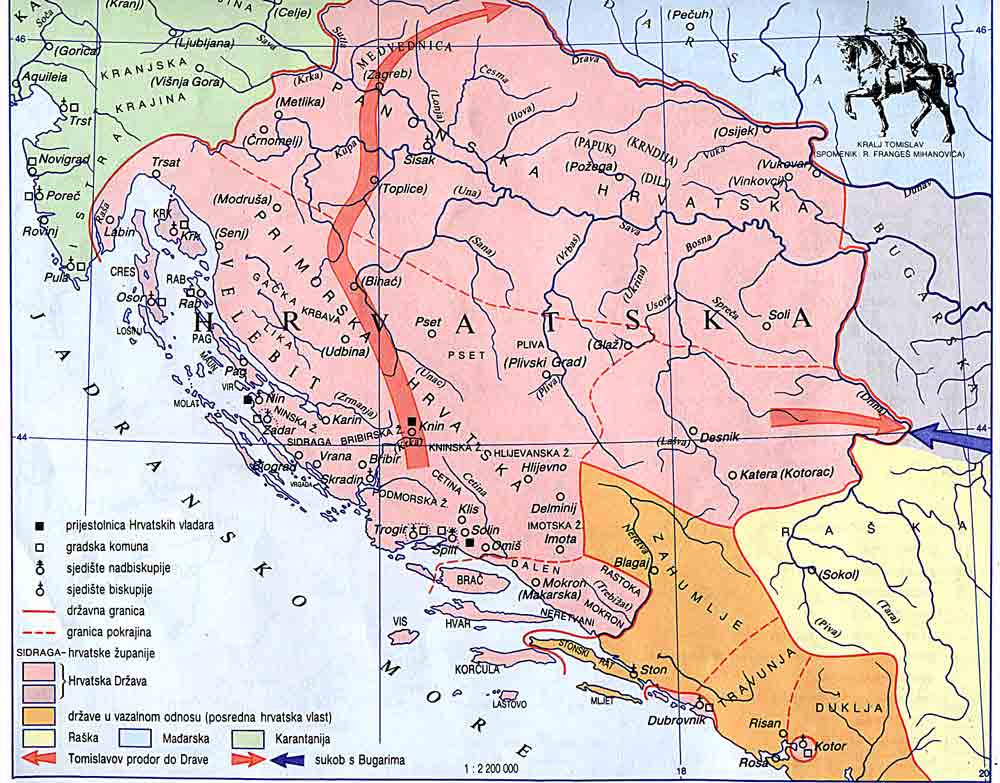
Something is wrong with this map!
Please compare to the Croation and Bosnian Kingdoms!
...according MOSTLY? to the De Administrando?
Please check historicaly more reliable maps than this one above!
It´s a FAKE!
http://www.croatia-in-english.com/images/maps/800s.jpg
http://www.croatia-in-english.com/images/maps/tomislav.jpg
There was already a discussion about this map among several users on Wikipedia. This map is based on the one from my historical atlas (Istorijski atlas, Beograd, 1999), made by several history professors. As for these two maps from your external links, it has been discussed that they are not from the same time period as this one, since Bosnia in various time periods belonged to Serbia or Croatia. PANONIAN (talk) 17:08, 31 December 2005 (UTC)
[edit] The names
This is a Mix-Mape the names are mixed from the past and today
No, it is not. The names are those from the 9th century. Find some historical atlas and you will see. PANONIAN (talk) 23:08, 17 April 2006 (UTC)

