Image:Palliser's Triangle map.png

From Wikipedia, the free encyclopedia

Wikimedia Commons logo This is a file from the Wikimedia Commons. The description on its description page there is shown below.
Commons is attempting to create a freely licensed media file repository. You can help.

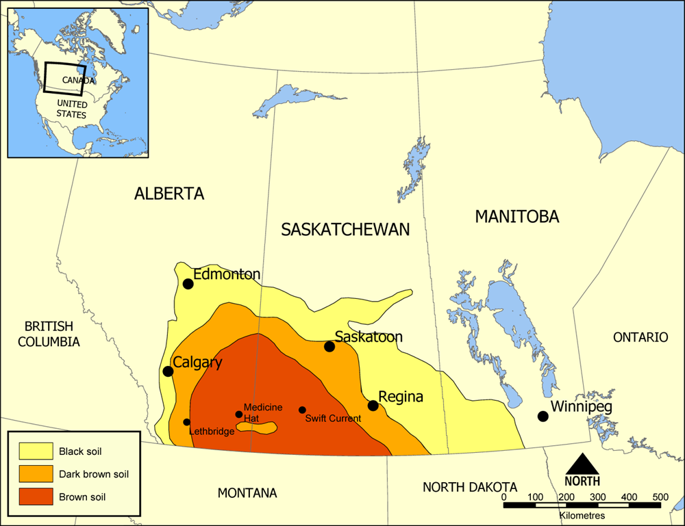
Map showing the extent of Palliser's Triangle in Western Canada. The area covers parts of Alberta, Saskatchewan, and Manitoba and is notable for its lack of trees. The lack of sturdy vegetation devastated the area during the Dust Bowl of the 1930s, but modern irrigation has allowed it to become an important wheat and beef area.

Created by NormanEinstein July 18, 2005.


I, the author of this work, hereby publish it under the following license:
GNU head Permission is granted to copy, distribute and/or modify this document under the terms of the GNU Free Documentation License, Version 1.2 or any later version published by the Free Software Foundation; with no Invariant Sections, no Front-Cover Texts, and no Back-Cover Texts. A copy of the license is included in the section entitled "GNU Free Documentation License".

العربية | Asturianu | Български | বাংলা | ইমার ঠার | Brezhoneg | Bosanski | Català | Sinugboanong Binisaya | Česky | Dansk | Deutsch | Ελληνικά | English | Esperanto | Español | Eesti | Euskara | فارسی | Suomi | Français | Galego | עברית | Hrvatski | Magyar | Bahasa Indonesia | Ido | Íslenska | Italiano | 日本語 | ქართული | 한국어 | Kurdî / كوردي | Latina | Lëtzebuergesch | Lietuvių | Bahasa Melayu | Nnapulitano | Nederlands | Norsk (nynorsk) | Norsk (bokmål) | Polski | Português | Română | Русский | Slovenčina | Slovenščina | Shqip | Српски | Svenska | తెలుగు | ไทย | Türkçe | Українська | اردو | Tiếng Việt | Volapük | 中文(简体) | 中文(繁體) | +/-

The following pages on the English Wikipedia link to this file (pages on other projects are not listed):