Image:Champlainmap.png
From Wikipedia, the free encyclopedia

No higher resolution available.
Champlainmap.png (500 × 500 pixel, file size: 34 KB, MIME type: image/png)
| | This is a file from the Wikimedia Commons. The description on its description page there is shown below. |
[edit] Summary
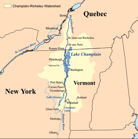
This is a map showing the Lake Champlain - Richelieu River watershed. I made using USGS, Census Bureau, and Digital Chart of the World data.
[edit] Licensing
|
File links
The following pages on the English Wikipedia link to this file (pages on other projects are not listed):

