Image:Hacha grande from papagayo pano.jpg
From Wikipedia, the free encyclopedia

| | This is a file from the Wikimedia Commons. The description on its description page there is shown below. |


[edit] Summary
| Description |
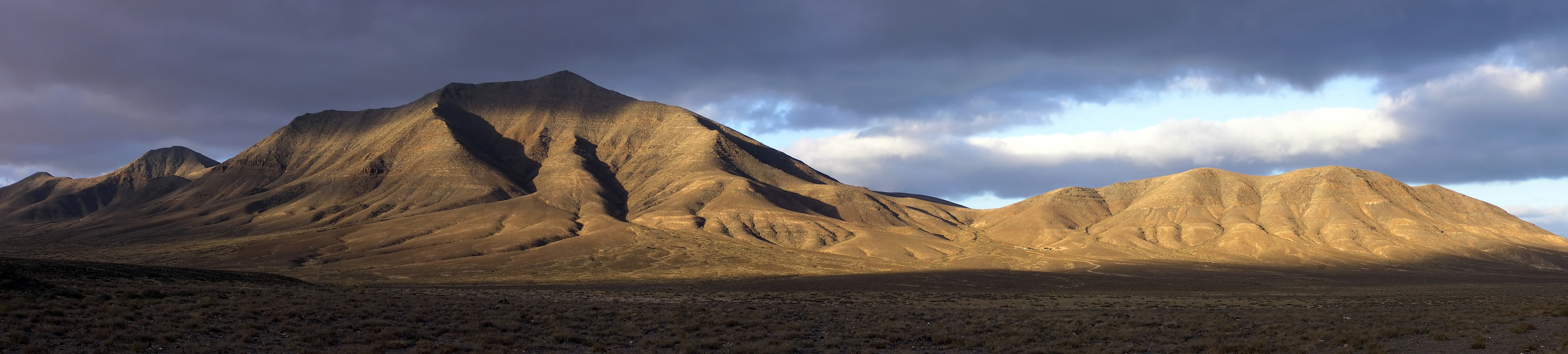
Hacha Grande (562m), the Degollada Valle Perdomo, Montaña Breña Estesa and the Morros de Hacha Chica (left to right) viewed across the arid plain of El Rubicón from the road to the Monumento Natural de los Ajaches (Punta de Papagayo), on the Canary Island of Lanzarote. Pico Redondo (562m) is visible on the far left. Lanzarote is a volcanic island with very low rainfall; much of the south of the island is desert and a barren expanse of lava flows. |
|---|---|
| Source |
Own work |
| Date |
July 2006 |
| Author | |
| Permission |
See license details |
[edit] Licensing
|
File links
The following pages on the English Wikipedia link to this file (pages on other projects are not listed):
- Canary Islands
- Lanzarote
- Yaiza, Las Palmas
- User:Peter Littmann
- User talk:Yummifruitbat
- Wikipedia:Picture of the day/October 2006
- Wikipedia:Featured pictures thumbs 06
- Wikipedia:Featured picture candidates/Hacha grande
- Wikipedia:Featured picture candidates/August-2006
- Hacha Grande
- Wikipedia:Wikipedia Signpost/2006-08-14/Features and admins
- Wikipedia:Picture of the day/October 4, 2006
- Wikipedia:POTD/October 4, 2006
- Wikipedia:POTD column/October 4, 2006
- Wikipedia:POTD row/October 4, 2006
- Wikipedia:Featured pictures/Places/Panorama
Metadata
This file contains additional information, probably added from the digital camera or scanner used to create or digitize it. If the file has been modified from its original state, some details may not fully reflect the modified image.
| Orientation | Normal |
|---|---|
| Horizontal resolution | 200 dpi |
| Vertical resolution | 200 dpi |
| Software used | Adobe Photoshop CS2 Windows |
| File change date and time | 19:52, 31 July 2006 |
| Color space | 65535 |

